Ivvavik National Park by Steyr / CC BY-SA 3.0
In northwestern Canada the Yukon Territory is a wild and rugged place. It borders Alaska, British Columbia, and the Northwest Territories. There is plenty of amazing natural beauty to see, but pretty much everything here is a remote location. The entire territory has only about 35,000 residents and towns are few and far between.
However, access is possible to several great locations. The Alaska Highway, Klondike Highway, and Dempster Highway are some of the major roads throughout Yukon. On this page you’ll find details of some of the best places to photograph in the Yukon Territory. The interactive map below shows the locations of the places mentioned on this page. We plan to update this page in the future, so please feel free to leave your own suggestions in the comments section.
Kluane National Park
Kluane National Park is in southwestern Yukon, and borders Wrangell-St. Elias National Park in Alaska. Mount Logan, the highest peak in Canada at nearly 6,000 meters, is within Kluane National Park. Most of the park consists of mountains and glaciers. The park also includes forest, but trees don’t grow in the areas of higher elevation.
Kathleen Lake is a popular area of the park, partly because it is one of the easiest areas to access. Hiking, rafting, and “flightseeing” tours are some of the best ways to see the park. Mountain biking is also popular. Haines Junction is the best town for accessing the park.
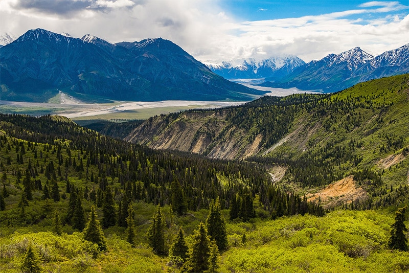
Kluane National Park by Paudia / CC BY 2.0
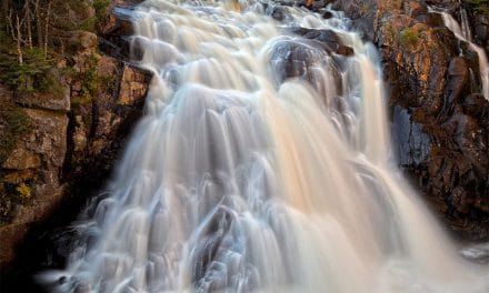
Lowell Lake and Lowell Glacier
Lowell Lake and Lowell Glacier are within Kluane National Park. Some of the most popular flightseeing tours at Kluane are glacier tours. Lowell Glacier is a large glacier that is worthy of a tour. Flights are available from Haines Junction.

Lowell Glacier by Jeffrey Bond / CC BY-SA 4.0
Mount Wallace
Mount Wallace is right next to Kluane Lake. You can get a nice view of the mountain and lake from Silver City, and old mining town. The Alaska Highway goes right by Mount Wallace.
Ivvavik National Park
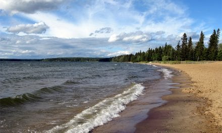
Ivvavik National Park is in far northwestern Yukon. This remote park was established as a result of an aboriginal land claims agreement, and it protects wildlife (including caribou, grizzly bears, black bears, timber wolves, moose, foxes, and more). The best way to access the park is by air from the town of Inuvik (Northwest Territories). All park visitors must register in Inuvik before entering the park and de-register after leaving the park. There are excellent hiking opportunities in the park, but no designated trails. Be sure you know where you are going, or go with a guide.
Ivvavik National Park by Steyr / CC BY-SA 3.0
Vuntut National Park
Vuntut National Park borders Ivvavik National Park to the south. Like Ivvavik, Vuntut is also a remote wilderness park. Also like Ivvavik, the landscape at Vuntut is well worth the effort for those who make the journey. There is no road access and no trails in the park. The town of Old Crow is about a 50 km flight from the park. This park is home to the Porcupine Caribou spring and fall migration. Although it is beautiful, a visit to Vuntut National Park is only for the adventurous.

Vuntut National Park by Джефрі Петер / CC BY-SA 3.0
Tombstone Territorial Park
Tombstone Territorial Park is in central Yukon, near the south end of the Dempster Highway. This large park (more than 2,000 square km) features a stunning mountain landscape. The Dempster Highway runs through the park, providing plenty of amazing views and photo opportunities. A few trails originate from the highway and allow visitors to see even more of the park.
Although the Dempster Highway does provide nice access to the park, it is still fairly remote. The nearest gas and lodging is in Dawson City, about a 1.5 hour drive south of the park. Be sure the plan ahead and be prepared. The park’s website also recommends having “a couple” of spare tires with you.
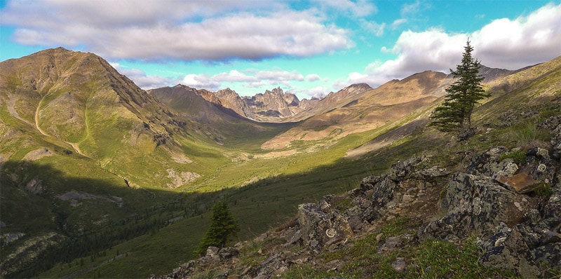
Tombstone Territorial Park by Bo Mertz / CC BY-SA 2.0
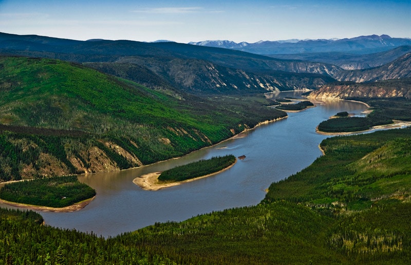
Klondike Valley
The Klondike River is a small river that flows into the Yukon River at Dawson City. The Klondike Highway runs along the river for a distance and also heads south to Skagway, Alaska.
Klondike River Valley by Joseph / CC BY-SA 2.0
Yukon River and Five Finger Rapids
The Five Finger Rapids on the Yukon River are near the town of Carmacks, and also near the Klondike Highway. There are four islands that divide the river into five fingers, creating the rapids. This area created a lot of trouble during the Klondike gold rush. If you’re traveling on the water you will want to stay to the east (your right as you are heading down river). For those on land, an excellent view of the area is ideal for photographs.
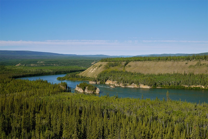
Yukon River by Joseph / CC BY-SA 2.0
Twin Lakes
The Twin Lakes are along the Klondike Highway about 50 km south of Carmacks. There is a Twin Lakes campground along the highway that is a great stopping point.
Dawson City
Dawson City sits right on the Yukon and Klondike Rivers and was originally a gold rush town. Although the population is now much smaller than at its peak, Dawson City is still one of the more developed towns in the region, and the Klondike Highway provides easy access. Dawson City’s location at the confluence of two rivers also makes it quite picturesque.
Dawson City by Phillip Grondin / CC BY-ND 2.0
Emerald Lake
Emerald Lake is in southern Yukon, just north of Carcross. The Klondike Highway runs right by Emerald Lake. This is an excellent location for photography because of the beautiful green color of the water, and the surrounding landscape. There is a small parking lot on the highway with an overlook for viewing the lake.
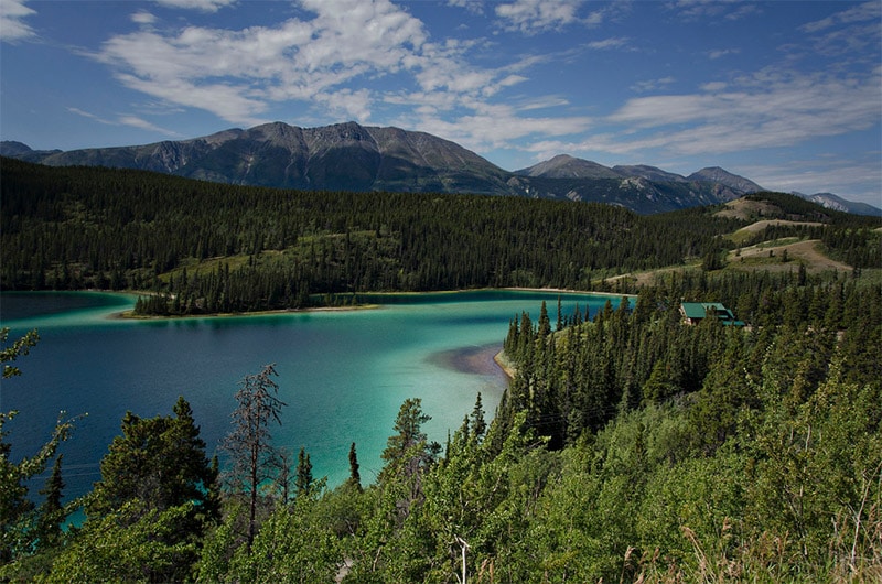
Emerald Lake by Boris Kasimov / CC BY 2.0
Tagish Lake and Bove Island
Tagish Lake is in southern Yukon and northern British Columbia. It has two arms. The Windy Arm (on the west) lies mostly in Yukon. The Taku Arm (on the east) lies mostly in British Columbia. The Klondike Highway runs just west of the lake, near the town of Carcross. Along the Klondike Highway there is a pull off and overlook for Bove Island. The overlook is near the 95th km of the South Klondike Highway.
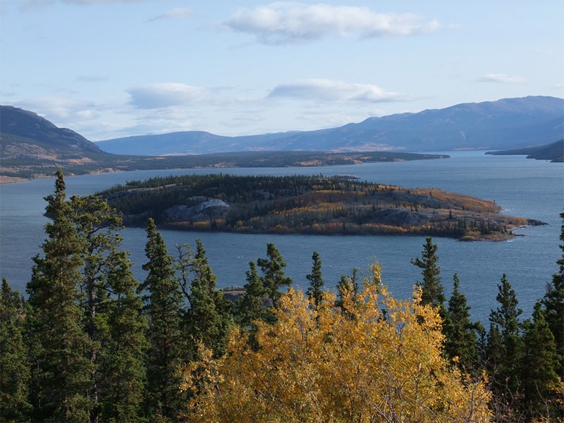
Bove Island by Ryan Schreiber / CC BY 2.0
Dempster Highway
The Dempster Highway begins at the Klondike Highway east of Dawson City. It extends to Inuvik, Northwest Territories. In the winter it extends almost another 200 km as an ice road. This gravel road provides hundreds of kms of beautiful scenery, and it is one of the best ways to travel in northern Canada. Gas and other facilities are few and far between on this road, so be prepared. Gas is available at the km 0, Eagle Plains, Fort McPherson, and Inuvik.

Dempster Highway by Pierre Racine / Public Domain
Bennett Lake
Bennett Lake is in southern Yukon and northern British Columbia, near Carcross. During the Klondike Gold Rush many people would purchase or build boats at Bennett Lake to raft down the Yukon River to Dawson City. The Klondike Highway runs through Carcross, next to Bennett Lake.
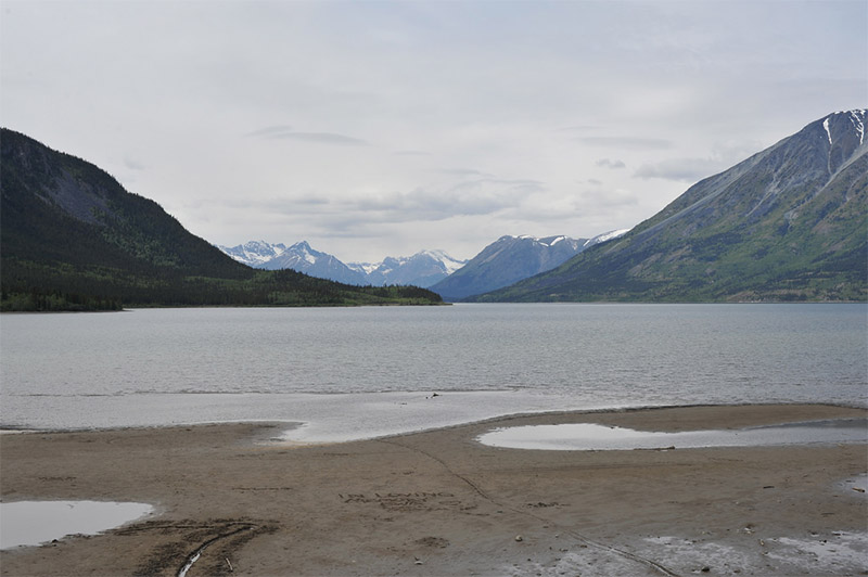
Bennett Lake by Chris Hunkeler / CC BY-SA 2.0
Carcross Desert
The Carcross Desert is located just outside of Carcross. It is sometimes considered the world’s smallest desert, although it is not technically a desert. The area is about one square mile of sand dunes, but it is too humid to be considered a desert. Although it is not officially a desert, it is dryer than the surrounding areas and there is some vegetation here that is uncharacteristic for Canada.
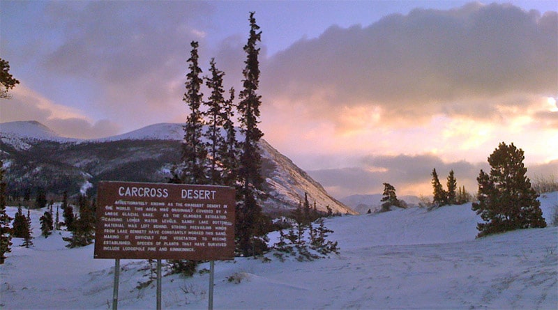
Carcross Desert by James Brooks / CC BY 2.0
Teslin Lake
Teslin Lake is a long, narrow lake in far southern Yukon and northern British Columbia. It lies right next to the Alaska Highway, making nice views of the lake pretty easy. There is a viewing area along the highway just outside of the village of Teslin.
Pickhandle Lake
Further north on the Alaska Highway is Pickhandle Lake. This picturesque area is also important for migratory birds. The Pickhandle Lake Recreation Site provides and ideal location to photograph the area.
Photo license links: CC BY 2.0, CC BY-SA 3.0, CC BY-SA 2.0, CC BY-ND 2.0