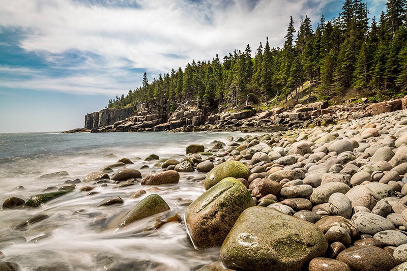
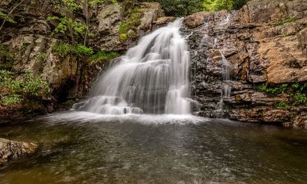
Boulder Beach, Acadia National Park
Acadia National Park in Maine is an iconic destination for landscape photographers. While many of the most popular national parks in the U.S. are out west, Acadia is a great option for those of us in the east. Although Acadia is small by national park standards, it is among the top ten most-visited national parks in the U.S.
There are several things to love about Acadia. There is a great deal of diversity in terms of the landscape and photo opportunities. You can photograph the beautiful, rugged coastline of New England, mountains, lakes, forests, and more. It’s easy to see and visit much of Acadia by car, but there are also plenty of excellent trails that are well worth the hike.
In this article I’ll cover the basics of Acadia National Park to help with planning your own trip to photograph the park.
→ See More of The Best Places to Photograph in Maine
The Layout
The are three main non-contiguous sections to Acadia National Park. The majority of the park is located on Mount Desert Island, which is separated from the mainland by the Mount Desert Narrows. The island is easily accessed by road over a bridge. In addition to the park area, Mount Desert Island is also home to a few small towns and communities (the park covers about half of the island). Bar Harbor is the largest town on the island and sort of serves as a gateway to the park.
The second section of the park is the Schoodic Peninsula. It is east of Bar Harbor, separated by the Frenchman Bay. To get to the Schoodic Peninsula from Mount Desert Island you will need to go back to the main land and drive north and east. It is around a one-hour drive from Bar Harbor. Most park visitors stick to Mount Desert Island, so you will find far fewer visitors at the Schoodic Peninsula.
The third section is Isle au Haut. The island is southwest of Mount Desert Island and accessible by ferry. Only a very small number of visitors make it to Isle au Haut.
I haven’t personally been to Isle au Haut, and since very few visitors make it there, this guide will focus on Mount Desert Island and the Schoodic Peninsula. All of the most popular, iconic destinations for photographers are on Mount Desert Island, but the Schoodic Peninsula does offer some nice scenery and smaller crowds.
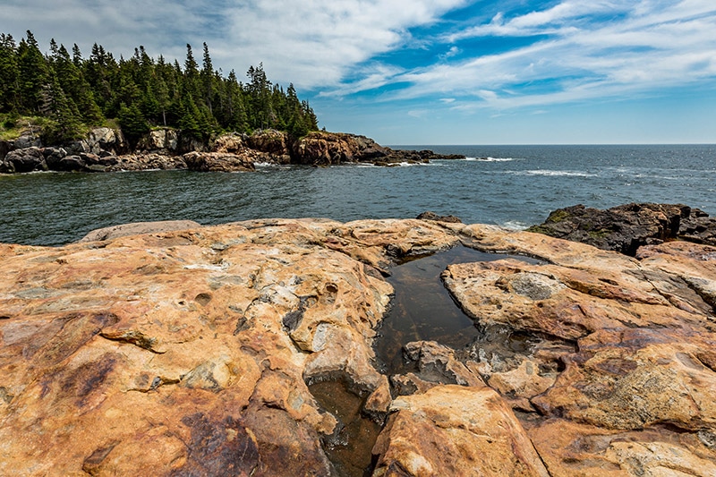
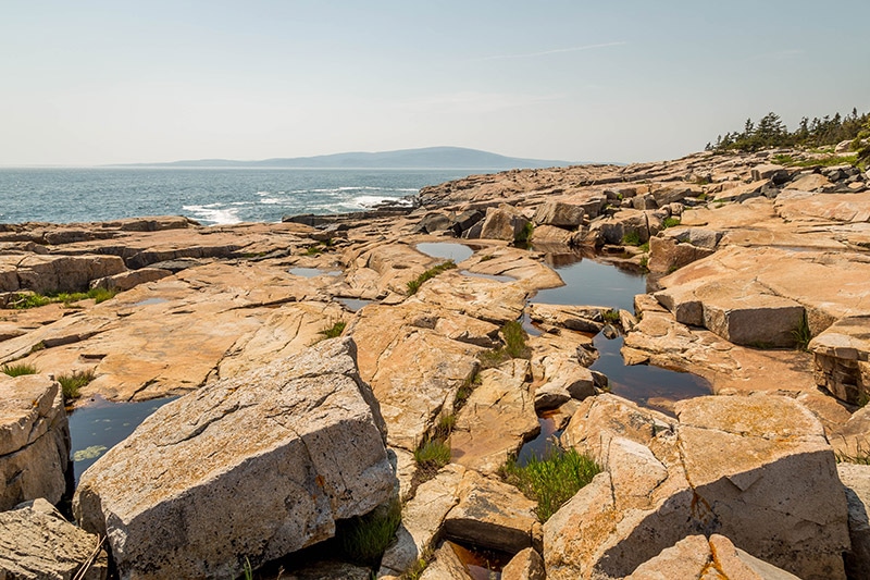
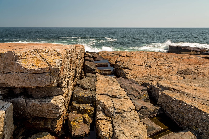
The coast at Acadia National Park
Mount Desert Island Layout
All the photos in this article were processed with the Landscape Legend Lightroom Presets or Aurora HDR. Those processed with Aurora HDR are noted in the caption. All others were processed with the Landscape Legend Lightroom Presets.
Road access to Mount Desert Island via Route 3 will bring you to the northwest part of the island. If you continue driving on Route 3 for about 10 minutes you will see signs for the Hulls Cove Visitor Center where you can enter the park. Here you can access the start of Park Loop Road. While this road does not loop around the entire park, it does provide access to many of the most noteworthy and popular areas of the park, all on the east half of Mount Desert Island.
Park Loop Road is one way in many sections. You can head south down along the east coast of Mount Desert Island and then loop back up a little further west.
There are a few other roads within the park, and many other roads on the island outside of the park, so I recommend picking up a map at the visitor center or at the gate where you pay or show your pass to enter the park.
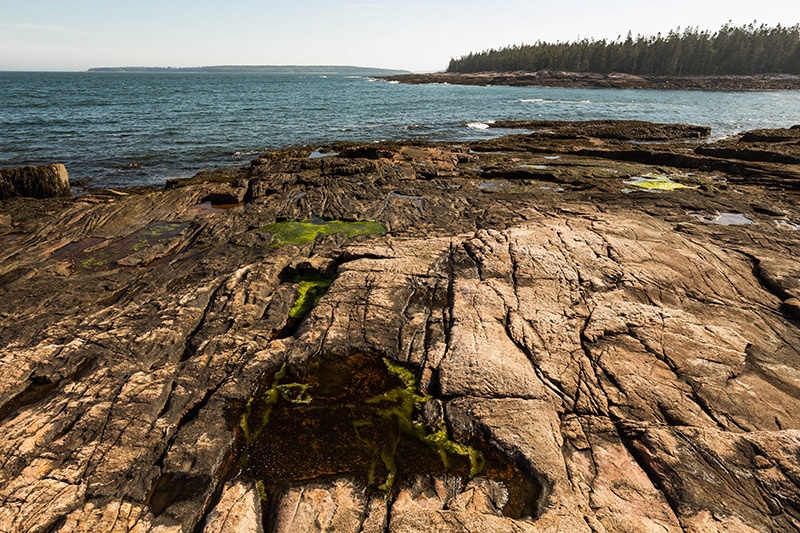
Along the coast
Mount Desert Island also has many carriage roads. Cars are not allowed on these roads, but you can bike or walk on these roads if you’d like. I have very little experience with the carriage roads so I won’t provide many details on them.
The Schoodic Peninsula also has a one-way loop road that provides access to the park. The road leads down the west side of the peninsula and then back up the right side.
Points of Interest
Acadia National Park has several different spots that are great for photographers. Of course, there are photo opportunities throughout the park, so don’t limit yourself only to the main points of interest. However, the spots listed below tend to be the most popular, and most of them are easy to access. They are listed in no particular order, but their locations can be seen on the map below.
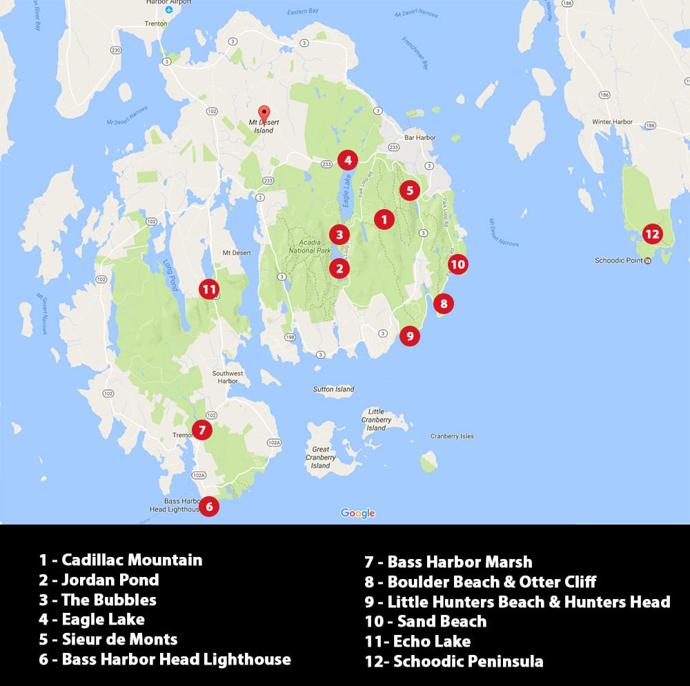
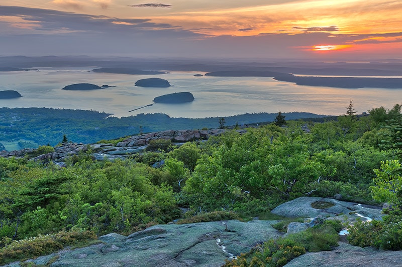
Cadillac Mountain
Cadillac Mountain is the highest peak on the east coast of the United States. At certain times of the year it is the first location in the U.S. to see the sunrise. It is easily one of the most iconic spots in Acadia and is certainly a must-see. It is 1,530 feet high, which doesn’t seem that high for a mountain. But being so close to the shore it is pretty impressive and offers views in all directions.
There are trails that lead up to the summit if you want to hike, but Cadillac Mountain Road makes the visit much easier and quicker. You can reach Cadillac Mountain Road from the northwest side of Park Loop Road. There are plenty of signs pointing you towards Cadillac Mountain, so it is pretty hard to miss.
Along the way up Cadillac Mountain Road there are some nice views of the island. At the summit there is a decent-sized parking lot. There is also a walking path around the parking lot and summit. From the walking path you can step out onto the rocks and explore the area near the summit.
Cadillac Mountain is an extremely popular spot, especially at sunrise and sunset. The amount of people here at these times can make it a challenge to get the shot that you want.
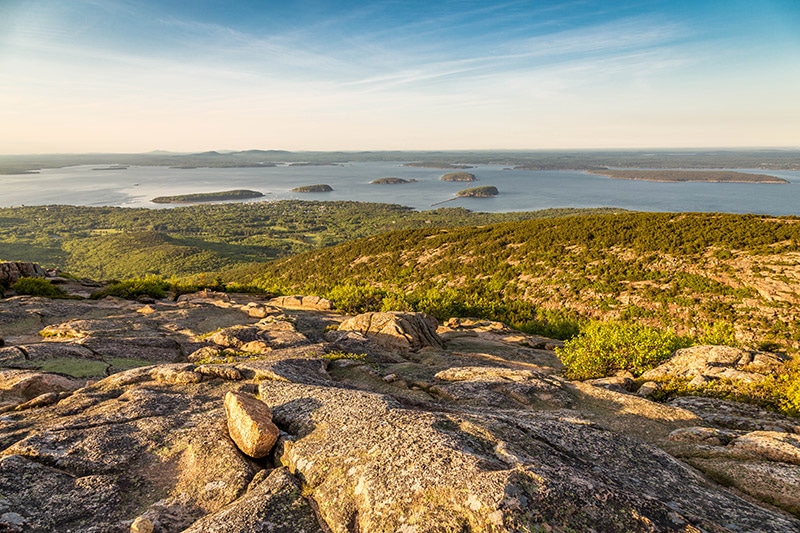
View from Cadillac Mountain
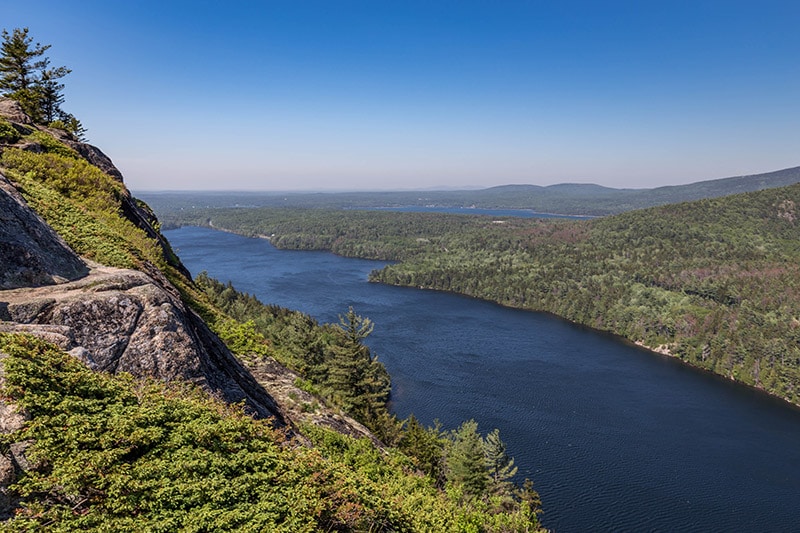
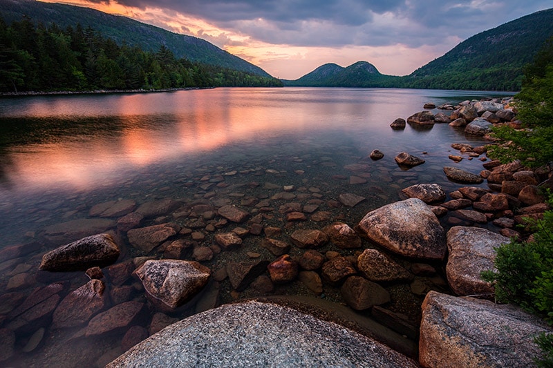
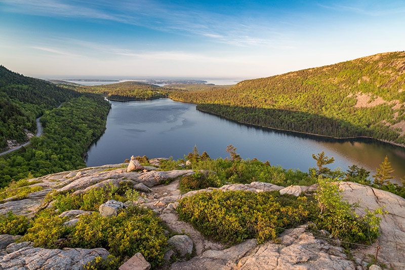
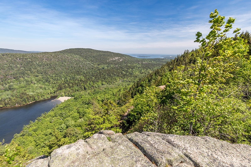
Jordan Pond and the Bubbles
One of the most picturesque spots in the park is Jordan Pond. Access to Jordan Pond is available from Park Loop Road, southwest of Cadillac Mountain. Follow signs to a parking lot near Jordan Pond. There is a trail that goes all the way around the pond. It is a 3.2-mile loop hike that is listed as moderate. More information about the trail is below, in the “Trails” section.
There are two locations that provide the best views of Jordan Pond, in my opinion. The first location is conveniently located near the parking lot. From the parking lot (which is at the south end of Jordan Pond), as you walk towards Jordan Pond to access the trail you will be able to look across the pond and see the Bubbles (North and South Bubble are two small mountains with rounded tops). You can photograph Jordan Pond with the Bubbles in the distance and some rocks in the foreground. There are a few different areas along the trail where you step out to the rocks and get these nice views.
The second location is from South Bubble looking down on Jordan Pond. From the Jordan Path you can take a side trail up South Bubble to reach these views, but there is an easier way. Along Park Loop Road there is a small parking lot for Bubble Rock (the parking lot is northeast of Jordan Pond). The Bubbles Divide Trailhead is located at this parking lot. It is about a 20-minute hike to Bubble Rock. Bubble Rock looks as if it is hanging off the edge and could fall at any minute.
Just a short distance from Bubble Rock you can get the iconic view of Jordan Pond from above. Taking the Bubbles Divide Trail from this parking lot will save some time and effort compared to hiking all the way up from Jordan Pond.
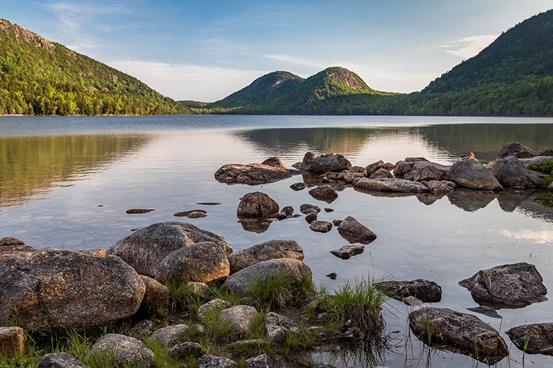
Jordan Pond and the Bubbles
Eagle Lake
Eagle Lake is north of Jordan Pond and west of Cadillac Mountain. It may be in your sunset photos taken from Cadillac Mountain. To get to Eagle Lake you can take Route 233 west of Park Loop Road for a short distance to a parking lot. There is a trail that wraps around Eagle Lake. It is about a 6 mile loop hike. I hiked on part of the trail near the parking lot to get some photos of Eagle Lake, but did not go all the way around the trail. There are nice views available at Eagle Lake, although not quite as iconic as Jordan Pond.
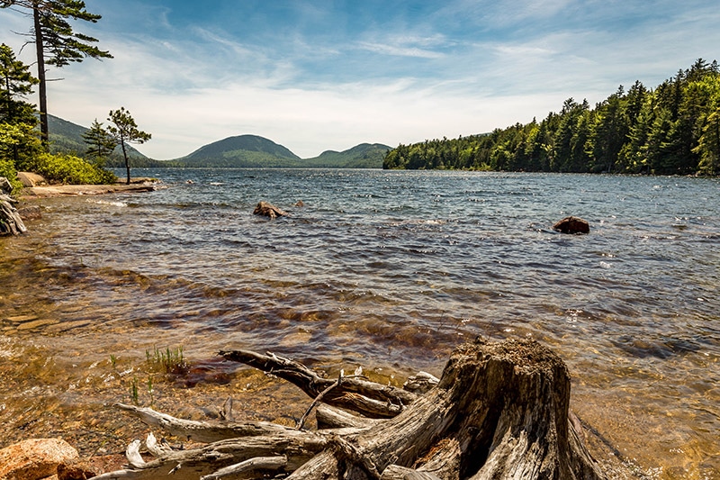
Eagle Lake
Sieur de Monts
Sieur de Monts is a unique section of Acadia. It is located north east of Cadillac Mountain and south of Bar Harbor. You can easily get to Sieur de Monts from Park Loop Road. This area, especially the spring, has some historic significance and played an important role in the creation of the park. From a photography perspective, Sieur de Monts is significant because it is a bit different than many other areas of the park.
Here you will find a museum, nature center, the Wild Gardens of Acadia, and beautiful trails. The Tarn (a small pond), and the Beaver Dam Pond are also nearby. For me, the main attraction at Sieur de Monts was the Jesup Path. This level trail features a boardwalk that leads you through a beautiful forest of birch trees. You can pick up this section of the Jesup Path just behind the Wild Gardens of Acadia.
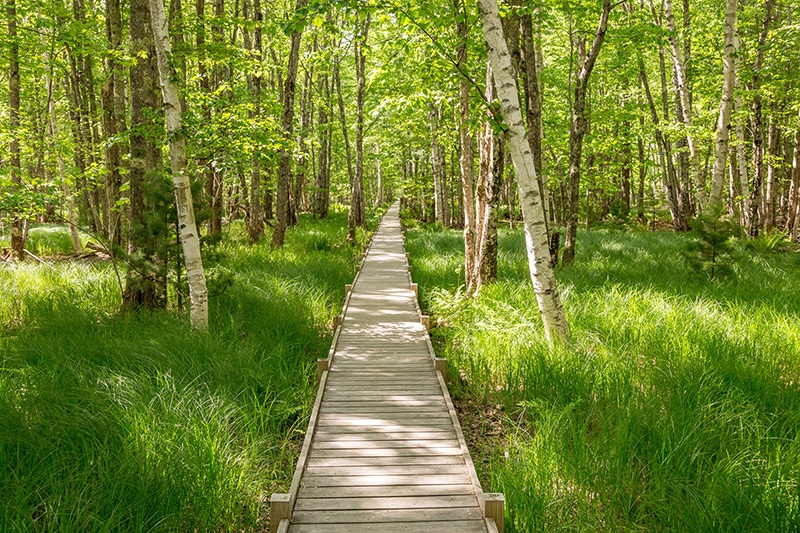
The Jesup Path
Bass Harbor Head Lighthouse
One of the most iconic scenes of Acadia National Park is the Bass Harbor Head Lighthouse. The west side of Mount Desert Island is less-frequently visited than the east side. The one very popular location on the west side is the lighthouse. You can take Route 102 to a parking area for the lighthouse, which sits at the southernmost point of the island. From the parking area you can walk around to the right to get close to the lighthouse. Or find the path at the left side of the parking lot that leads down to the rocks and a great view for photographing the lighthouse.
Bass Harbor Head Lighthouse, processed with Aurora HDR
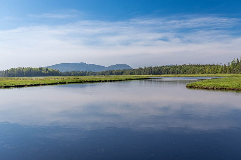
Bass Harbor Marsh
Located at the north end of Bass Harbor is the Bass Harbor Marsh. Route 102 crosses over the edge of the marsh. There are a few small pull offs along the road where you can park. Cross over the guide rail to get some separation from the road (be careful, cars go by here very fast) and walk down to the marsh.
Bass Harbor Marsh
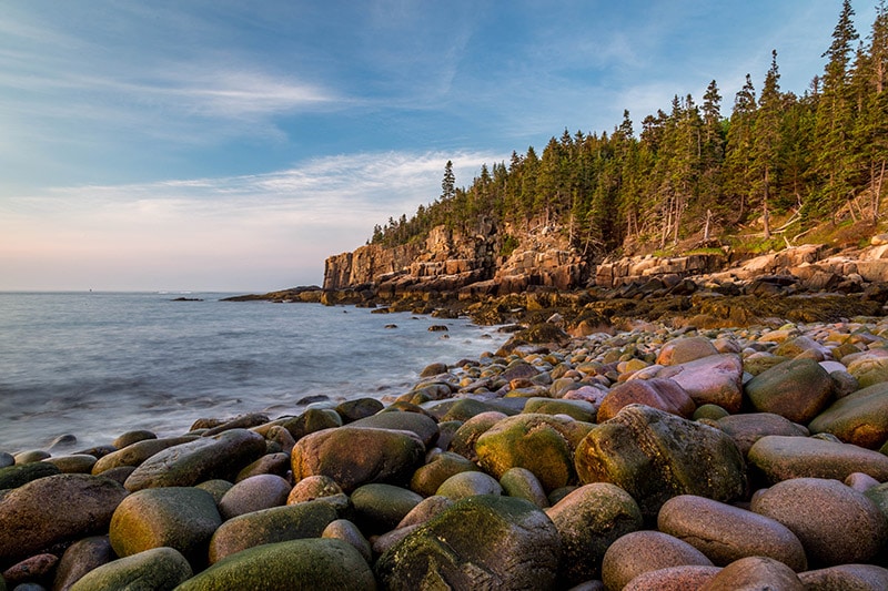
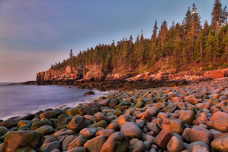
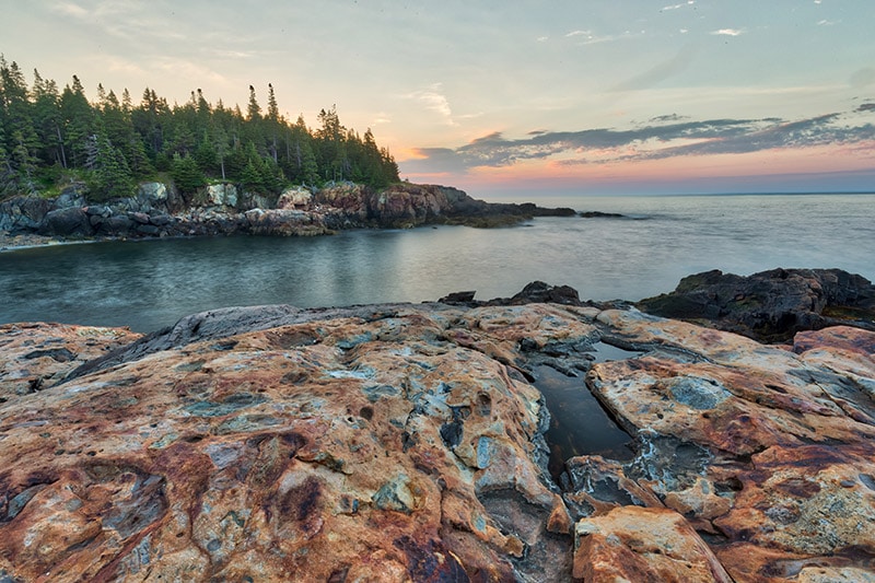
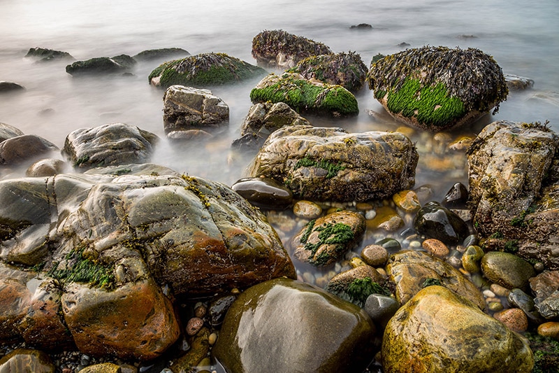
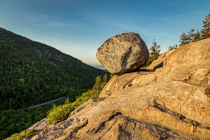
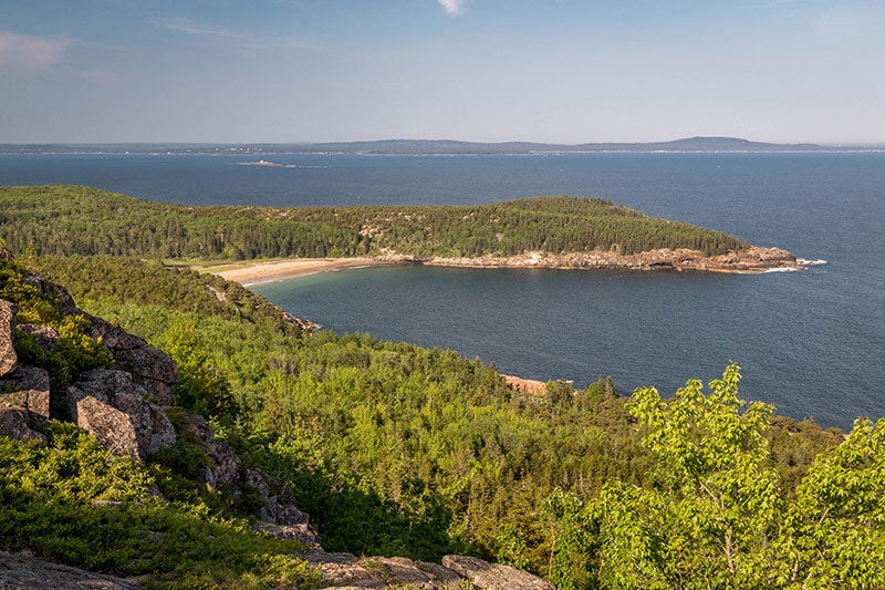
Boulder Beach and Otter Cliffs
Boulder Beach (unofficial name) is a section of the coast that features thousands of round boulders, roughly the size of bowling balls. It is right along Park Loop Road and very easy to get to. It is just north of Otter Cliff. You can photograph Otter Cliff with Boulder Beach in the foreground.
To access this area take park loop road and go past the parking area marked for the Gorham Mountain Trailhead. Shortly after that you will come to to another parking area. Park here, cross the street, head a short distance south toward Otter Cliff and you will see Boulder Beach. There is a path that you can take to get down to the boulders. It is not an official trail, but you can see where other people have made the short trek down to the boulders.
Be careful on these boulders, especially if they are wet. They are very smooth and can be more slippery than most of the other rocks on the coast.
Boulder Beach and Otter Cliff, processed with Aurora HDR
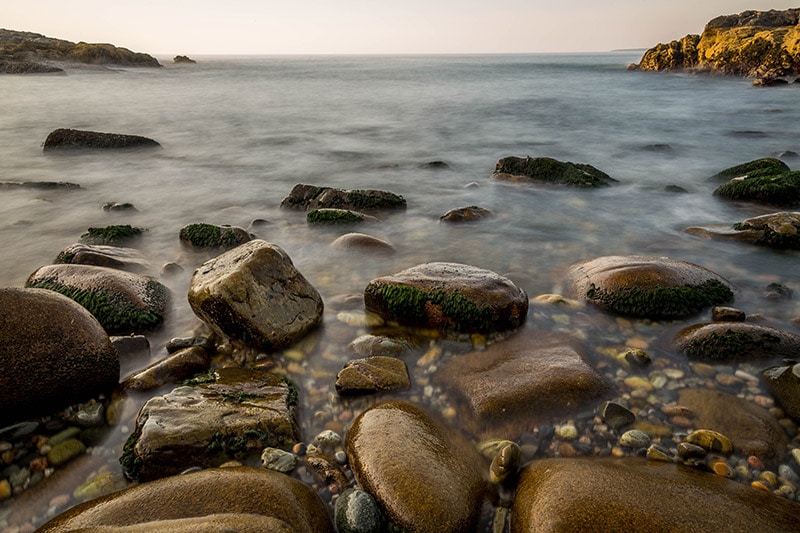
Little Hunters Beach and Hunters Head
A short drive past Otter Cliff will take you to Little Hunters Beach and Hunters Head. Little Hunters Beach is kind of similar to Boulder Beach. There are a lot of smooth, rounded rocks here, but they are smaller than the ones at Boulder Beach. This is a great area to photograph the rocks with the waves coming in, or you can explore some of the larger rock formations on the sides of the beach.
Little Hunters Beach
Little Hunters Beach is easy to reach, but you kind of need to know where to find it. You’ll come across a small bridge on Park Loop Road. There is no parking lot, but there are a few small pull off areas with room for a few cars. At the side of the road right next to the bridge their are stairs that lead down to the beach. If you walk past the stairs there is a trail that leads through some trees and eventually out onto some rocks that you can explore.
Large rocks to the side of Little Hunters Beach
Sand Beach
Sand Beach is a popular area, especially in the summer. It is located right along Park Loop Road and there is a parking area that often fills up. There are several trails that start in this area, and the beach itself is, of course, popular. You can get a view of Sand Beach from several trails, including the Beehive, Great Head, and Gorham Mountain.
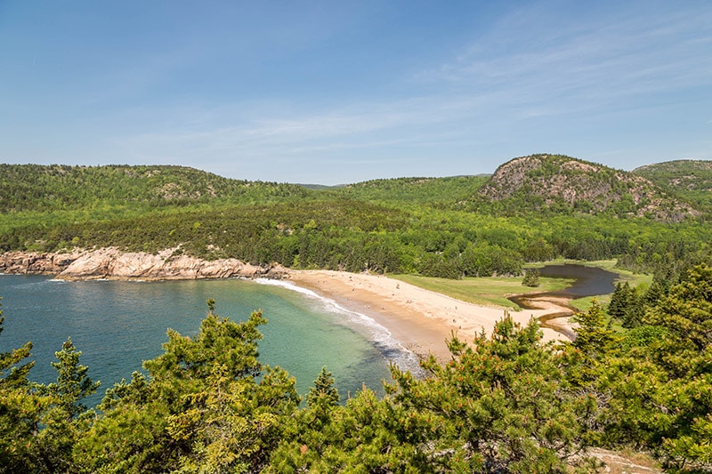
View of Sand Beach and the Beehive from the Great Head Trail
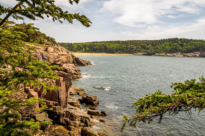
Echo Lake
Located on the west side of the island, Echo Beach also has a nice sandy beach area. I headed this way to get some photos of Echo Lake, but there are limited places with easy access aside from the beach area. In the summer the beach can be crowded, making photography here more challenging. The parking lot for Echo Lake also serves as the trailhead for the Beech Mountain Trail. I’ll give more details in the “Trails” section, but you can take this trail if you want some views of the beach and Echo Lake from above.
View of Echo Lake from the Beech Mountain Trail
Schoodic Peninsula
The Schoodic Peninsula is overshadowed by Mount Desert Island, but still worth visiting if you have the time. As you take the loop road around the peninsula there are several places where you can pull off and photograph the rocky coast. Schoodic Point, at the south end of the Peninsula, is the most interesting location along the road, in my opinion. You’ll actually need to turn onto Arey Cove Road the head down to Schoodic Point. There is a large parking lot and here you can walk out onto massive rocks along the coast. You can photograph the coast and the waves crashing into the rocks.
Schoodic Point
Most people who visit Acadia National Park never make it to the Schoodic Peninsula. If you have a few hours to spare it is worth the effort to drive over to the Schoodic Peninsula. But if you are short on time I would recommend that you prioritize the locations on Mount Desert Island. The coast of the Schoodic Peninsula is nice, but very similar to what you will find on Mount Desert Island. And in some cases, less dramatic than what you will find on Mount Desert Island.
Schoodic Point
Best Sunrise Locations
If you’re headed to Acadia for photography you will want to make the most of sunrise each day. Because of its northeast location, sunrise can be pretty early in the summer. When I was there in early June sunrise was around 4:45. And with some of the locations being popular at sunrise, you’ll want to arrive well ahead of the actual sunrise time.
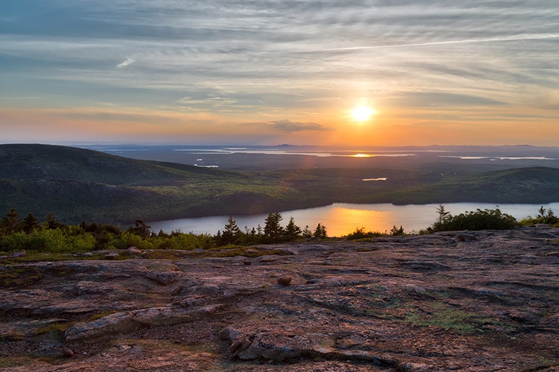
Cadillac Mountain
The most iconic sunrise location in the park is Cadillac Mountain. From the summit you can get a nice east-facing view looking over Frenchman Bay and Bar Harbor. Before you go you should know that this is a very popular sunrise location. It’s not uncommon for the parking lot to fill up and for there to be a few hundred people at the summit for sunrise. When I arrived at 4:00 there were already several people there, and by 4:30 it was packed. I’d say there were at least 200 people there for sunrise, probably more.
The crowds make it a challenge to find the shot that you want, assuming you want to keep people out of your shot. Arriving early can help, but it’s still likely that some people will make their way in front of you. You can try to go off to the side as much as possible to get away from the crowds. Even with that approach I had a hard time finding a spot that would avoid people and still have decent foreground interest in the photo.
Also be aware that weather can be an issue here. A lot of times it can be foggy and you may not have much of a view.
Sunrise from Cadillac Mountain, processed with Aurora HDR
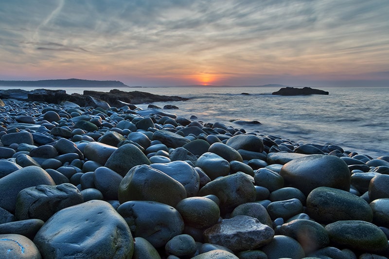
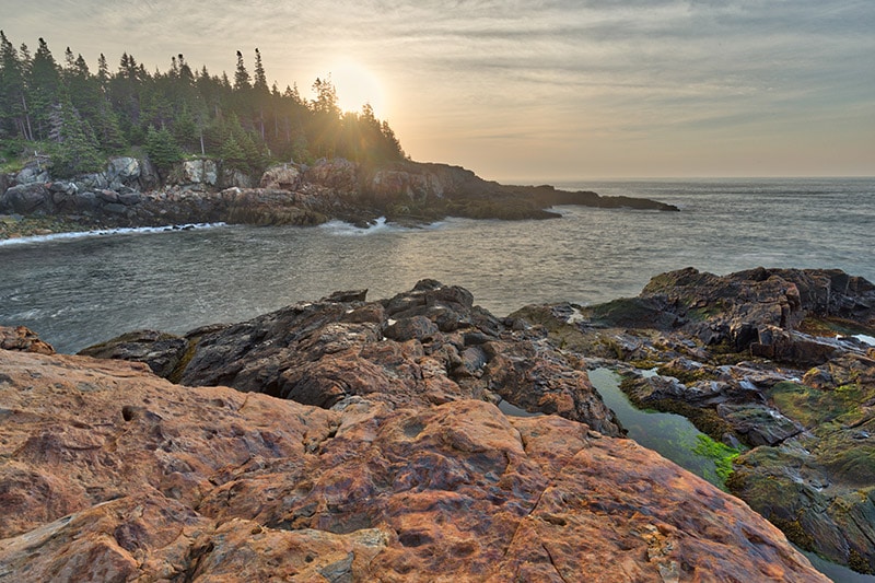
Boulder Beach and Otter Cliff
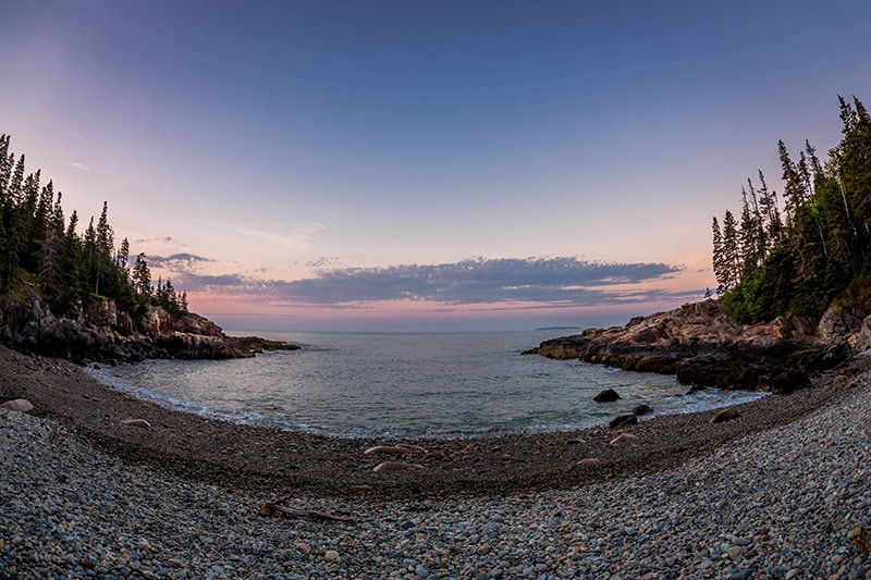
This is another popular sunrise location, although I was alone on the day I was there. If you are at Boulder Beach you will be looking south towards Otter Cliff. Check the sunrise location for the day you will be there. You won’t have the sun directly in your shot, but you may have some color in the sky and the cliffs may be lit up and have a sort of glow from the sunrise. I didn’t find the lighting to be that great on the day I was there, but I still loved it as a sunrise location. Next time I am back I will be sure to spend another sunrise here.
Boulder Beach and Otter Cliff, processed with Aurora HDR
You can also turn and face the sun from this spot. The photo below was taken at exactly the same location as the photo above, I just turned the camera northeast to face the sunrise.
Boulder Beach, processed with Aurora HDR
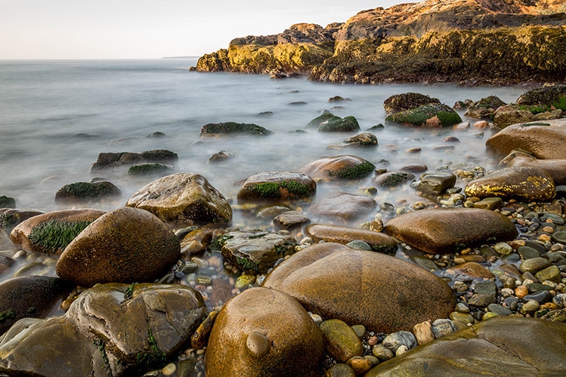
Little Hunters Beach
Just a short distance south of Otter Cliff is Little Hunters Beach. The rocks and trees here may prevent you from seeing the sun right at sunrise, but you can still get some great color in the sky both before and after sunrise.
Sunrise at Little Hunters Beach, processed with Aurora HDR
The photo below was taken about an hour after sunrise, when the sun finally reached the top of the trees.
Sunrise at Little Hunters Beach, processed with Aurora HDR
Both of the photos above were taken from some large rocks to the right side of Little Hunters Beach. The photo below was taken a short time after sunrise along the rocks at Little Hunters Beach. This is a great location to photograph before the sun gets to high and too harsh, and I’m sure it would also be an excellent option for an overcast day.
Little Hunters Beach
Others
There are many great sunrise locations and I haven’t been to them all. Here are a few others that you may want to consider.
Schoodic Peninsula
I have seen some very nice sunrise photos of the Schoodic Peninsula Coast. Schoodic Point or anywhere on the east side should be a good location.
Anywhere on the East Coast of Mount Desert Island
Park Loop Road runs along the coast from Sand Beach down to Hunters Head. You could certainly scout out many different locations along the way. North of Sand Beach, Schooner Head Road provides access to some overlooks and trails that could give you a nice east-facing view.
Best Sunset Locations
Just like sunrise, sunset is a great time to photograph many areas of the park. Here are some of the best options.
Cadillac Mountain
Cadillac Mountain is a great choice for sunrise or sunset. At sunset you can photograph from the summit. A better location is the Blue Hill Overlook, which is along the road just a short distance from the summit. There is a parking lot here, but it often fills up at sunset, so arrive early. The overlook can get quite crowded, so finding your spot is a challenge. I actually photographed from the rocks above the overlook. When I set up there was no one else here, but it did get crowded by the time the sun set.
Facing west from Cadillac Mountain you have a a great view of Eagle Lake and other parts of Mount Desert Island. I found the same challenge at Cadillac Mountain for sunrise and sunset: composing an interesting shot that avoids people. It can be very windy on top of the mountain, so I would recommend avoiding tall trees and plants in the foreground of your photos as they are likely to be blowing and blurry.
Most of the people will head to their cars at sunset. If you stay beyond sunset you can benefit from some great light and colors in the sky, plus you may be able to move around more freely with smaller crowds.
Sunset from Cadillac Mountain, near the Blue Hill Overlook, processed with Aurora HDR
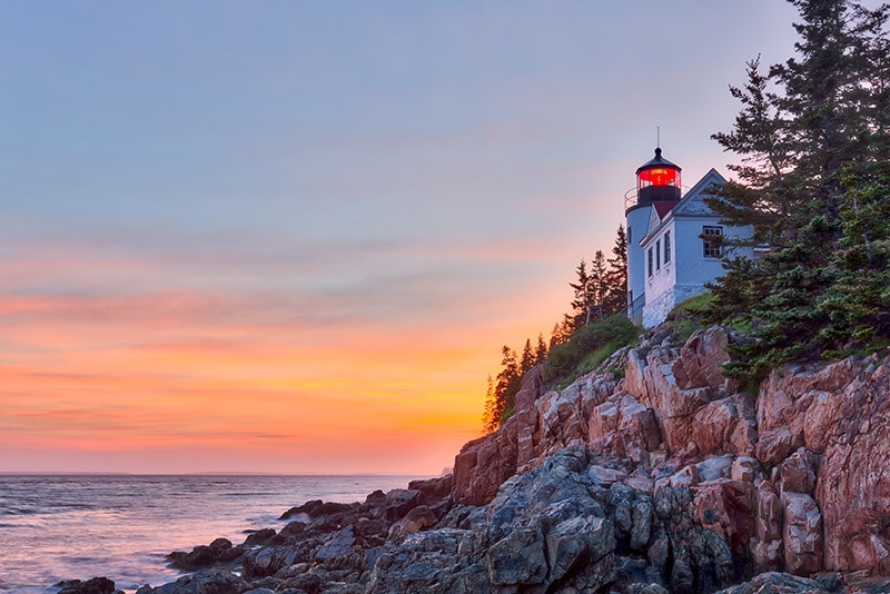
Bass Harbor Head Lighthouse
My favorite sunset spot in the park is at Bass Harbor Head Lighthouse. If you’ve looked at many photos from Acadia you have almost certainly seen photos of the lighthouse at sunset or after. This is a popular location and there is limited room on the rocky coast for photographers and tripods, so be sure to show up early. I was running a little late and arrived about 45 minutes ahead of sunrise. There were already several photographers set up and so I didn’t get as good a view as I would have liked. The parking lot is fairly small and sometimes fills up for sunset, so be sure you arrive early. The popularity of the location and limited space does present some challenges. There was a bit of drama the night I was there because of one photographer who wasn’t very considerate.
This is listed as a day use area that closes at sunset. The night I was there pretty much everyone (photographers and other visitors) stayed about 20-30 minutes past sunset. We had no issues, but be aware that it is a day use area and you will need to leave at sunset or shortly after.
Bass Harbor Head Lighthouse, processed with Aurora HDR
Jordan Pond
Jordan Pond can be a nice dusk location, even if you can’t really see the sun setting. The colors in the sky over the mountains and reflecting in the lake can be beautiful. I chose to photograph from the south end of Jordan Pond near the parking lot because the sun was setting to the northwest. From there you have a nice view of the Bubbles.
The other option I considered was taking the Bubbles Divide Trail and photographing Jordan Pond from above and from the north. If you choose this location you’ll need to hike down the Bubbles Divide Trail after sunset, but it’s only about a 20 minute hike so it shouldn’t be too hard.
Jordan Pond sunset
Others
I didn’t photograph the locations below at sunset, but they should be good options.
Bass Harbor Marsh
If I had more time in the park I would have liked to photograph the marsh at sunset. From the side of Route 102 you will be facing west and should have a great view.
Schoodic Point
With the rock formations along the coast at Schoodic Point this should be another good sunset option. Face west towards Mount Desert Island and you should get some nice photos here.
Best Times to Visit Acadia National Park
When planning a trip to Acadia it is important to keep a few things in mind. First, much of the park is not accessible in the winter. Most of Park Loop Road is closed from December 1 – April 14 (can be longer in some years). Without access to Park Loop Road you will be very limited in what you can do and see.
Second, the park is very busy in the summer. Because the park attracts a lot of visitors and because it is small, the crowds can be an issue.
By coming in late April or May you can beat the summer crowds and still get to see everything in the park. I was there in early June and the crowds had already arrived, although it will be worse later in the summer.
Autumn is probably the best season to visit. The combination of the fall foliage and smaller crowds than summer make this time of year an excellent choice.
Getting Around
Acadia is much easier to navigate than many other national parks. Most of the major attractions can be visited by car, especially along Park Loop Road. Many visitors never even get very far off the road because there is so much to see with easy access. There are also tour buses available. Most of the carriage roads are good for bikes, and there are also plenty of hiking trails to explore on foot.
Tips for Photographing Acadia National Park
Plan Your Trip for the Best Times
I had planned to visit Acadia in May, but wound up not being able to go until June. The summer crowds were definitely an issue, although it will be worse in July and August. I would recommend going in late April or May, or in the fall after kids are back in school.
Take Advantage of Sunrise and Sunset
There are plenty of great locations for both sunrise and sunset at Acadia. Be sure you make the most of the best times of each day for photography. Plan ahead and have a list of a few possibilities for sunrise and sunset, and then scout out each location when you arrive to see which ones you prefer.
Prioritize
There is a lot to see and photograph at Acadia National Park, and chances are, you won’t be there long enough to fit it all in. You’ll need to prioritize so you get the most out of your time there. Do you want iconic shots like sunrise at Cadillac Mountain, looking across Jordan Pond to the Bubbles, and Bass Harbor Head Lighthouse at sunset? If you’d rather photograph something less common there are plenty of options for exploring and finding your own shots, especially along the coast.
How much time will you have there? There are lots or great trails to hike, but if you are working with very limited time you can see more by car with a few short hikes. If you have more time the trails are definitely worth the effort.
Be Flexible
The weather can be a little unpredictable. Foggy and cloudy weather is common here. Work with the weather to make the best of your time in the park. Overcast days without sun may not be great for sunrise or sunset, but they are ideal for photographing in the forest, or exploring the small streams and waterfalls in the park. If you’re at the coast for sunrise and the sun doesn’t show up, adjust and photograph the water and rocks along the coast.
Rocks at Little Hunters Beach
Recommended Gear
Here are some items that I recommend taking with you on a photography trip to Acadia.
Sturdy Tripod
Several of the popular sunrise and sunset locations can get really windy, including Cadillac Mountain, the Bass Harbor Head Lighthouse, and other points along the coast. You’ll need a sturdy tripod to be sure that it will stand up to the wind. If you are going to be hiking it’s ideal if your tripod is also lightweight. I use and recommend the Sirui T-024x carbon fiber tripod, which is a nice lightweight tripod that is also very sturdy. It has a clip that you can use to add some extra weight for even better sturdiness.
Wide Angle Lens
The wide angle lens is a staple of landscape photography, and you will definitely want one at this park. Photographing Jordan Pond, the coastline, and epic sunrises/sunsets will be easier with a quality wide angle lens. I use and recommend the Canon 16-35mm f/4. See our Reviews of the Best Wide Angle Lenses for Canon DSLRs and Reviews of the Best Wide Angle Lenses for Nikon DSLRs.
Telephoto Lens
If you want to capture details a telephoto lens can also be helpful. See our Reviews of the Best Telephoto Lenses for Canon DSLRs and Reviews of the Best Telephoto Lenses for Nikon DSLRs.
Polarizer
A polarizer can help to add contrast to the sky and to reduce glare on wet rocks and water. For me, a polarizer was most important at Acadia for photographing the lakes and ponds without intense glare (especially at Jordan Pond). I use a Tiffen circular polarizer.
Neutral Density Filters
Neutral density filters reduce the amount of light that reaches the cameras sensor, allowing you to use slow shutter speeds without overexposing your photos. At Acadia you may find ND filters to be useful when photographing along the coast. You can do this to get a blurred water effect with the water rolling over the rocks.
Graduated Neutral Density Filters
Graduated neutral density filters can be useful for balancing out your exposures in situations where one part of the scene is very bright and another part of the scene is very dark. This is pretty common at sunset and sunrise. I personally use exposure bracketing and HDR processing instead of using a graduated neutral density filter, but there are pros and cons of each approach.
Lens Wipes
Any time you are photographing near the ocean you will want to make sure you keep your lens and gear clean. Spraying water and wind usually leads to a need to clean your gear more frequently. I use and recommend these lens wipes from Zeiss.
Landscape Legend Lightroom Presets
Our own Landscape Legend Lightroom Presets is the most comprehensive collection of Lightroom presets made specifically for landscape photos. They can help you to save hours of time in post processing and allow you to get the best results with your photos.
Aurora HDR
As I mentioned earlier, I use HDR processing for scenes where the dynamic range of a scene is too much to handle with a single exposure. In most cases this is around sunrise and sunset. I recently started using Aurora HDR instead of Lightroom’s built-in HDR merge feature, and I have been very impressed with Aurora HDR. It’s extremely powerful, easy to use, and I just like the results better.
Great Trails
While many of the major points of interest in the park can be reached by car, there are many trails that are worth hiking. The trails allow you to get different points of view and get the best photos possible. Here are some trails that I recommend.
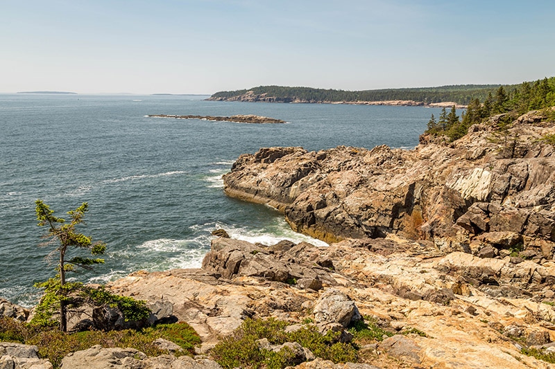
Ocean Path
This trail runs along Park Loop Road from Sand Beach to Otter Point. It is 4.4 miles out and back (rated as easy). Along this trail you’ll get many of the same views that you get from Park Loop Road and the major stopping points in this area, but the trail can be helpful if you want to slow down and be sure that you are not driving by excellent photo opportunities.
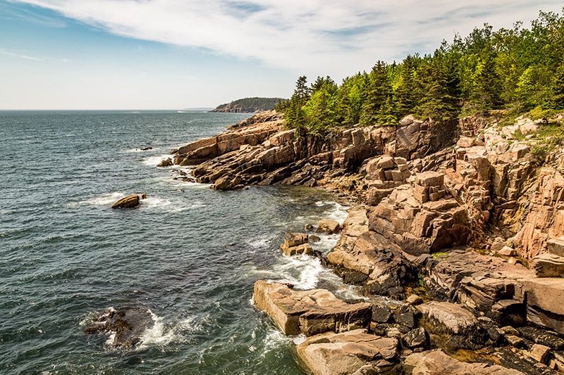
Mount Desert Island coastline
Jordan Pond Path
The 3.2 mile loop (rated moderate) around Jordan Pond is an excellent hike. The path hugs the edge of the pond and in some places is very rocky. There are several side trails that you can use along the loop to extend your hike, if you’d like. The best views are near the parking area looking from the south end of Jordan Pond across the water to the Bubbles in the north, so if you are really limited on time and you can’t hike the entire loop, at least get to the parking lot and photograph from this point.
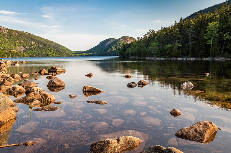
Along the southeastern edge of Jordan Pond
Bubbles Divide Trail
The Bubbles Divide Trail (1 mile, rated moderate) begins at the Bubble Rock parking lot on Park Loop Road. This trail will take you up South Bubble to see Bubble Rock.
Bubble Rock
Not far from Bubble Rock you can get one of the best views in the park, overlooking Jordan Pond. If you’re here to photograph the park, this trail is a must.
View of Jordan Pond
Jesup Path
The Jesup Path is an easy trail in the Sieur de Monts area. Part of the Jesup Path is a boardwalk that leads you through a birch forest. This trail looks amazing in the fall with changing leaves, but is a good choice in any season. An ideal time would be a cloudy, overcast day. I was here when it was sunny and my photos are not great.
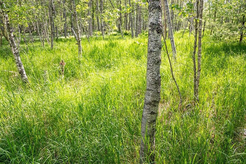
Along the Jesup Path
Great Head Trail
The 1.5 mile loop Great Head Trail (rated as moderate) offers some great views. The trail begins east of Sand Beach and rises in elevation to provide an excellent view of Sand Beach and the southeastern part of Mount Desert Island.
View from the Great Head Trail
Gorham Mountain Trail
The Gorham Mountain Trail is 1.8 miles out and back (rated as moderate). This one also provides excellent views of the southeastern part of Mount Desert Island, from the opposite side of Sand Beach as compared to the Great Head Trail. There is a parking lot for this trailhead along Park Loop Road, south of Sand Beach and Thunder Hole.
View from the Gorham Mountain Trail
Beech Mountain Trail
The Beech Mountain Trail is on the west side of Mount Desert Island. It is 1.1 miles out and back and rated as moderate. Great Head, Gorham Mountain, and Beech Mountain are all rated as moderate, but I would say the Beech Mountain Trail is slightly more challenging than the others. There are probably 5 or 6 sections on the way to the summit where ladders are built in to the rocks to help you ascend very steep areas. The reward is a great view of Echo Lake, Echo Lake Beach, and well beyond.
View from the Beech Mountain Trail
Wonderland Trail
The Wonderland Trail in southwestern Mount Desert Island is a good option if you are looking for something to do close to the Bass Harbor Head Lighthouse. The trail is 1.4 miles out and back and listed as very easy. It leads through a forest and to a beautiful rocky coast. At the coast you can explore the rocks and photograph the area.
The end of the Wonderland Trail
Iron Rung Trails
Acadia has several trails rated as strenuous that make use of iron rungs, handhold, and ladders to go up steep sections of mountains. The trails involve narrow cliffs, steep drops, and are not ideal for small children or anyone with a fear of heights. Popular options include the Beehive Trail, the Precipice Trail, and Acadia Mountain Trail. I don’t have personal experience with any of these trails. Many of them were closed for Falcon nesting when I was in the park. I have seen photos of several of them and they are excellent options if you are looking for some adventure and great views. However, you can also get great views with many of the moderate trails and even from some places along the road (like Cadillac Mountain).


Mark,
Thanks for the guide! It is going to be very hard to decide where to spend time. I’m Colorado boy and will be heading out to New Hampshire and Acadia in October and this is a good starting point as it is my first visit to the east coast.
Beautiful Park, would love to visit. Love this article