Raymondskill Falls by Marc Andre
Waterfalls are a favorite subject for many landscape photographers, and fortunately, there are a lot of great waterfalls to photograph. Of course, there are many other locations that could have been listed, but these locations allow you to photograph multiple waterfalls and, in most cases, are pretty easy to access through maintained trails. The Delaware Water Gap National Recreation Area is a 70,000-acre area on both sides of the Delaware River that is managed by the National Park Service.
It stretches for 40 miles of the river, with the west side in Pennsylvania and the east side in New Jersey. Outdoor recreation activities include hunting, fishing, canoeing, hiking, camping, swimming, and more. For landscape photographers, the Delaware Water Gap includes mountains, the river, and many beautiful waterfalls.
In this article we’ll look at a route you can take to see, and photograph, many of the most noteworthy waterfalls within the Delaware Water Gap. We’ll provide the locations and basic information that you’ll need to photograph these waterfalls.
In total, there are seven different waterfalls that can be visited along this tour. There are many other waterfalls within the Delaware Water Gap, but this tour will take you to several of the most noteworthy and will allow you to visit them rather quickly.
None of these waterfalls require a long hike to see, so you could photograph all seven of them in one day.
Of the seven waterfalls that will be covered here, six are in Pennsylvania and only one is in New Jersey. The Pennsylvania side of the water gap is more developed and easier (and quicker) to access.
If you had to cut this tour a little short you could skip the last stop in New Jersey and just visit the six falls in Pennsylvania. They are all very close together.
→ See More of The Best Places to Photograph in Pennsylvania and New Jersey
The Start of Our Waterfall Tour: Dingmans Falls Visitor’s Center
U.S. Route 209 runs mostly north and south all the way through the Pennsylvania side of the Delaware Water Gap. Unlike some of the roads on the New Jersey side of the Water Gap, Route 209 is a good road that provides easy access to many different places.
The Dingmans Falls Visitor’s Center is located in the town Dingmans Ferry just a short distance from Route 209. To reach the visitor’s you will head west on Johnny Bee Road (there are signs for the visitor’s center).
The GPS coordinates for the visitor’s center are: 41.229486, -74.887781
From the visitor’s center, there is a trail that leads to Silverthread Falls and Dingmans Falls. This is a handicap accessible trail on a boardwalk that includes no steps. It takes about 10 minutes to walk the trail out to Dingmans Falls, and then you’ll make the reverse trip back to the parking lot.
At the start of the trail, you’ll take the bridge over Dingmans Creek and you will very quickly reach Silverthread Falls.
Silverthread Falls is a very beautiful waterfall, but there is usually not a very high volume of water flowing. It is a total of about 80 feet, which includes a few different drops. You’ll have a good view of the falls from the viewing area along the trail, but it sits back in a gorge and can be difficult to photograph on sunny days.
→ Related reading: 10 Tips for Fabulous Waterfall Photography
Silverthread Falls by Nicholas A. Tonelli / CC BY 2.0
After you’re done photographing Silverthread Falls you will continue on the path for several minutes until you reach Dingmans Falls. I didn’t see an official trail distance listed anywhere, but I would guess it is about 1/2 mile each way. The woods along the trail also presents excellent photographic opportunities. This is especially true in the spring and early summer when everything is very green, and in the autumn when fall colors are on display.
At the end of the trail, you will reach Dingmans Falls. This 130-foot waterfall is one of the highest in Pennsylvania, and there is a much stronger flow here as compare to Silverthread Falls. The viewing area at the end of the trail puts you at the base of the falls with a nice vantage point for photographs.
If you’d like, you can also take many stairs to the top of the falls. The stairs are off to the left just before you reach the end of the trail.
Dingmans Falls by Marc Andre
Dingmans Falls is one of the more popular falls in the Delaware Water Gap and as a result, it can get crowded. I was there at an off-peak time and there were still several photographers with tripods lined up. Try to avoid peak times here so you won’t have to fight a crowd.
Like most waterfalls, Dingmans Falls will be best photographed on a cloudy, overcast day.
After you are done photographing Dingmans Falls take the roughly ten-minute walk back to the parking lot and get ready to move on to the next stop on the tour.
2nd Stop on the Waterfall Tour: George W. Childs Park
George W. Childs Park is noteworthy because of the 1.5-mile loop trail that takes you past three different waterfalls. Conveniently, it is only a five-mile drive from the Dingmans Falls Visitor’s Center. Head back to Route 209 and turn left to go north.
Go a short distance and turn left on PA 739. Then you’ll take a left onto Silver Lake Road, which will lead you to George W. Childs Park.
GPS coordinates of the parking lot are: 41.237814,-74.919966
This is another area that can be fairly popular, so avoid peak times if you want some privacy. This trail is paved at the beginning, but once you reach the first waterfall the paved section ends. There are steps in many places and you will generally be going downhill on the way out and uphill on the way back. It is a loop trail with sections on both sides of the creek. I recommend staying to the left as you are heading down, as you will have a better view of photographing the falls from this side. There are a few different spots along the trail where you can cross over the creek.
The first waterfall is Factory Falls. Back in the 1800s, there was a mill along the banks of the creek near Factory Falls, and from the trail, you can still see the remains of the building. Factory Falls includes several different drops, and there are a few different spots along the trail from which you can photograph Factory Falls.
Factory Falls by Jason / CC BY-ND 2.0
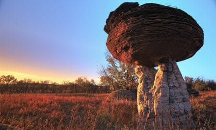
Just a short distance downstream from Factory Falls is Fullmer Falls. This waterfall is about 55 feet high, which makes it the highest of the three falls along this trail.
Fullmer Falls by Marc Andre
Downstream from Fullmer Falls is Deer Leap Falls. There is a bridge that crosses the top of Deer Leap Falls, giving you a nice view looking down, and there is a good viewing area from the base of the falls.
Deer Leap Falls by Marc Andre
When you are done photographing you can take the loop back to the parking lot and move on to the next stop.
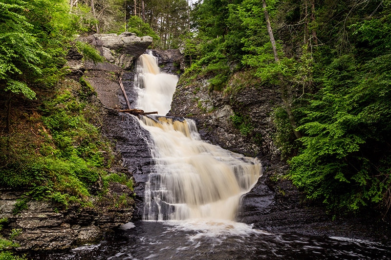
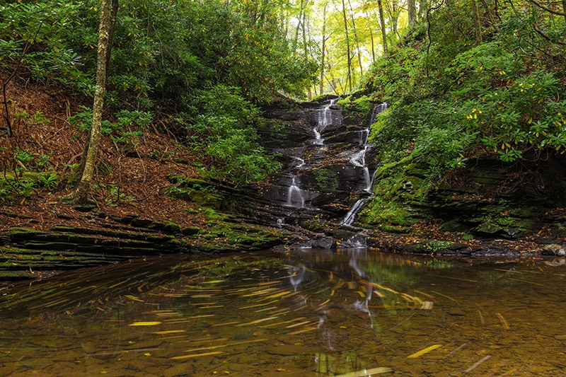
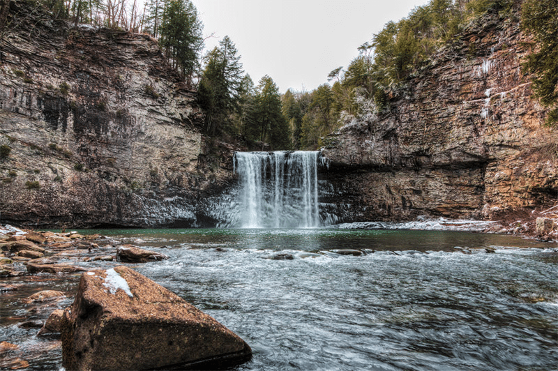
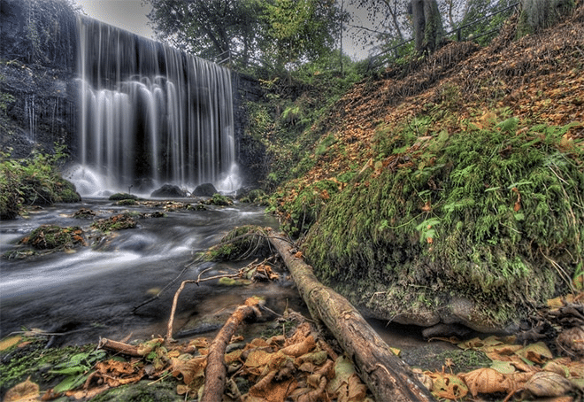
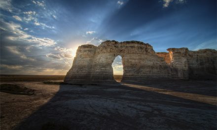
3rd Stop on the Waterfall Tour: Raymondskill Falls
Raymondskill Falls is only about a 7.5-mile drive from George W. Childs Park. The quickest way to get there is to take Silver Lake Road like you are heading back to Route 209, but instead of going all the way to 209 you can turn left (north) onto Millford Road (County Road 2001). After about five miles, turn right onto Raymondskill Road.
Then, in about one mile you will reach the parking lot for Raymondskill Falls. It will be on the right side of the road.
The GPS coordinates of the parking lot are: 41.290291,-74.840466
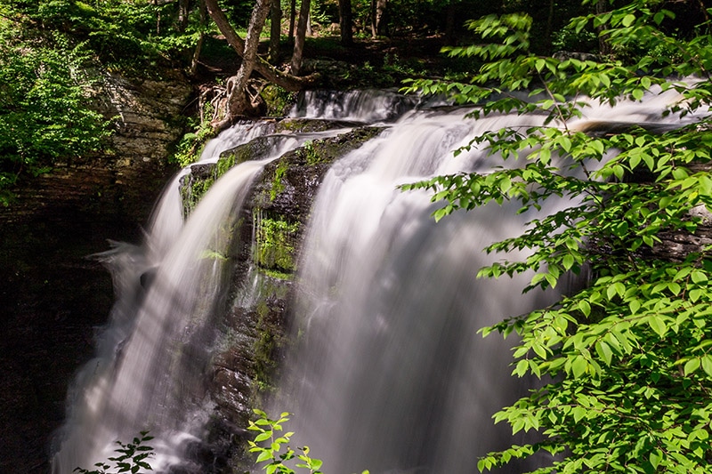
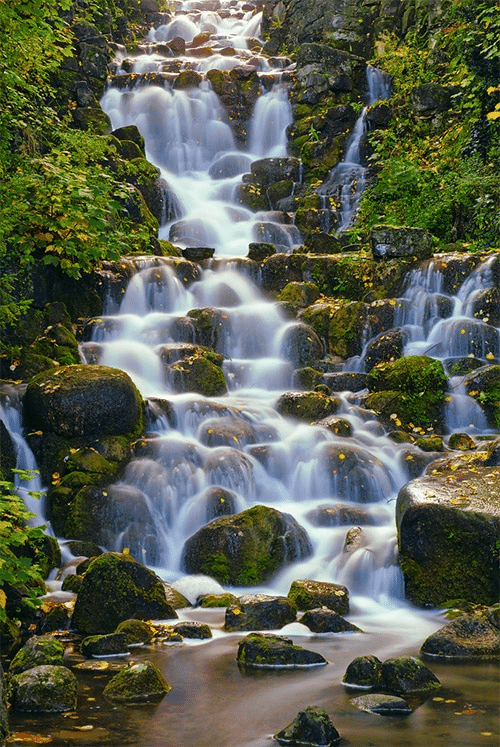
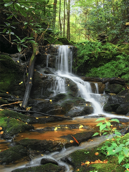
Raymondskill Falls is the tallest waterfall in Pennsylvania, but it kind of cheats to get that title. It is a multi-tier drop and the combined height is about 150 feet. However, the lower falls is separated by a fairly large pool and feels more like a separate waterfall.

Raymondskill Falls by Marc Andre
From the parking lot, there is a trail that leads to a nice viewing area, but this viewing area is above the last drop or tier, so your photos will be of the upper section unless you venture off the beaten path. The trail is short, only about a quarter mile each way, but fairly steep. It’s not bad, but it is considerably steeper than the trails to any of the other falls on this tour. Like Dingmans Falls, Raymondskill Falls is rather powerful with a pretty high flow of water at most times.
When you are finished photographing Raymondskill Falls head back up the trail to the parking lot and then you can move on to the final stop along the tour.
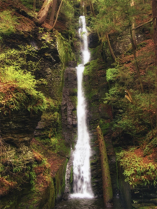
4th Stop on the Waterfall Tour: Buttermilk Falls
For the last stop on this tour, we’ll cross the Delaware River and venture into the New Jersey side of the Water Gap. It will be about a 30-minute drive from Raymondskill Falls to Buttermilk Falls.
The GPS coordinates for the parking lot at Buttermilk Falls are: 41.137042,-74.889084
Start by heading east on Raymondskill Rd. You’ll turn right to head south on Route 209 for almost 6 miles. You will see signs for the Dingmans Ferry Bridge.
Follow the signs by turning left onto Dingmans Turnpike (State Route 739) which will lead you to the bridge. There is a small toll for the bridge, I believe it is $1. Once you cross the bridge you will be in New Jersey.
Continue on the road until the first intersection, where you will turn right onto Old Mine Road. In about one mile Old Mine Road will turn into Walpack Road. At one point the road will turn right, take this right to stay on Walpack Road (which is now also National Park Service Road 615).
Drive for about three miles and turn left onto Main Street. Then go about half a mile and turn left onto Brook Road. Continue on Brook Road for about one mile and it will turn in to Mountain Road.
Mountain Road is very rough and you will need to drive very slowly. You don’t need four-wheel-drive, but a high clearance vehicle is ideal because there are a ton of potholes on this road and some of them are pretty deep. At this point you are in a rather remote area of the Delaware Water Gap, so be sure that you research ahead of time and know where you are going, and remember how to get out of there for when you are ready to leave.
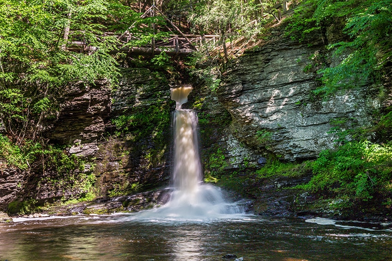
Although the road to Buttermilk Falls can be a bit of an adventure (compared to the roads on the Pennsylvania side of the Water Gap tour), there is no hike at all required to see the falls. The falls are literally right across the street from the parking lot.
Buttermilk Falls by Marc Andre
Buttermilk Falls is a 200-foot cascading waterfall. Although there is not a high flow of water at most times it is still quite a beautiful waterfall. Like all of the other falls on this tour, it is best photographed on a cloudy, overcast day.
You can easily photograph the falls from the base, and there is also a trail that leads to the top of the falls.
I’ve read that Buttermilk Falls can be a popular spot because it is also a trailhead for a longer hike, but when I was there I was alone (except for my family) and I didn’t see another car anywhere near the falls on the way in or the way out.
5th Stop on the Waterfall Tour: Slateford Creek
Slateford Creek is located at the very southern edge of the Pennsylvania side of the Delaware Water Gap National Recreation Area. From US 209 you can turn onto National Park Drive and go just a short distance before you reach an area where you can pull off the side of the road and park. The GPS coordinates for this parking area are: 40.946441, -75.116055
There is enough room for just a few cars to park here. After you park you’ll walk beyond the guardrail and you will see a small trail that leads into the forest. The trail leads up a small hill and then in just a very short distance you’ll reach the first waterfall. You can see the waterfall off to your left.
So after I left here I drove a short distance to the other end of the Slateford Creek trail where there is another waterfall. This one is just a short distance from the road.
Head to these GPS coordinates: 40.947095, -75.127288
Here you’ll find another small pull off at the side of National Park Drive. Again, there is only room for a few cars here. You’ll see a trail that heads downhill. Take that trail just a short distance and you’ll come to the waterfall.
There are some rocks here that you can use to keep your feet dry while still getting a nice view. If the water level is not too high you can even get very close to the waterfall. Just be careful, because these rocks will be wet and very slippery.
That concludes the waterfall tour of the Delaware Water Gap! In just a few hours you can photograph all seven of these amazing waterfalls. If you still want more you can visit Bushkill Falls, a popular tourist destination not far from Dingmans Falls, but technically outside of the Water Gap. See our Guide to Photographing Bushkill Falls.
Outstanding Locations for Photographing Waterfalls
Columbia River Gorge – Oregon
The Columbia River Gorge is a canyon along the Columbia River, western Oregon, and Washington. This area is absolutely filled with spectacular waterfalls that are a photographer’s dream. Several different trails provide access to the falls, and in several cases, you can hike a few miles along one trail and see multiple waterfalls.
The best of the falls are on the Oregon side, and you could easily spend several days hiking and photographing the waterfalls of this area. Multnomah Falls (pictured below) is the most famous of the falls in the Columbia River Gorge, but there are plenty of others that are very impressive as well. From the Historic Columbia River Highway, you can access several different trailheads that will lead you to waterfalls.
→ See more places to photograph in Oregon and Washington.
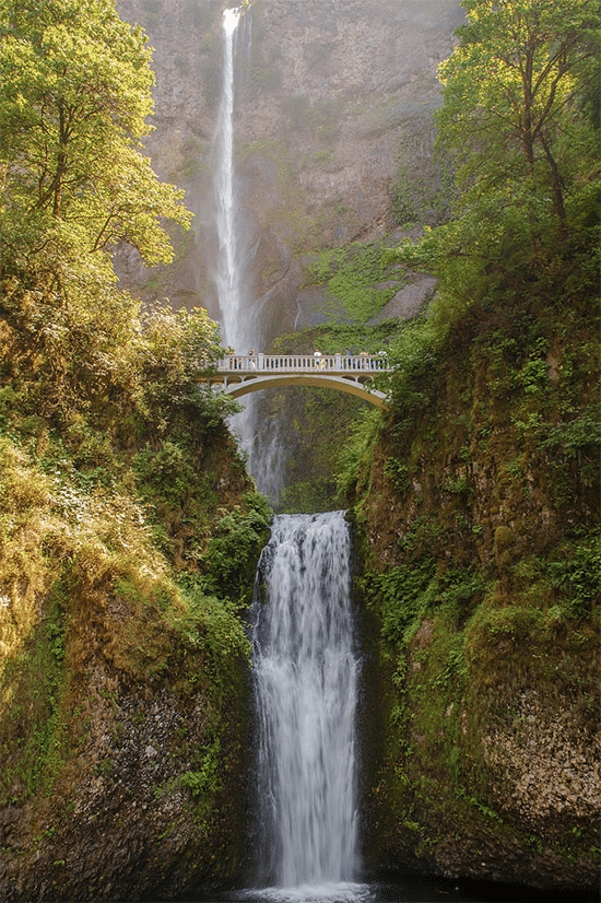
Multnomah Falls by Paul VanDerWerf / CC BY 2.0
Silver Falls State Park – Oregon
Silver Falls State Park is in western Oregon, less than a two-hour drive from the Columbia River Gorge. This is Oregon’s largest and most popular state park, and mostly because of its amazing waterfalls.
The Trail of Ten Falls is a 7-mile loop trail that leads you past 10 different waterfalls. Many of them are very picturesque, and you can walk behind a few of them. South Falls is the most popular in the park and is about 175 feet high.
→ See more places to photograph in Oregon.
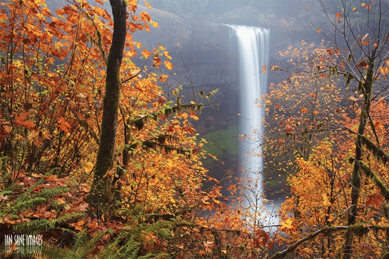
Silver Falls State Park by Ian Sane / CC BY 2.0
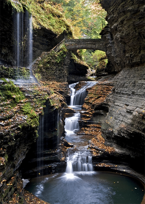
Watkins Glen State Park – New York
Watkins Glen State Park is in the Finger Lakes region and is about a 1.5-hour drive from Letchworth State Park. It features a 400-foot-deep gorge and the Glen Creek. The creek runs through the gorge to create stunning scenery (see The Guide to Photographing Watkins Glen State Park).
There are three trails in the park. The Gorge Trail descends into the gorge and leads to the 19 waterfalls of the park. The trail does include a lot of steps, but the photos you get will be well worth the effort.
→ See more places to photograph in New York.
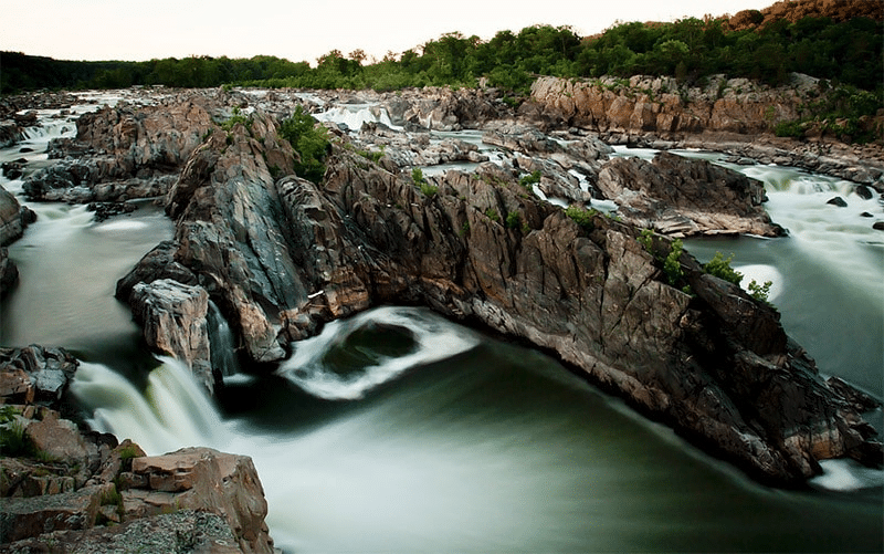
Great Falls by Mehul Antani / CC BY 2.0
Fall Creek Falls State Park – Tennessee
Fall Creek Falls State Park in central Tennessee features the 250-foot Fall Creek Falls, as well as five other impressive waterfalls. A short trail leads from a parking lot to the base of Fall Creek Falls.
Several trails throughout the park lead to other falls, including the Gorge Trail. In addition to the waterfalls, the park also features the impressive gorge, stream, and forests.
→ See more places to photograph in Tennessee.
Fall Creek Falls State Park by Michael Hicks / CC BY-ND 2.0
Gooseberry Falls State Park – Minnesota
Gooseberry Falls State Park is located along Lake Superior in northeast Minnesota. In addition to this park, Minnesota State Highway 61 provides access to several other noteworthy state parks along the north shore.
This park surrounds the mouth of the Gooseberry River in a rocky gorge and features Upper, Middle, and Lower Gooseberry Falls. Getting a view of the falls is pretty easy from the trails of the park.
→ See more places to photograph in Minnesota.
Gooseberry Falls State Park by Anita Ritenour / CC BY 2.0
Other Beautiful Locations for Photographing Waterfalls

Waterfall by Ralf Kayser / CC BY 2.0

Waterfall by Rui Antunes / CC BY 3.0
Creek Waterfall by Bence Bálint / CC BY 3.0
Albion Falls, Hamilton Ontario by Joe deSousa / Public Domain

Kirkjufellsfoss by Andrés Nieto Porras / CC BY-SA 2.0
Falls by mike138 / CC BY-ND 2.0
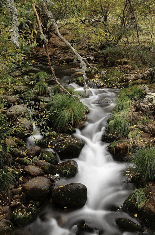
Arroyo en La Isla (Rascafría) by Manolo P. / CC BY 3.0

Venford Falls by Dan Braunton / CC BY 3.0

Schiessentumpel Waterfall by Tristan Schmurr / CC BY 3.0
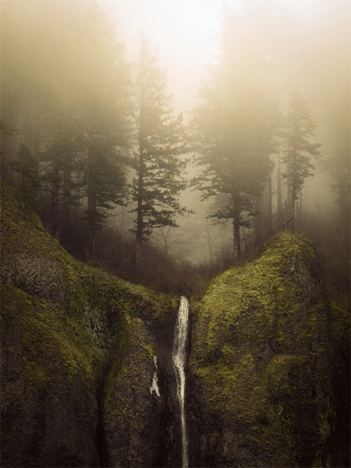
Falls & Fog by Luke Detwiler / CC BY 3.0
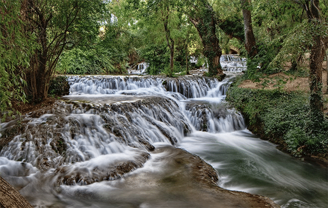
Monasterio de Piedra by Manolo P. / CC BY 3.0
Waterfall by RedBull Trinker / CC BY 2.0
12 Little Waterfalls by Martin Cathrae / CC BY-SA 2.0
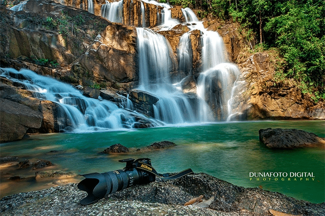
Pandan Waterfall by Duniafoto Digital / CC BY 2.0
Chutes du Diable Waterfall – HDR by Nicolas Raymond / CC BY 3.0

Waterfall at Virginia Water by William Warby / CC BY 2.0
Channeled by Nicholas A. Tonelli / CC BY 2.0

Blackwater Falls – HDR by Nicolas Raymond / CC BY 3.0

The Loup of Fintry Waterfall by Paisley Scotland / CC BY 2.0
Rosecrans Falls by Nicolas A. Tonelli / CC BY 2.0
Watkins Glen by Peter Rivera / CC BY 2.0
Photo license links: CC BY 2.0, CC BY 3.0, CC BY-SA 2.0, CC BY-ND 2.0


This is great info for both the DWG and Bushkill Falls. Well done and many thanks. Hoping to visit in a couple months.
Thanks Jack, I’m glad you found it to be helpful. Enjoy your trip! I’ll probably be out at some of the DWG waterfalls in a few months too.
Thanks, Marc! Will follow your guide this weekend for a drone trip. Instagram: @sky_fly_designs
You’re welcome Dan. I would love to see your drone photos. Feel free to share them on our Facebook page if you’re interested – https://www.facebook.com/loadedlandscapes