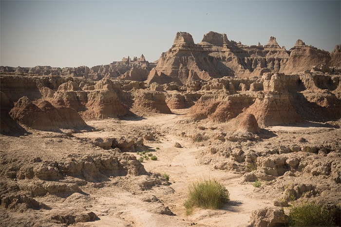
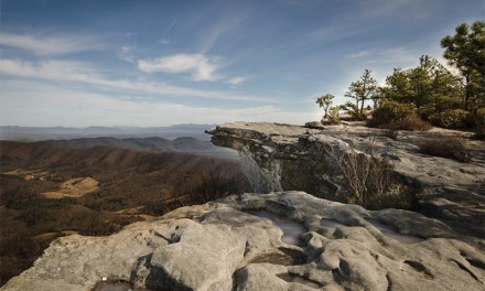
Badlands National Park may not be as well-known or popular as other parks like Yosemite, Yellowstone, or the Grand Canyon, but it does present the opportunity to see a beautiful and amazing landscape. The park, located in western South Dakota, is 240,000+ acres of stunning wilderness that is a paradise for landscape photography.
The eroded buttes, spires, and pinnacles make the badlands one of the more unique landscapes in the United States. It is one of the more surreal destinations that I have visited, and pictures really can’t show just how vast and impressive it is.
Capture the scenery at sunrise or sunset and you’re likely to see stunning colors that make your photos come to life. The park also includes some wildlife, including bison, bighorn sheep, and pronghorn antelope. Although, you’re likely to see more prairie dogs than anything else.
→ See more of The Best Places to Photograph in South Dakota
Although Badlands is a fairly large park, there are not that many roads and trails within the park. This makes it pretty simple to get around within the park, but you’ll want to know where you are going because getting from one spot to another can take quite a while since you’ll be driving a long way.
Here you’ll find a detailed look at the park from a photography-influenced perspective. Hopefully this will help you to understand the main spots of interest and to get more out of your time there. I highly recommend studying the map of the park (click on the map below to see it in full size) and follow along on the map as you read this article.
Getting to Badlands National Park
Badlands National Park is divided into two main sections: the North Unit, also known as the Badlands Wilderness Area, and the South Unit, also known as the Stronghold Unit. Most visitors spend their time primarily in the North Unit, as the Stronghold Unit has very few paved roads and access is difficult. The Stronghold Unit is on the land of the Pine Ridge Indian Reservation and in some cases you would need to get a permit from landowners in order to cross their land to reach the park. With that in mind, the majority of the information on this page will focus on the North Unit.
There are only a few main ways to enter the park by road. If you are coming from the west you may enter the park in the town of Scenic, South Dakota. From Route 44 you can turn left (north) onto Sage Creek Road. This is a gravel road that will lead you along the north rim and eventually to the paved Badlands Loop Road. There are many overlooks and places to pull over along Sage Creek Road and Badlands Loop Road.
If you are coming from the north you can enter the park at the Pinnacles Entrance, near the town of Wall. From here you will enter right onto Badlands Loop Road. From the east you can enter the park either at the Northeast Entrance or the Interior Entrance. Either will put you right on Badlands Loop Road.
You can also enter the park from the south by using Conata Road. However, to get to Conata Road from Route 44 you will have either passed the entrance at Scenic or the Interior Entrance.
Points of Interest Within Badlands National Park
There are several overlooks and a few trails that are the most popular spots for photographing the park. Fortunately, most of them are located in the North Unit of the park and are easily accessed by Badlands Loop Road or Sage Creek Road. While there are some trails in the park, most of them are short and you won’t need to spend hours hiking to reach the best spots for photography.
Badlands Loop Road
This is the main paved road that goes through the park. The road is 50+ miles long and has plenty of overlooks and vistas that will provide amazing views and awesome photographic opportunities. Below we’ll look at some of the specific points of interest. These points of interest will be listed in order, assuming you are entering the park at the Northeast Entrance and heading west on Badlands Loop Road.
Big Badlands Overlook
Just a short distance from the Northeast Entrance, Big Badlands Overlook is the first main point of interest. It’s a great place to photograph the sunrise, and if you are staying at the Cedar Pass Lodge within the park it will be just a short drive to capture that beautiful sunrise.
Door, Window, Notch, and Castle Trails
Along Badlands Loop Road just a few miles south of Big Badlands Overlook you will find the a parking area and trailheads for the Door, Window, Notch, and Castle Trails. The Door and Window Trails are both short and easy, but will allow you to get a nice view that you don’t get from the road.
The Door Trail is .75 miles roundtrip that leads you through “the Door”, which is a gap the Badlands Wall, where you will find a nice view.
The Window Trail is .25 miles roundtrip and leads you to a natural window in the Badlands Wall.
The Notch Trail is 1.5 miles roundtrip and more strenuous than the Door or the Window Trails. As part of this trail you will climb a log ladder and you’ll be rewarded with a great view of the valley below.
Castle Trail is the longest trail in the park at 10 miles roundtrip. The trail passes through the Badlands with nice, but not stunning, views throughout. If you’re working with limited time you will probably want to skip this trail and use your time along the road and the shorter trails.
Saddle Pass Trail
A few more miles down Badlands Loop Road you will find Saddle Pass Trail. This is a very short trail at just .25 miles roundtrip, but it’s not an easy hike because it climbs very quickly. The trail leads up the Badlands Wall to give you a nice view over the river valley.
White River Valley Overlook
This overlook is a great place to get a view of the valley below. There are a few paths that you can explore for a unique view, but be careful.
Panorama Point
Another excellent location for sunrise photography, Panorama Point is located about halfway from Cedar Pass Lodge to the Pinnacles Entrance. it offers a great view, including to the south and southeast.
Burns Basin Overlook
Just a short distance from Panorama Point, Burns Basin Overlook offers a nice view to the south and southwest.
Homestead Overlook
At Homestead Overlook you can catch a view that goes on for miles, extending over the flatter plains area.
Conata Basin Overlook
Approaching Conata Road, which heads north and south leading in and out of the park, you will reach the Conata Basin Overlook. This spot also provides a nice view to the southwest and is a great location for sunset photography.
Yellow Mounds Overlook
The Yellow Mounds Overlook is one of the most popular spots for photography, because it gives a great view of the most colorful formations in the park.
Pinnacles Overlook
From the parking lot you can take steps down to an overlook with a beautiful view. This westward view is an excellent choice for sunset photography. You will also see a little more plant life from this overlook than some of the others that you have already passed.
Sage Creek Rim Road
If you’ve been following Badlands Loop Road past all of these points that have been mentioned you will now be at the point where you can follow the road out of the park to the north at the Pinnacles Entrance, or you can continue on Sage Creek Rim Road. This is a gravel road (as far as gravel roads go, it’s in pretty good shape) that leads to many other beautiful parts of the park that you will want to see.
You’ll find that the landscape quickly changes and soon becomes less dramatic, but this area of the park is where you are more likely to spot wildlife. So continue on this gravel road and the points of interest mentioned below are in the order that you will reach them.
Badlands Wilderness Overlook
This area of the park does not include as many scenic vistas, but Badlands Wilderness Overlook is one of the best options along Sage Creek Rim Road.
Roberts Prairie Dog Town
For whatever reason this area of park is home to a huge number of prairie dogs. You won’t find the most amazing landscape, but if you are into prairie dogs, and lots of them, you will like this stop.
Sage Creek Basin Overlook
While the landscape here is not as dramatic as you will find along Badlands Loop Road, Sage Creek Basin Overlook is another spot that is good for sunset photography.
Sage Creek Road
After passing the points of interest mentioned above you can continue on Sage Creek Road, which will lead you to Route 44 in the town of Scenic. From here you can leave the park or head east on 44 to go back to the Interior Entrance if you are staying at the Ceder Pass Lodge.
Tips for Photographing Badlands National Park
Stay at Cedar Pass Lodge
The best photographs at the Badlands are likely to come at sunrise and sunset, or during the golden hours. During mid-day the harsh sunlight can really wash out the rock formations. By staying at Cedar Pass Lodge you’ll be nice and close to plenty of viewpoints for the best sunrise and sunset photos.
Be Prepared for Extreme Weather
Summers can be extremely hot, and winters very cold. Be sure to bring water, especially if you are hiking. Even if you are not hiking you’ll want to bring some food and drink with you because at most locations in the park you will be a good distance from any stores or restaurants. It can also be quite windy within the park, and the weather can change quickly.
Be Careful
If you’re hiking or exploring the areas around the viewpoints be sure to watch your step. The ground can easily crumble or break off in many places, causing you to slip. Also be aware of the wildlife within the park. Rattlesnakes are common (I heard one, but didn’t see it). If you’re hiking or climbing don’t put your hands or feet anywhere that you can’t see because the rattlesnakes like to stay in these crevices. If you see any bison in the park be sure to keep your distance.
Have the Right Gear
You’ll definitely want to have a wide angle lens to capture the vastness of the landscape. One of the biggest challenges that I felt when photographing the Badlands was showing just how massive and unending the landscape is. Ultra wide lenses will give you the best option for overcoming this, and you can also use a series of photos and then create a panorama in Lightroom.
In addition to a wide angle you will likely also want to have a telephoto lens for capturing the formations up close to show details. As always with landscape photography, you’ll want to have a sturdy tripod. You probably won’t have to do as much hiking as you would at some other locations, so having a lightweight tripod is not as critical, but due to the wind you will want a sturdy tripod. You may even want a weight to hang from the tripod for added stability.
Cleaning equipment, including wipes, is also important. A good polarizer and some graduated neutral density filters will also be helpful.
For processing your photos, try our own Landscape Legend Lightroom Presets.
Other Destinations in the Area
While you are visiting Badlands National Park you may also want to visit some of these other points of interest in the region.
Devil’s Tower
Devil’s Tower, in Wyoming, is about 2.5 hours west of the Badlands.
Mount Rushmore
Mount Rushmore is about 1.5 hours west of the Badlands.
Custer State Park
About 2 hours west of the Badlands, and just south of Mount Rushmore, is Custer State Park. This is a great park where you will find a lot of wildlife, including herds of bison. The drive between Mount Rushmore and Custer State Park is also very scenic with plenty of places to photograph. See our Guide to Photographing Custer State Park.
Photo license links: CC0, CC BY 2.0, CC BY-ND 2.0, CC BY-SA 3.0, CC BY-SA 4.0


