Great Smoky Mountains National Park in Tennessee and North Carolina is a paradise for landscape and nature photographers. It hosts more visitors each year than any other national park in the United States, and photographers can enjoy and appreciate it in any season.
The park totals more than 800 square miles and hundreds of miles of trails, including the Appalachian Trail. Photographers flock to the Great Smoky Mountains to capture beautiful landscapes and wildlife, as well as a wide variety of plants. The mountains and streams that fill the park offer unlimited opportunities for photographers. Wildlife within the park includes white-tailed deer, black bears, elk, and turkey, but spotting the wildlife within the park isn’t easy.
→ See More of The Best Places to Photograph in Tennessee and North Carolina
The Layout
Although the park is large there are only a few major roads within the park. This makes it a bit easier to plan your trip as you can get an idea of where points of interest are located and how you can get to them.
There are several different ways to enter the park with the most popular being at Gatlinburg, TN to the north end of the park, at Townsend, TN to the northwest section of the park, and at Cherokee, NC to the south end of the park. US route 441 travels through the park from Gatlinburg to Cherokee and is also called Newfound Gap Road within the park. Several of the parks main attractions and trailheads can be accessed from this road.
Visitor’s centers are located near both entrances on 441. The Sugarlands Visitor’s Center is located just after the main Gatlinburg entrance and the Oconaluftee Visitor’s Center is located near the Cherokee entrance. Clingman’s Dome Road, which leads to the highest point of the park, is accessible via Newfound Gap Road, roughly halfway between the Gatlinburg and Cherokee entrances along the border of TN and NC.
Little River Road is another major road that runs from the Sugarlands Visitor’s Center to Cade’s Cove at the west end of the park. There are also many viewpoints and trails that can be accessed by Little River Road.
The map below shows some of the major points the will be mentioned later. Click on the map to see a larger version.
→ Related reading: The Photographer’s Guide to the Grand Canyon
Best Places to Photograph at Great Smoky Mountains National Park
There is no shortage of opportunities for landscape photographers within the park. Although there are several popular destinations that will be mentioned on this page, you should also explore on your own. The many trails within the park will provide some of the best opportunities that you will find for beautiful and unique photos. We’ll look a a few of the most noteworthy trails in more detail.
Newfound Gap Road
Newfound Gap is the lowest driveable pass through Great Smoky Mountains National Park. Newfound Gap Road runs through the park from Gatlinburg, TN to Cherokee, NC with plenty places to stop and photograph. Most of the parks visitors stay on the major roads within the park, and Newfound Gap Road is one of those major roads. While there are many different viewpoints along the road there are also plenty of opportunities to explore and get away from the crowds. Newfound Gap Road is the location of many trailheads (I’ll mention some of them later).
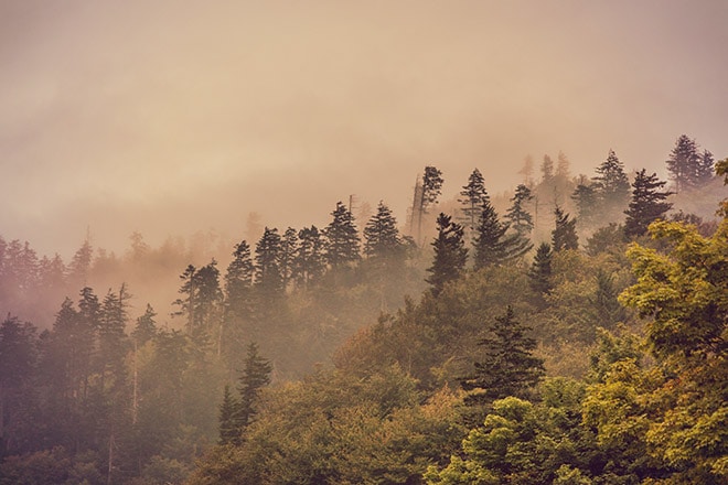
Foggy Sunrise at Newfound Gap by Loaded Landscapes
The parking lot and viewpoint at Newfound Gap provides a great view and is an ideal place for sunrise photography. The view from the parking lot faces east and if you want a good westward view there is a pull off just north of Newfound Gap. The Appalachian Trail is also accessible from the parking lot at Newfound Gap.
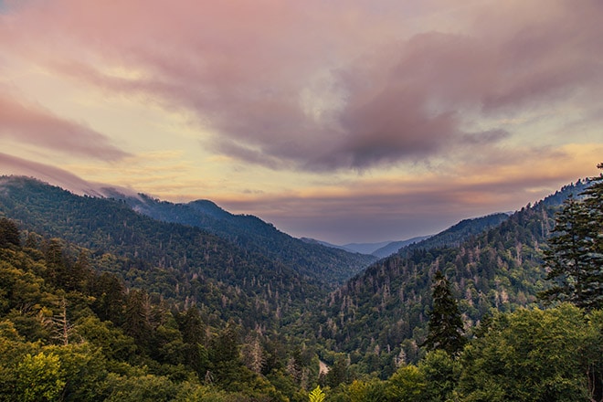
Sunrise from Newfound Gap by Loaded Landscapes
The north end of Newfound Gap Road runs along the Little Pigeon River and the south end of the road runs along the Oconaluftee River. The rivers provide great photographic opportunities and there are many trails and places where you can access the water. Park and explore on foot to get some of your best photographs within the park.
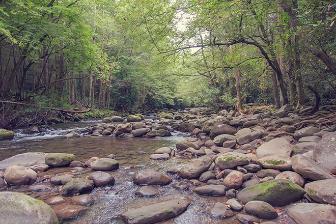
Little Pigeon River by Loaded Landscapes
Clingman’s Dome
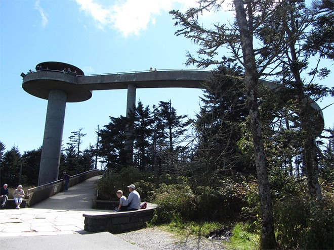
Clingman’s Dome is the highest point in Great Smoky Mountains National Park at more than 6,600 feet. The seven-mile long Clingman’s Dome Road leads to a parking lot. At the parking lot you will have amazing views of the surrounding area, and there is also a paved half-mile, and steep, walkway to the top of Clingman’s Dome observation tower. Although this is the highest point in the park there are some trees that can get in the way of the view, so you may prefer the view from the parking lot for photos.
Clingman’s Dome Road can be accessed about 0.1 mile south of Newfound Gap (you’ll see signs for Clingman’s Dome near the parking lot of Newfound Gap). The observation tower is open year-round but Clingman’s Dome Road is closed December through March.
Mount Le Conte
Mount Le Conte is the third-highest peak within the park, behind Clingman’s Dome and Mount Guyot. It is accessible by hiking an intense 5.5 miles from the Alum Cave Trailhead on Newfound Gap Road. To reach the trailhead drive south about 8.7 miles from the Sugarlands Visitor’s Center near Gatlinburg and you will find two parking lots for the trailhead. The Le Conte Lodge is located near the peak, so you can stay overnight and return he next day.
Chimney Tops
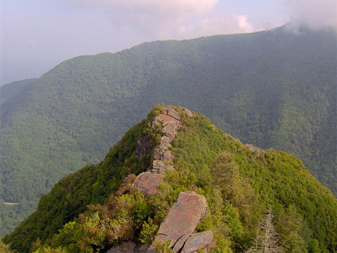
Chimney Tops is a mountain that offers a popular hike with beautiful panoramic views. The trail is about 3.8 miles roundtrip and is very steep in certain locations. At the peak of Chimney Tops you’ll have a great view for photographs. Along the trail you’ll also have plenty of views, including a stream. The trailhead is located on Newfound Gap Road about 6.9 miles south of the Sugarlands Visitor’s Center.
Cade’s Cove
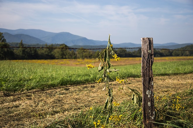
Cades Cove by Loaded Landscapes
Located at the western side of the park, Cade’s Cove is one of the more popular spots within Great Smoky Mountains National Park. Cade’s Cove was the location of a small settlement (around 270 people at its peak) before the area was made a national park. It lies in a valley surrounded by the mountains and is one of the best places in the park for (possibly) viewing wildlife. It’s common to see deer, and if you’re lucky you might spot a black bear.
You can reach Cade’s Cove from Laurel Creek Road, which can be accessed from the town of Townsend, TN using route 73. If you are entering the park at Gatlinburg you can also get to Cade’s Cove by taking Little River Road (by the Sugarlands Vistor’s Center) to Laurel Creek Road. Cade’s Cove maps and info are available at the visitor’s center. The drive from Gatlinburg to Cade’s Cove is about an hour and a half, if I remember correctly.
Once you reach Cade’s Cove there is an 11-mile road that loops around the valley (one-way road). From that road you can park and get out at many different locations. There are many buildings still standing, including homes, barns, churches, and a grist mill. There are also cemeteries next to the churches. Some of the structures are right along the road, but you will need to hike a small ways to reach some of them. There is a visitor’s center at Cade’s Cover, but it is halfway around the loop, so you will want to have a map from one of the other visitor’s centers before getting there.
Because Cade’s Cove is a popular area traffic on the loop can be quite heavy and slow-moving, so don’t expect to drive around the area very quickly. Driving around the loop and getting out at several stops can easily take a few hours, and that is without spending a lot of time for photography or hiking some of the longer trails.
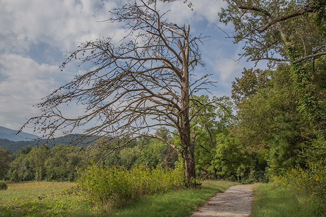
Trail in Cade’s Cove by Loaded Landscapes
It’s important to note that Cade’s Cove is closed to motor vehicles at certain times for bicyclists and pedestrians. Be sure to check on the details when you are visiting, but currently motor vehicles are restricted until 10:00 AM every Saturday and Wednesday from May to September.
Roaring Fork Motor Nature Trail
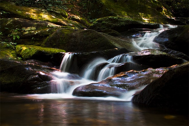
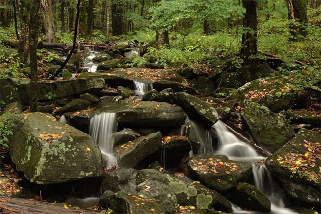
The Roaring Fork Motor Nature Trail (closed in winter) is another popular spot within the park. It is easily reachable from Gatlinburg and serves as an access point to a few key trails and waterfalls. The Motor Nature Trail is a winding 5.5 mile one-way loop that can be quite steep at certain points. The Roaring Fork stream runs through the area and is a great subject for photographs.
To reach the trail turn at traffic light #8 on the main parkway in Gatlinburg and follow Historic Nature Trail Road to the Cherokee Orchard entrance to the national park. Before entering the trail you’ll also have access to the Noah “Bud” Ogle self-guiding nature trail and the trailhead for Rainbow Falls. The trailhead for Grotto Falls is also located along the Motor Nature Trail, and near the end of the trail is the Place of a Thousand Drips, a waterfall that may be very little water or something more significant after a recent rain. When the water is flowing at the Place of a Thousand Drips it provides an excellent photographic opportunity.
Little River Road and Trail
Little River Road runs for 18 miles between the Sugarlands Visitor’s Center and Cade’s Cove. Along the road there are a number of viewpoints and overlooks where you can find great views of the mountains and the river. Little River Trial offers you a great opportunity to get photos of the river, including at Huskey Branch Falls, a small but beautiful cascade about 2.2 miles into the hike. To get to the trailhead drive about 4.9 miles on Little River Road from the Sugarlands Visitor’s Center and turn left towards the Elkmont Campground. Then drive 1.4 miles to reach the campground. Before entering the campground turn left and drive 0.6 miles to a parking lot for the trail.
Oconaluftee River Trail
The Oconaluftee River Trail offers easy access views of the river. The trail runs about 1.5 miles and starts at the Oconaluftee Visitor’s Center.
Waterfalls
Great Smoky Mountains National Park is home to a number of different waterfalls that are just waiting to be photographed. The bad part is that almost all of them require a hike to reach, and in some cases the hike will be several miles. So if you have a short visit you will need to determine your priorities and plan your time accordingly. You can get a map specifically for the waterfalls at the visitor’s centers. Here is a look at some of the noteworthy waterfalls within the park.
Laurel Falls
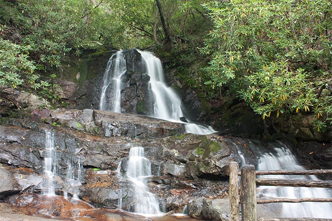
Laurel Falls is one of the more popular falls in the park, and it includes an upper and lower falls with a walkway in the middle. The trail to Laurel Falls is about 2.5 miles roundtrip and is steep in places. To access the trailhead take Little River Road from the Sugarlands Visitor’s Center (heading towards Cade’s Cove) about 3.5 miles. Parking lots for the trailhead are on both sides of the road.
Grotto Falls
Grotto Falls is accessible by a 3 mile rountrip hike. The trailhead is located on the Roaring Fork Motor Nature Trail (it is stop #5 on the trail). To get to the Motor Nature Trail turn at traffic light #8 on the main parkway in Gatlinburg and follow Historic Nature Trail Road to the Cherokee Orchard entrance to the national park. The Motor Nature Trail is closed during the winter.
Abrams Falls
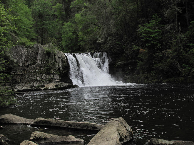
Abrams Falls is only 20 feet high, but more water flows through it than any of the other falls in the park. You’ll need to hike 5 miles roundtrip to see the falls. The trailhead is located on the Cade’s Cove loop at stop number 10.
Rainbow Falls
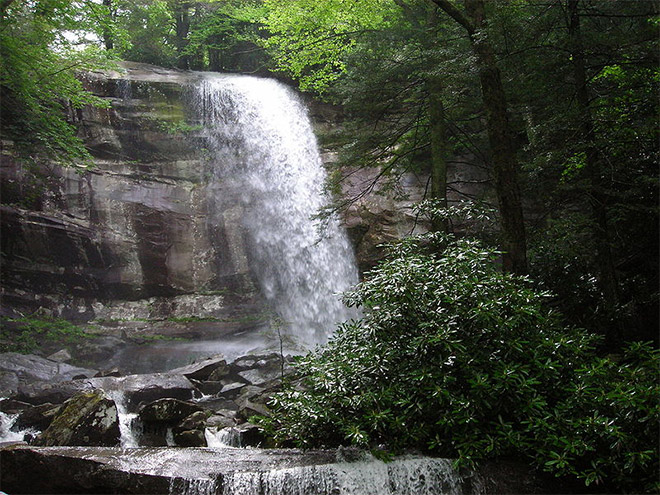
Rainbow Falls is named for the rainbow that is formed by the mist on sunny afternoons at this 80-foot waterfall. The trailhead to Rainbow Falls is just before the entrance to the Roaring Fork Motor Nature Trail. The trail is about 5.5 miles roundtrip and much of the trail winds along the LeConte Creek, providing plenty of photographic opportunities along the way to the falls. The trail continues beyond the falls to the summit of Mount LeConte (about 4 miles past Rainbow Falls).
Mingo Falls
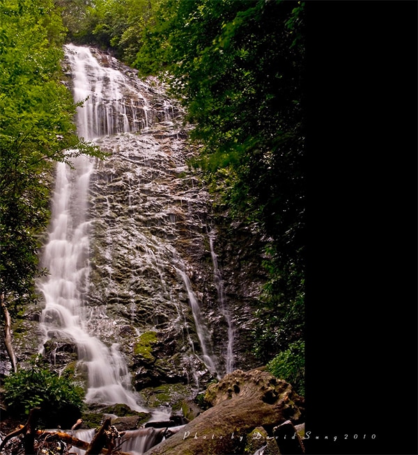
Mingo Falls is actually located just outside of the park on the Cherokee Indian Reservation. The trail to Mingo Falls is only about .5 mile roundtrip, but it is moderately difficult because it involves climbing more than 150 stairs. The 200-foot waterfall flows quite strong after a rain. To reach the trailhead drive south from the Oconaluftee Visitor’s Center on US 441 and take the second left onto Big Cove Road. Then turn left at the first stop sign and drive for about 4.5 miles to the Mingo Falls Campground.
→ Related reading: Photographing Zion National Park
Best Times to Visit
Great Smokey Mountains National Park is beautiful in any season. Spring provides opportunities to photograph wildflowers and the amount of water flowing through the streams and waterfalls is highest in spring and summer. Fall is, of course, a great time to photograph the landscape in beautiful colors. And winter provides opportunities for photographing the landscape with snow and ice.
The most popular seasons are spring and fall, so those times will involve the largest crowds. While there are a few great photography spots in the park that you can easily drive to, like Newfound Gap and Clingman’s Dome, many of the best photo opportunities will require some hiking. Since the majority of the parks visitors stay on the main roads and at the major viewpoints this means that the crowds really aren’t that big of a factor as far as photography is concerned. Even during the busy times you can easily get some seclusion by taking to the trails, so the best time to visit really depends on what you want to photograph. Keep in mind that although the park is open year round some roads are closed during the winter, most notably the road to Clingman’s Dome and the Roaring Fork Motor Nature Trail.
Depending on where you will be staying the crowds can impact how easy or difficult it will be for you to get in and out of the park. The town of Gatlinburg, the most popular entrance at the northern side of the park, is a very busy tourist area, as is the town of Pigeon Forge, which is next to Gatlinburg. Traveling a relatively short distance can take quite a while if you are going through the heart of Pigeon Forge and Gatlinburg to get to the park (there is a bypass that will make the trip much quicker depending on where you are coming from). There are campsites within the park that will save you from this traffic.
Busy seasons also mean more cars on the main roads within the park, like Newfound Gap Road and the loop at Cade’s Cove. Since it is a large park getting from one location to another can take some time even without the traffic.
As far as fall foliage is concerned, the changing colors will happen at different times because there is so much elevation change within the park. In general, October is a great time to visit for autumn photography (details).
→ Related reading: Guide to Photographing Badlands National Park
Tips for Photographing Great Smoky Mountains National Park
1. Plan Ahead
Planning and preparation is key to any photography trip, and visiting the Smokies is no different. Planning is important here for a few reasons. First, it is a big park with only a few major entrances, so it is important to know where you want to be. There are plenty of places to stay in Gatlinburg, and there are also several campgrounds within the park, but where you choose to stay will have a big impact on how long it takes you to get to the spots that interest you the most.
Another factor that makes planning so important is that getting the best photos at Great Smokey Mountains National Park will require getting off the main roads and hiking. Many of the hikes are several miles long and will take half a day or more. You’ll want to know which ones are most important to you so you can use your time effectively.
2. Allow Plenty of Time, Especially for Sunrise and Sunset
Getting around the park can take some time, especially due to the size of the park and the fact that you are likely to need to hike. If you want to be at a particular spot for sunrise you’ll need to leave plenty of time to get there and be in position. When I visited it took longer than I expected to get to the park and to get to the spot I wanted before sunrise, even with almost no traffic at that time.
For sunset shots you’re much more likely to have to deal with traffic, both inside and outside of the park, in order to reach your chosen destination. So be sure that you leave plenty of time if you don’t want to miss the opportunity.
3. Don’t Ignore the Popular Spots
Some of the most popular spots in the park include Newfound Gap, Clingman’s Dome, and Cade’s Cove. Part of the reasons these spots are popular is because there are roads that will lead you easily to them. Although all of these spots can get crowded you can still get great shots. At Newfound Gap and Clingman’s Dome you’ll be photographing the mountains and valleys and the surrounding views. Even if the parking lots and viewpoints are fairly crowded you can still usually find a spot to set up your tripod and capture the scene.
Traffic at Cade’s Cove moves pretty slowly during peak times, but once you get out of the car there are still plenty of great photo opportunities with traffic and crowds not being a major factor. There are several places where you can hike from the Cade’s Cove loop and the longer the hike the fewer people you’ll come across.
4. Explore on Your Own
The best photos you’ll get in the Smokey Mountains are likely to be taken on a trail or while exploring on your own. Although the major viewpoints are worth visiting you certainly won’t want to ignore the opportunities to get off the main roads. The trails throughout the park not only are great for photographing, but they will also allow you to enjoy the natural beauty and peacefulness. There are plenty of tails to choose from and there are also a number of places where you can access the rivers or streams from one of the major roads.
5. Be Prepared to Hike
A photographic trip to Great Smoky Mountains National Park is not relaxing. Be prepared to spend a lot of time on foot, and bring appropriate clothing and shoes/boots. Most of the hikes are at least a few miles roundtrip, so you’ll need to account for hours of hiking in your planning.
6. Stay in the Park or as Close as Possible to a Main Entrance
One of the things I would have done differently about my first trip to Great Smoky Mountain National Park is to chose a hotel closer to the main entrance of the park. I stayed in Pigeon Forge, one town over from Gatlinburg, but it can take quite a while (depending on traffic and lights) just to get to the entrance of the park. And then once you are in the park you’ll have a significant drive and/or hike to just about any destination within the park. I felt like I spent way too much time driving between the park and the hotel even though I was only there for a few days. There are a number of hotels in Gatlinburg that will put you within minutes of the entrance to the park, and camping inside the park is also an option.
Recommended Gear:
1. Lightweight Tripod
Because you will almost certainly be doing a lot of hiking, and sometimes very strenuous hiking, you will want your tripod to be as light as possible.
2. Backpack
You’ll need a backpack that will allow you to comfortably carry your gear while your are hiking. Since many of the trails are steep it can help to have a backpack that will keep your hands free. Those from Case Logic or Lowepro are good options.
3. Rain Gear
Rain in the Smokies is not uncommon, so you will want to be able to protect your gear. An inexpensive rain cover, like this one from Altura Photo, is a great thing to have with you.
4. Wide Angle Lens
A must-have for landscape photography, you’ll want a wide angle lens to be able to capture the vastness of the mountains ad valleys. See our reviews of the best wide angle lenses for Canon and our reviews of the best wide angle lenses for Nikon.
5. Telephoto Lens
A telephoto lens will also be helpful for capturing details from the mountain peaks and from the trails. See our reviews of the best telephoto lenses for Canon and our reviews of the best telephoto lenses for Nikon.
6. Landscape Legend Lightroom Presets
When it comes to processing your landscape photos, the Landscape Legend Lightroom Presets can be a huge time saver. The set includes more than 290 presets, which includes 100 one-click presets and loads of stackable workflow presets that give you countless options.
Photo license links: CC BY 2.0, CC BY-SA 2.0, CC BY-SA 3.0, CC BY-ND 2.0







Awesome stuff!
Can’t wait to return here. Gawd I had dreadful shooting conditions for the most part back in 2011 and it became very hot and muggy early in the season. I did manage some beautiful misty scenes of the Oconaluftee River after wild storms passed through my final evening. Gotta get back!
Endless photo ops depending on your likes. Get out extra early and avoid the traffic. Can be useful to concentrate on one part of the park at a time to avoid extra drive times. Keep several lenses and rain gear in your pack. Get out there and enjoy !