Bear Rocks by Marc Andre
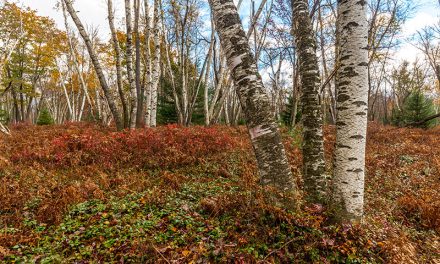
The Dolly Sods Wilderness is located in the Monongahela National Forest in West Virginia. The 17,000-acre wilderness includes high plateaus, rocky plains, bogs, and amazing vistas. It is located a short drive from Blackwater Falls State Park, so if you are in the area be sure to set some time aside for visiting Dolly Sods.
→ Related reading: Photography Guide to Blackwater Falls State Park
Getting Around
There are 47 miles of hiking trails available within the wilderness, with many of the following old railroad grades and logging roads. You can learn more about the trails from this brochure. The main roads for driving in Dolly Sods are Forest Roads 75 and 19.
They are rough, unpaved roads, but in normal weather conditions, they don’t require a four-wheel-drive, although a vehicle with high clearance would be ideal. In winter the roads are impassable due to snow.
→ See More of The Best Places to Photograph in West Virginia
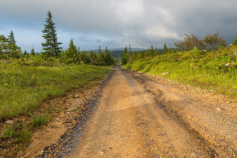
Forest Road 75 by Marc Andre
Bear Rocks
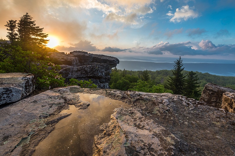
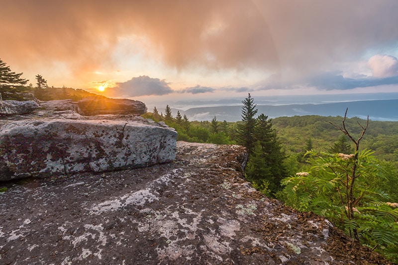
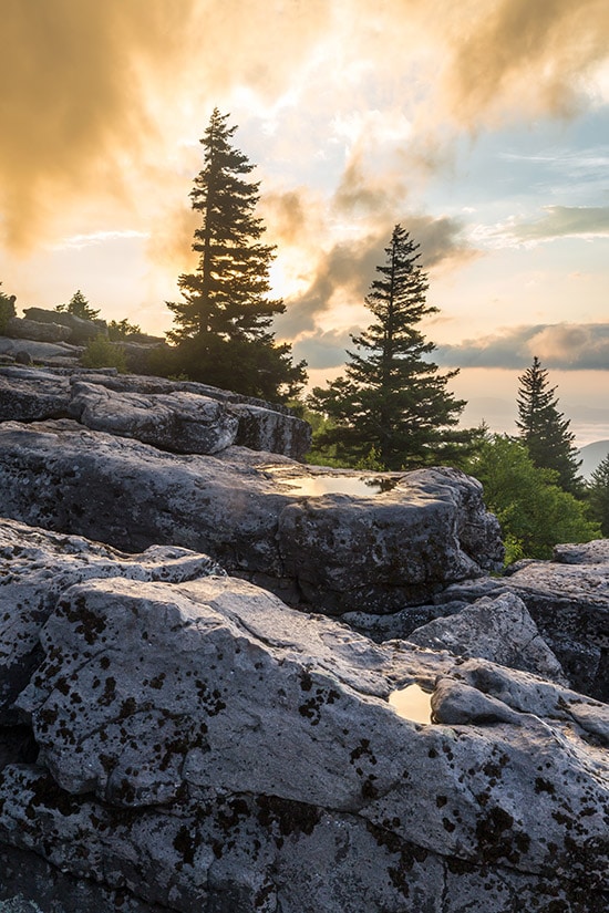
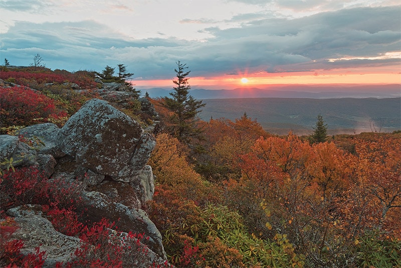
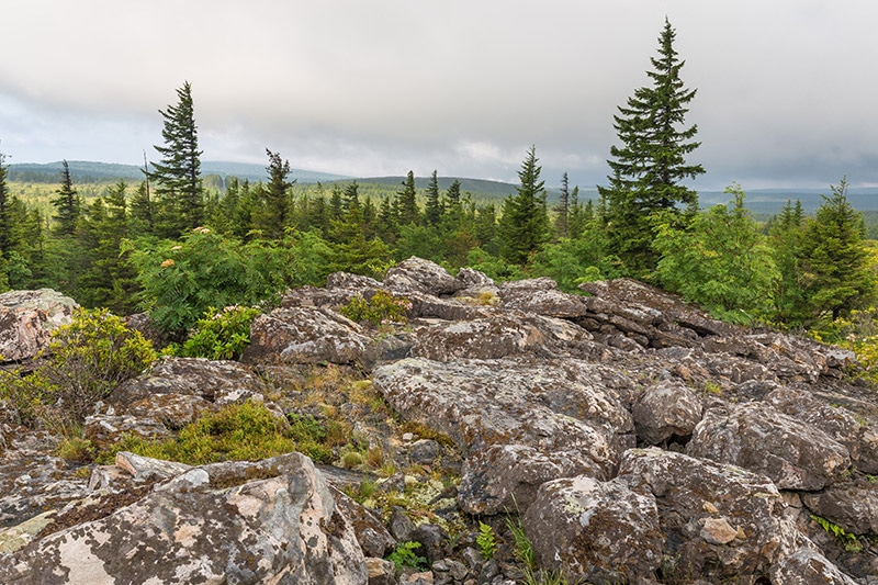
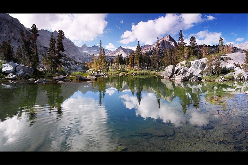
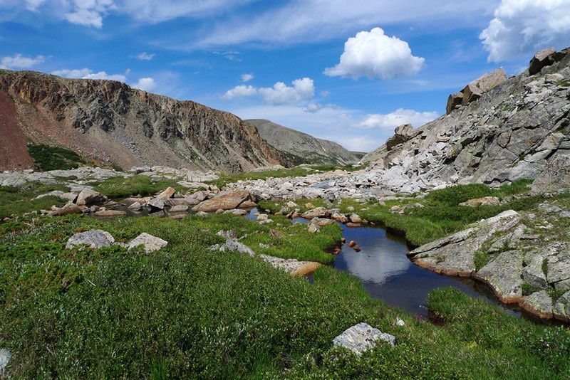
One popular location within Dolly Sods is Bear Rocks. It is located at the north end of the wilderness just off of Forest Road 75. This rocky summit provides a great view of the surrounding area and is one of the most photographed locations in West Virginia.
I recently visited Bear Rocks for some sunrise photography.
Bear Rocks by Marc Andre

Bear Rocks by Marc Andre
Bear Rocks by Marc Andre
In autumn the colors are amazing and the area is even more popular with photographers.
Bear Rocks by Nicolas Raymond / CC BY 2.0
Beautiful Wilderness
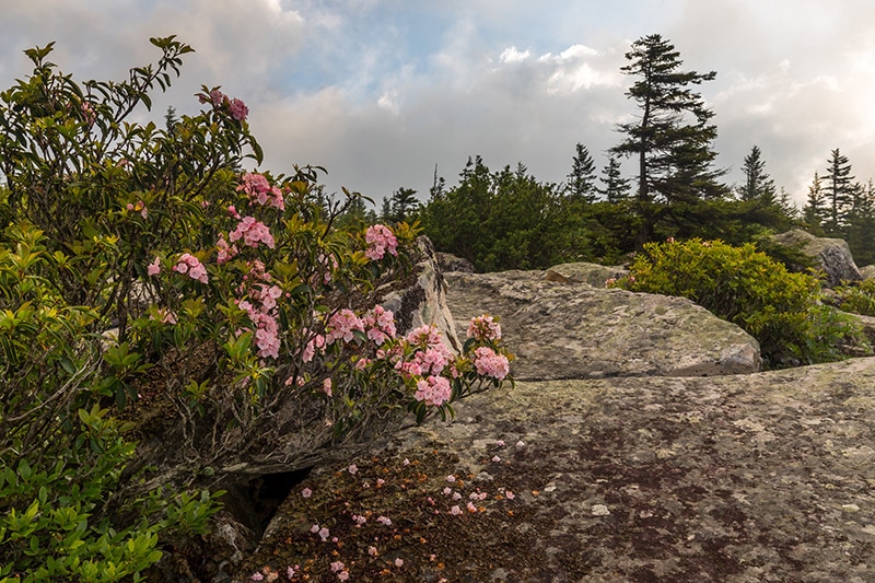
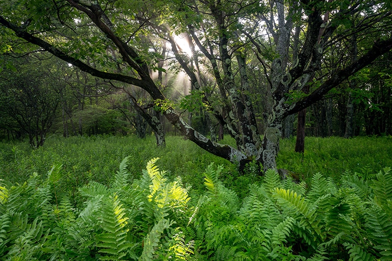
Dolly Sods is home to a lot of beautiful trees and plants that are perfect for photographing.
Dolly Sods Wilderness by Marc Andre
Dolly Sods Wilderness by Marc Andre
If you want to see, experience, and photograph Dolly Sods you can explore some of the trails throughout the wilderness, or simply drive on the forest roads and pull over when you see something interesting.
The photo below was taken along the side of Forest Road 75.
Dolly Sods Wilderness by Marc Andre
Amazing Wilderness Areas for Photographers
If you prefer solitude instead of fighting the crowds at popular parks, wilderness areas can be an excellent destination for your landscape and nature photography. In most designated wilderness areas you can photography nature that is uncompromised and spectacular.
The downside to photographing these wilderness areas is that access is usually not easy. You may need to hike a few (or many) miles to get the shot.
But on the bright side, wilderness areas are not explored by millions of people like a national park, so your photos will be more unique.
If you are willing to drive some unpaved roads or hike a few miles, visiting a wilderness area can be a very rewarding experience. In this article, we’ll look at ten outstanding wilderness areas in the United States that offer amazing photographic opportunities.
John Muir Wilderness – California
The John Muir Wilderness covers about 650,000 acres in the Sierra Nevada of California, near Sequoia/Kings Canyon National Park. Elevation in the wilderness ranges from about 4,000 to 14,000 feet, with many peaks exceeding 13,000 feet, including Mount Whitney.
This beautiful wilderness features stunning mountains, canyons, lakes, and forests. It features almost 600 miles of maintained trails, including parts of the popular John Muir Trail and Pacific Crest Trail. All overnight trips require a permit, and quotas are in place, so planning is recommended.
→ See more places to photograph in California
John Muir Wilderness by Jeff P / CC BY 2.0
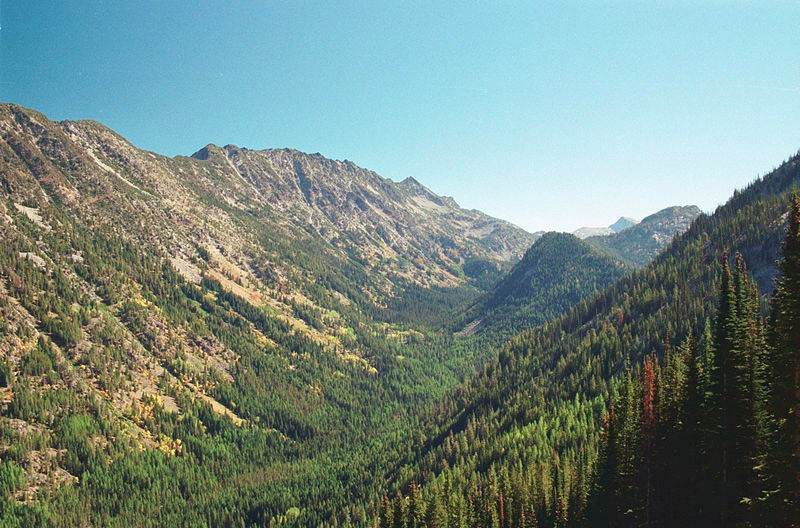
Eagle Cap Wilderness – Oregon
The Eagle Cap Wilderness is in northeastern Oregon in the Wallowa Mountains. It covers about 360,000 acres and elevation ranges from about 3,000 feet to 9,000 feet. This wilderness is filled with mountains, alpine lakes and meadows, and glacial valleys.
There are about 500 miles of hiking trails from about 50 different trailheads. Trailheads are reachable from all sides of the wilderness.
The Lakes Basin is one of the most popular areas. The Eagle Cap Wilderness is also home to several scenic rivers.
Wilderness Visitor Permits are required (one per group), and a Northwest Forest Pass is required for parking at some trailheads.
→ See more places to photograph in Oregon
Eagle Cap Wilderness by Dsdugan / Public Domain
Three Sisters Wilderness – Oregon
The Three Sisters Wilderness, named after the Three Sisters volcanoes, covers about 285,000 acres of west-central Oregon. Elevation ranges from about 2,000 feet to 10,000 feet, with all three sisters exceeding 10,000 feet. In addition to the peaks, the Three Sisters Wilderness features several glaciers.
There are more than 250 miles of trails in the wilderness, including the Pacific Crest Trail and the French Pete Trail. Some trailheads require Recreation Pass and Permits.
This is a great wilderness to photograph because of the beautiful peaks, glaciers, lakes, waterfalls, streams, meadows, and forests.
→ See more places to photograph in Oregon
South Sister, Three Sisters Wilderness by Sheila Sund / CC BY 2.0
Alpine Lakes Wilderness – Washington
The Alpine Lakes Wilderness covers more than 400,000 acres of central Washington. This area of the Central Cascades is known for its scenic beauty. It features stunning ridges, valleys, and hundreds of picturesque lakes, as well as some small glaciers. Elevation ranges from about 1,000 feet to 9,000 feet.
There are over 600 miles of trails, including part of the Pacific Crest Trail, and nearly 50 trailheads. Some trailheads require a recreation pass.
The beautiful lakes and snow-capped peaks make the Alpine Lakes Wilderness a great place for photographers.
→ See more places to photograph in Washington

Robin Lakes in the Alpine Lakes Wilderness by Jeff P / CC BY 2.0
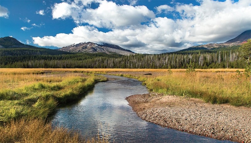
Owyhee River Wilderness – Idaho
The Owyhee River Wilderness covers about 250,000 acres of southwest Idaho. This amazing wilderness features the beautiful river, deep canyons, and desert. There are a few rough roads, but no trails within the wilderness.
Cross-country hiking, without trails, is possible for experienced hikers. The area is also popular for whitewater rafting.
Although there are not a lot of roads, the roads that do exist provide access to spectacular scenery. The Owyhee Uplands National Back Country Byway is a great option.
→ See more places to photograph in Idaho

Owyhee River Wilderness by BLM / CC BY 2.0
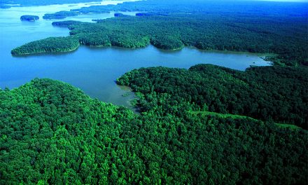
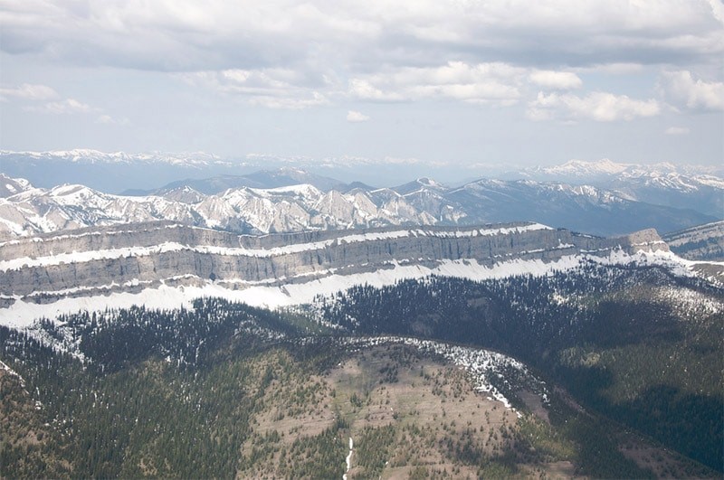
Bob Marshall Wilderness – Montana
The Bob Marshall Wilderness in western Montana (south of Glacier National Park) covers more than 1,000,000 acres. Elevation ranges from about 4,000 feet to 9,000 feet. One of the most noteworthy features is the Chinese Wall that rises about 1,000 feet and runs for more than 20 miles.
There are no roads in the wilderness, but nearly 2,000 miles of trails. US Highway 2 runs along the north of the wilderness, separating it from Glacier National Park. Multiple popular points of entry exist on the east and west sides.
→ See more places to photograph in Montana
Chinese Wall, Bob Marshall Wilderness by Sam Beebe / CC BY 2.0
Indian Peaks Wilderness – Colorado
The Indian Peaks Wilderness is in northern Colorado, northwest of Denver, and south of Rocky Mountain National Park. It covers more than 75,000 acres and features 7 peaks that reach over 13,000 feet in elevation.
There are 50 lakes and about 130 miles of trails (about 30 different trails) for exploring the area. This is a popular wilderness area due to its proximity to Denver. Permits are required in some situations and the availability of permits is limited, so planning is recommended.
→ See more places to photograph in Colorado
Indian Peaks Wilderness by Chad K / CC BY 2.0
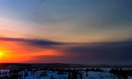
Jarbidge Wilderness – Nevada
The Jarbidge Wilderness covers more than 100,000 acres in the Jarbidge Mountains of northeast Nevada. This is a very remote area on the north end of the Great Basin. Eight mountain peaks of over 10,000 feet are located in the wilderness.
This area is seen by very few people, but it features outstanding beauty and mountain views.
There are about 170 miles of trails throughout the wilderness with trailheads being accessible from unpaved roads.
→ See more places to photograph in Nevada
Jarbidge Wilderness by Marshal Hedin / CC BY-SA 2.0
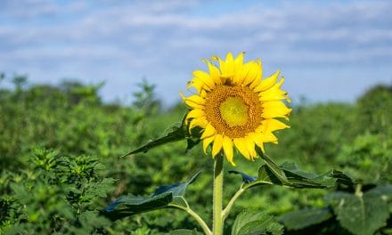
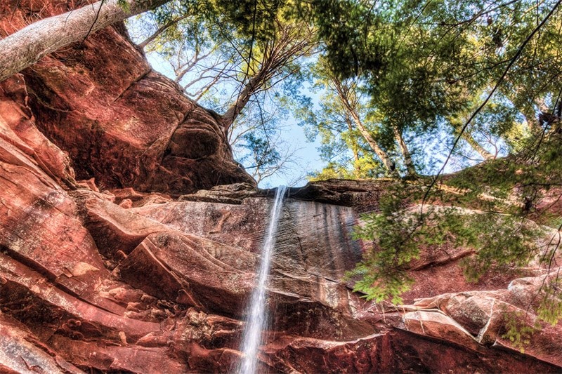
Sipsey Wilderness – Alabama
The Sipsey Wilderness covers about 25,000 acres in northwest Alabama. It was the first designated wilderness area east of the Mississippi River and is noteworthy for its many beautiful waterfalls. Several creeks and rivers flow through the wilderness and over limestone and sandstone to result in these waterfalls.
There are 12 maintained trails in the wilderness, many of them originating from the Sipsey River Recreation Area.
→ See more places to photograph in Alabama
Sipsey Wilderness by Michael Hicks / CC BY-ND 2.0
Photo license links: CC BY 2.0, CC BY 3.0, CC BY-ND 2.0, CC BY-SA 2.0