The McKee-Beshers Wildlife Management Area is a 2,000 acre wildlife area near the Potomac River. It is managed by the state of Maryland and features woodlands, fields, and wetlands. Part of the area borders the Chesapeake and Ohio Canal National Historic Park.
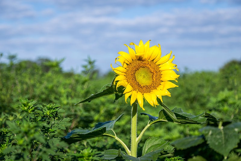
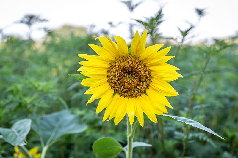
McKee-Beshers has some hiking trails and wildlife (obviously), but the sunflower fields are the main attraction for photographers. Every summer several different fields of sunflowers are planted, and this is a great place to photograph these beautiful flowers. Typically, the sunflowers bloom late July and early August. Check their website in the summer and you will find details of when the flowers are blooming and how long it is expected to last.
In August I made a trip to McKee-Beshers. Unfortunately, I was about a week late for the peak of the bloom, but there were still a number of sunflowers there to photograph. However, with the bad timing I wasn’t able to get any photos of an entire field of blooming flowers.
→ See More of the Best Places to Photograph in Maryland
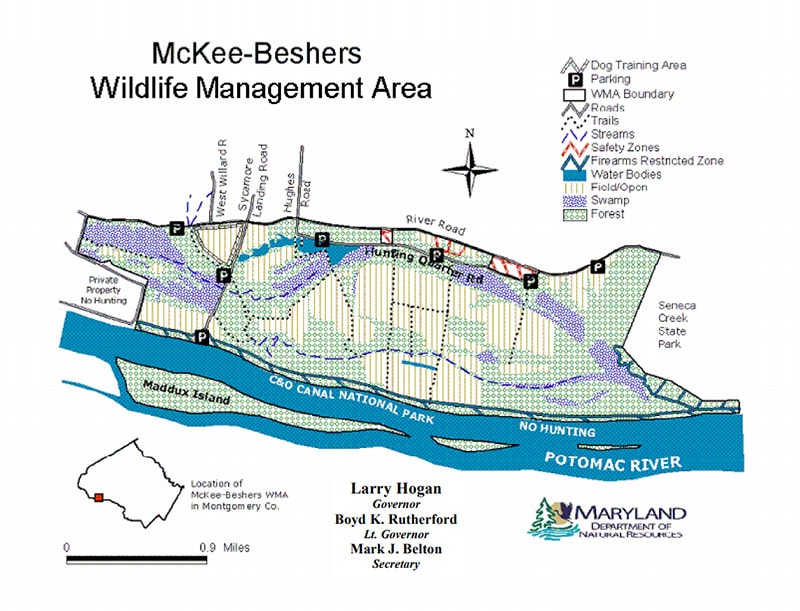
Prior to your visit I recommend also visiting the McKee-Beshers website for a map that shows the locations of the sunflower fields. Here is the general map of the area. For the 2017 sunflower season they had a map on their website that showed the exact location of the sunflower fields.
There are a few different parking areas. The parking lots are not huge, and the sunflower bloom is a busy time of year here, so the lots can fill up. If you park in the lower lot at the end of Sycamore Landing Road you’ll have easy access to the trail along the old canal, which is also worth exploring.
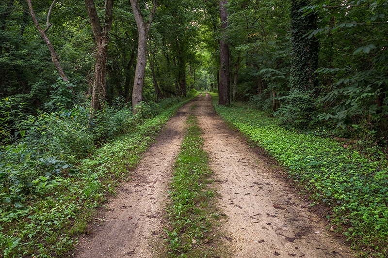
Along the Canal
Getting There
One of the reasons McKee-Beshers Wildlife Management Area is popular is because it is close to both Baltimore and Washington, DC. It is only about a one-hour drive from both of those cities, yet with its location along the Potomac River it feels pretty peaceful and secluded.
The main parking area on River Road is at the following GPS coordinates: 39.081343, -77.372962. If you turn towards the river on Hunting Quarter Road there are also some other parking lots, but some parts of Hunting Quarter Road are rough.
The parking lot on Sycamore Landing Road that I mentioned earlier is at these coordinates: 39.074897, -77.420061. And to get to that lot you will pass another small parking lot on Sycamore Landing Road.
Tips for Photographing the Sunflowers
If you’re planning to photograph the beautiful sunflowers at McKee-Beshers Wildlife Management Area, here are a few tips.
Wear Long Pants – Although the sunflowers bloom during July and August, it is a good idea to wear long pants rather than shorts. Chances are you will be walking between rows of sunflowers, and they are very close together. Between prickly weeds and bugs, wearing long pants is recommended.
Bring Bug Spray – There are a ton of bugs here. Be prepared by bringing some bug spray.
Don’t Arrive Too Early in the Morning – The sunflower fields are surrounded by other areas of the Wildlife Management Area, and most of the is woodlands. I arrived a little after sunrise, and although the sun was up, most of the sunflowers were still in shadow from the nearby trees. I hadn’t really thought about the trees blocking the sun, and of course, you want the flowers to be in the sun so they open up as much as possible. After I was there for about an hour it got a lot better.
Also in the Area
While you’re in the area you may want to visit some of these other places as well (all of the places listed below are less than an hour’s drive away).
Great Falls Park – Great Falls Park is managed by the National Park Service and is located on the other side of the Potomac, in McLean, Virginia. There are three different overlooks that give you a nice view of the great falls, a rough area of rapids and small waterfalls on the Potomac. See our Guide to Photographing Great Falls Park.
Olmsted Island – Olmsted Island also gives you a view of the great falls, but it is accessed from the Maryland side of the Potomac.
Scott’s Run Nature Preserve – Scott’s Run Nature Preserve is in McLean, Virginia, just a few miles away from Great Falls Park. This is a great place to hike and photograph. There are several trails that run through forest, along the Potomac, and along Scott’s Run. See our Guide to Photographing Scott’s Run Nature Preserve.
Monocacy Aqueduct – The Monocacy Aqueduct is the largest aqueduct of the C & O Canal, and it is managed as part of the National Historical Park. There is a parking lot near the Monocacy River that provides great access.
Photos in this post were processed with the Landscape Legend Lightroom Presets. Click here to learn more about Landscape Legend.