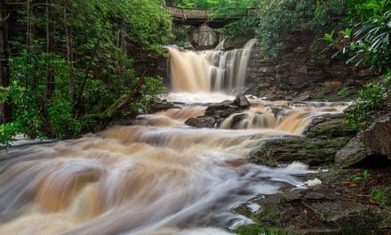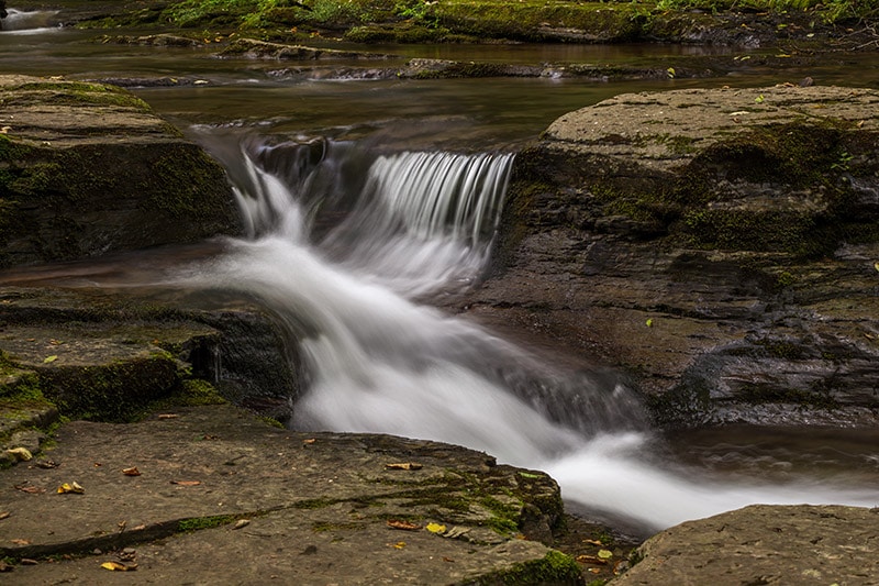
Cascading stream at Worlds End State Park – by Marc Andre
Worlds End State Park is a beautiful mountain park in a somewhat remote part of Pennsylvania. The park features some outstanding hiking trails, great mountain views, beautiful forests, cascading streams, and a few waterfalls. There is also plenty of wildlife in the park.
The Loyalsock State Forest borders, and actually nearly surrounds, Worlds End State Park. Some of the trails lead through parts of the park and parts of the state forest. If you enjoy hiking there are some excellent trails here that are well worth exploring.
Although I have spent most of my life in Pennsylvania, I had never heard of Worlds End State Park until a few years ago when I started searching for places to photograph in my home state. After being in the area a few times I really like this area of Pennsylvania, and I hope to make many more trips here in the future. It offers the features I would expect to find in a rugged Pennsylvania park: mountains, forests, and waterfalls. It is in a fairly remote location, but easy to reach.
→ See More of the Best Places to Photograph in Pennsylvania
Points of Interest
Here is a look at some of the spots in the park that are likely to be of the most interest for photographers.
Double Run Nature Trail
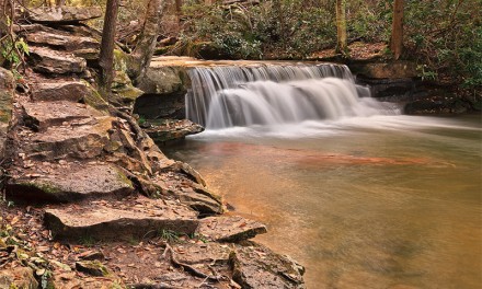
The Double Run Nature Trail is one of the most popular trails in the park. It’s a fairly easy loop hike (listed at 1.2 miles) near the west branch of Double Run. The cascades of Double Run are perfect for photographing. There is a small waterfall near the start of the trail. The GPS coordinates of the trailhead are: 41.465882, -76.578643
There is a small parking lot at the trailhead. The Double Run Nature Trail also connects with a few other trails, including the Link Trail.
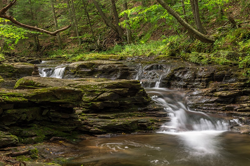
Small waterfall near the start of the Double Run Nature Trail – by Marc Andre
And further along on the trail you can photograph Cottonwood Falls.
Loyalsock Trail and Link Trail
The Loyalsock Trail is a popular 60-mile trail that leads through the Loyalsock State Forest, as well as Worlds End State Park. You’ll see “LT” blazes along the Loyalsock Trail. The Link Trail connects with the Loyalsock Trail.
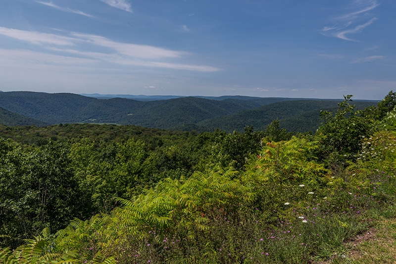
Canyon Vista
Canyon Vista provides one of the best views in the park. From here you can overlook the canyon and the Loyalsock Creek. There is a trail that leads up to the Canyon Vista, but naturally it has a very steady incline. You can also drive up to Canyon Vista, which is what I did. Canyon Vista Road, or Mineral Spring Road on some maps, is unpaved and fairly steep, but as far as unpaved mountain roads are concerned, it is pretty good. I had no problem making it up to Canyon Vista without a high clearance vehicle and without 4-wheel drive. Under good weather conditions any car should be fine on this road. I definitely would avoid this road if there is snow or ice on the ground because it is quite narrow in some places, and there are steep drops of the side of the road.
Once you are at Canyon Vista you’ll have a nice mountain view. There is an overlook area that gives you plenty of room to photograph.
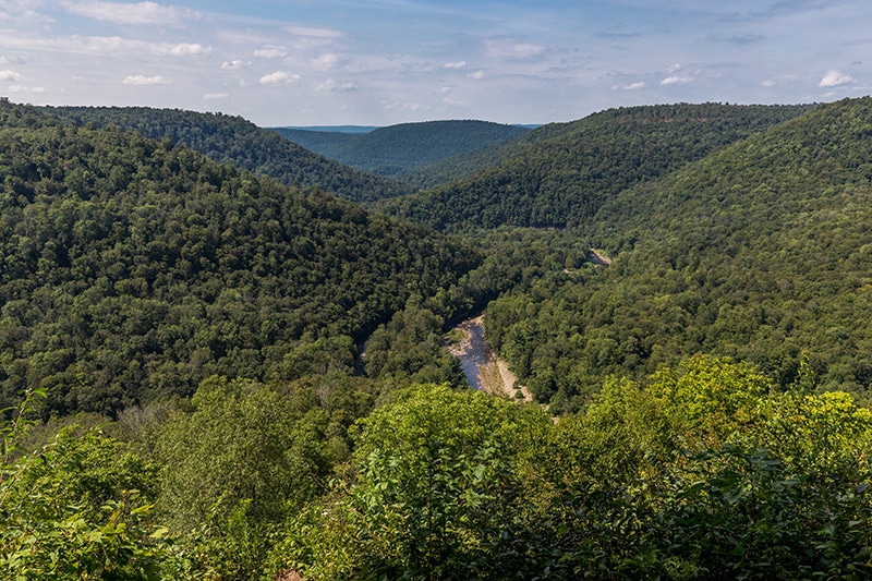
Canyon Vista by Marc Andre
Rock Garden
Along the Canyon Vista Trail, and right next to Canyon Vista, is the rock garden. This area features some large rocks that are worth exploring.
Angel Falls
By far the highest waterfall in the park is Angel Falls. It can be reached by a challenging hike that is about 2 miles out and back. I didn’t hike this trail because I ran out of time. I had seen some recent photos before my trip with a very low volume of water flowing at Angel Falls, so I prioritized other trails and views.
All photos in this post were processed with the Landscape Legend Lightroom Presets. Learn more about how Landscape Legend can help you to save time and process your photos more effectively.
Also in the Area
High Knob Overlook – The High Knob Overlook is located just a few miles outside of Worlds End State Park, and within the Loyalsock State Forest. The GPS coordinates are: 41.443682, -76.679073. There is a parking area right by the overlook.
High Knob Overlook
Dry Run Falls – Dry Run Falls is very close to the High Knob Overlook. If you are coming from Worlds End State Park you will drive down High Knob Road and there will be signs to the right for the High Knob Overlook. Instead of turning right, keep going straight. The name of the road changes from High Knob Road to Dry Run Road, and it now becomes an unpaved road. Although it is unpaved it is in good condition and not steep. Dry Run Falls is located just by the side of the road. See our Guide to Photographing Dry Run Falls for more details.
Ricketts Glen State Park – Ricketts Glen State Park is one of the best places in the area for photographing waterfalls, and it is about a 30-minute drive from Worlds End State Park. See our Guide to Photographing Ricketts Glen State Park.