
Haystack Rock by Tiger635 / CC BY-SA 3.0
Few locations can match the beauty of the landscape of Oregon. The state is filled with awesome locations that are loved by landscape and nature photographers. Oregon features beautiful coastline, plenty of amazing waterfalls, striking mountains, and vast wilderness. On this page you’ll find information on some of the most noteworthy destinations in Oregon for nature photographers. The interactive map below shows the location of each spot mentioned on this page.
This page will continue to be a work in progress, so please feel free to leave a comment with your own suggestions of great places to photograph.
Columbia River Gorge
The Columbia River Gorge sits on the border between Washington and Oregon and runs for about 80 miles through the Cascade Range. At some locations the canyon is up to 4,000 feet deep, and this area of Oregon is full of beautiful scenery, especially waterfalls. The Columbia River Gorge National Scenic Area covers almost 3,000 acres in Washington and Oregon. The Historic Columbia River Highway is a good starting point for exploring the area. Below you will find details about several specific points of interest within Columbia River Gorge before we move on and explore other locations throughout the state.
→ Related reading: 10 Tips for Fabulous Waterfall Photography
Crown Point
About 15 miles east of Portland is Crown Point, which provides a fabulous view of the river and gorge. At more than 700 feet above the river you are sure to catch a great view. In addition to photographing the view, the Vista House that sits at Crown Point can present photo opportunities as well.

View from Crown Point by Tiger635 / CC BY-SA 3.0
Latourell Falls
Just about 2.5 miles east of Crown Point is the trailhead for Latourell Falls, which is within Guy W. Talbot State Park. A parking lot is located not far from Lower Latourell Falls, but you’ll need to take a 2+ mile hike in order to get a view of the Upper Latourell Falls.
Upper Latourell Falls by Ian Sane / CC BY 2.0
Bridal Veil Falls
About 2 miles east of Latourell Falls is Bridal Veil Falls. This is easily accessed from the Historic Columbia River Highway. From the parking lot this is a short hike down to the creek and a viewing platform.
Bridal Veil Falls by Kirt Edblom / CC BY-SA 2.0
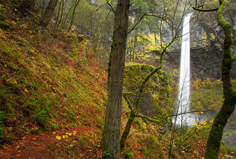
Wahkeena Falls
From Bridal Veil Falls you can reach Wahkeena Falls by traveling about another 3 miles. Just a short hike is required to reach this waterfall that cascades for more than 200 feet.
Wahkeena Falls by John Fowler / CC BY 2.0
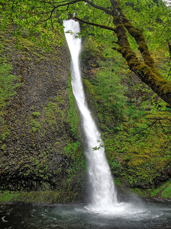
Fairy Falls
Fairy Falls is reachable from Wahkeena Falls with about a 1-mile hike on the same trail. This smaller 20-foot waterfall is beautiful in its own right and is well worth the extra hike.
Fairy Falls by Chris Tillman / CC BY 2.0
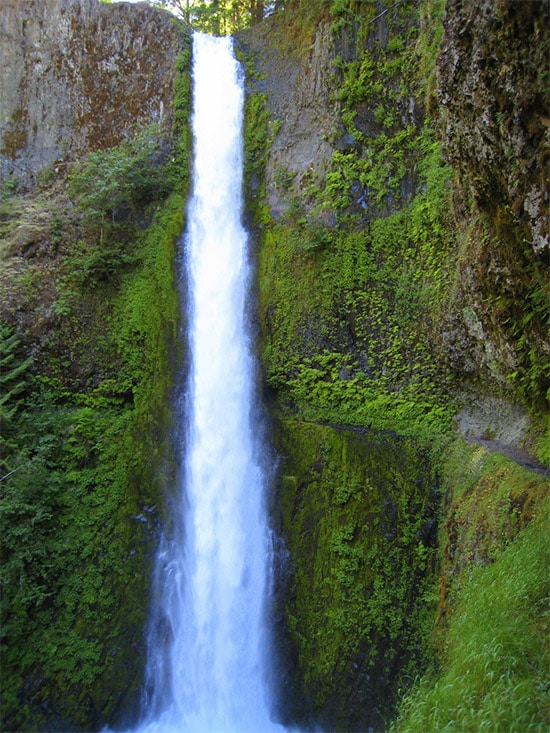
Multnomah Falls
Multnomah Falls is the most famous waterfall within the Columbia River Gorge. It is located just 1 mile east of Wahkeena Falls. You can get to Multnomah Falls by hiking from Wahkeena Falls, or get back in the car and drive to a parking area for Multnomah Falls. This is a two-drop fall with the upper falls being well over 500 feet, and the lower falls around 70 feet. A trail leads to the footbridge that is about 100 feet above the lower falls. The trail continues to the top of the upper falls.
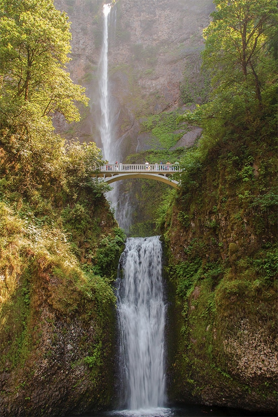
Multnomah Falls by Paul VanDerWerf / CC BY 2.0
Weisendanger Falls
Weisendanger Falls is about 0.5 miles upstream from Multnomah Falls. To reach Weisendanger Falls take the trail to the top of Multnomah Falls and then continue on that rocky trail for about another half mile. This roughly 50-foot waterfall may look small in comparison to Multnomah Falls, but it is much less crowded and certainly a great subject for photos.
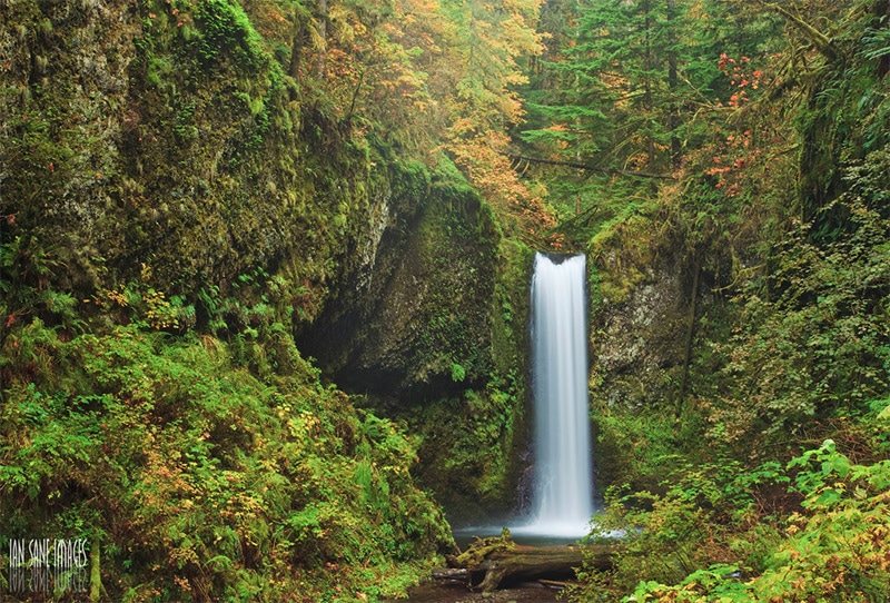
Weisendanger Falls by Ian Sane / CC BY 2.0
Horsetail Falls
Horsetail Falls is about 2.5 miles east of Multnomah Falls. You can view Horsetail Falls from the trailhead, no real hike required. If you’d like, you can take the trail about half a mile to the much smaller, but still beautiful, Ponytail Falls.
Horsetail Falls by Kirt Edblom / CC BY-SA 2.0
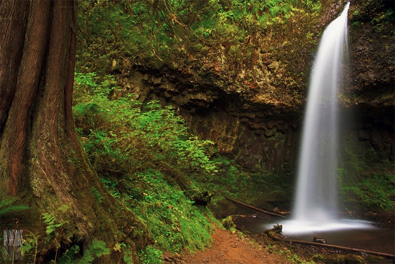
Elowah Falls
A few miles east of Horsetail Falls is Elowah Falls. Reaching this 200-foot waterfall requires a fairly easy 1.5 mile roundtrip hike that starts in John B. Yeon State Park.
Elowah Falls by Ian Sane / CC BY 2.0
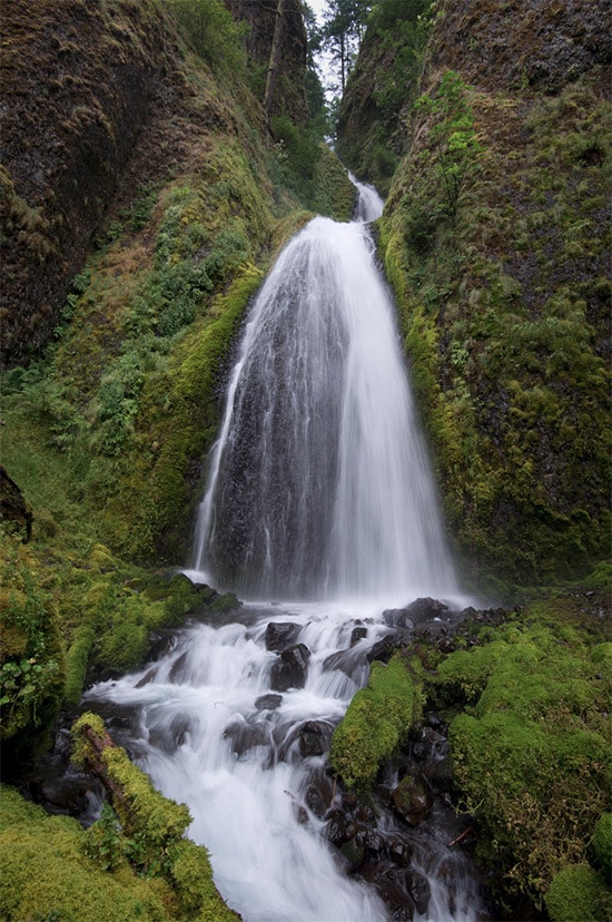
Wahclella Falls
Just a few miles east of Elowah Falls is Wahclella Falls. From the trailhead it is about a 2 mile roundtrip hike that leads to this photogenic waterfall. Along the trail you’ll also pass the smaller Munra Falls.
Wahclella Falls by stokes rx / CC BY-ND 2.0
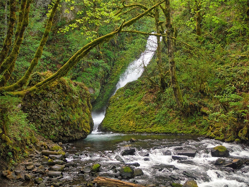
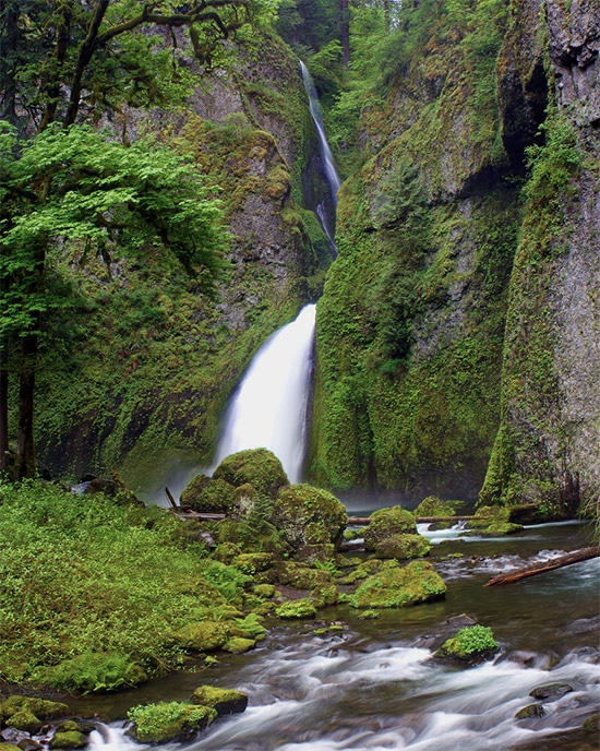
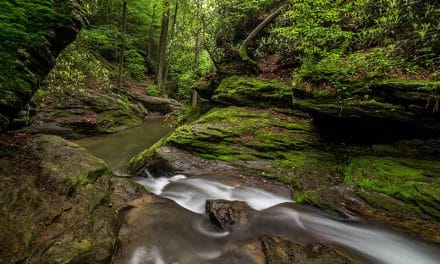
Punchbowl Falls
Punchbowl Falls is not a tall waterfall, but it is quite picturesque. It lies east of Wahclella Falls and can be reached with about a 4-mile roundtrip hike. The trailhead starts at NE Eagle Creek Loop and trail #440 leads to Punchbowl Falls.
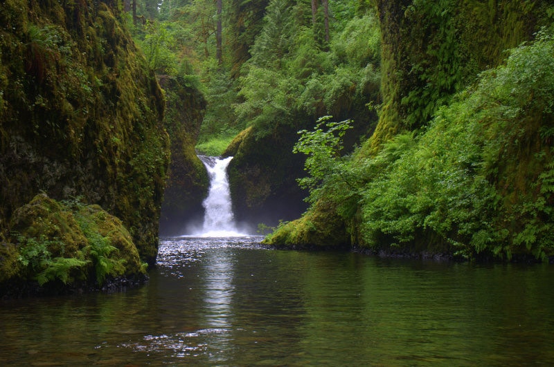
Punchbowl Falls by Alan / CC BY 2.0
Tunnel Falls
From Punchbowl Falls you can continue along trail #440 for about 4 more miles and you will come to Tunnel Falls. This 150+ foot waterfall is quite the scene. Along the way you’ll also pass many other waterfalls on the same trail aside from just Punchbowl Falls and Tunnel Falls.
Tunnel Falls by Christopher / CC BY-SA 2.0
Oregon Coast
While there is plenty to love about the Columbia River Gorge, the Oregon coast is equally special. There is no shortage of great locations, and we’ll cover some of the best ones below. The coastal locations covered here will be in order going north to south.
Oregon Coast Trail
The Oregon Coast Trail runs from the mouth of the Columbia river in northern Oregon all the way south to the California border. The trail is roughly 380 miles long and includes hiking on the beach, on trails, and on paved roads. If you really want to experience the Oregon coast this trail is a great way to do it. The trail runs through many of the other locations that will be mentioned below.
Oregon Coast Trail by TravelingOtter / CC BY-SA 2.0
Peter Iredale Shipwreck
Within Fort Stevens State Park in northern Oregon, a popular subject for photographs is the remains of the Peter Iredale. The site of the shipwreck is about 4 miles south of the Columbia River.

Peter Iredale Shipwreck by Pdxvector / CC BY-SA 3.0
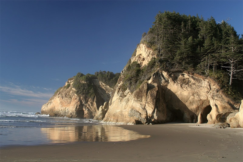
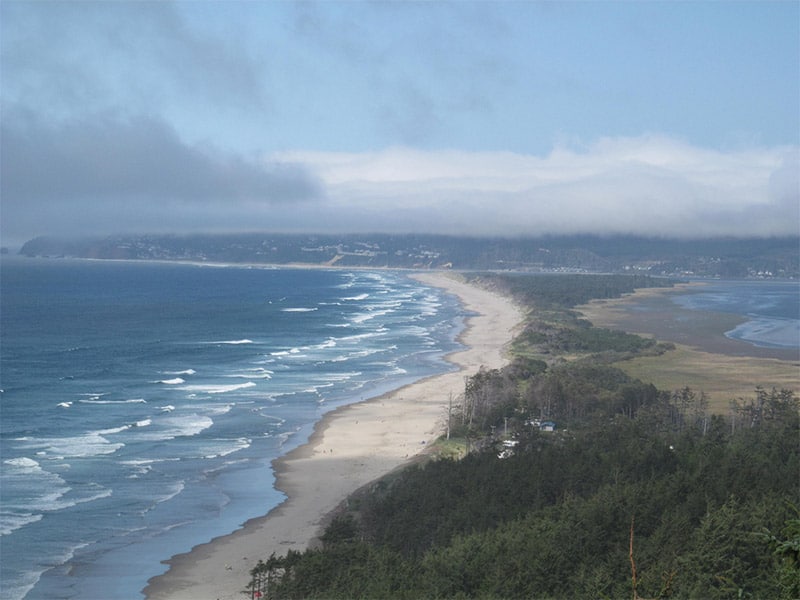
Ecola State Park
Ecola State Park includes 9 miles of beautiful coast line and a few different beaches. Haystock Rock (mentioned below) is visible from some parts of Ecola State Park.
Ecola State Park by Ian Sane / CC BY 2.0
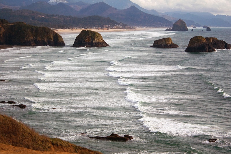
Cannon Beach and Haystack Rock
Just south of Ecola State Park is Cannon Beach. Haystack Rock, which rises more than 200 feet, is a favorite of many visitors and photographers. You can find Haystock Rock and the nearby Needles about 1.5 miles south of downtown Cannon Beach.
Haystack Rock by Tiger635 / CC BY-SA 3.0
Hug Point State Recreation Site
Hug Point State Recreation Site is just about 5 miles south of Cannon Beach. The cliffs and shoreline of this 40-acre park make it well worth visiting.
Hug Point by Patty Myrick / CC BY-SA 2.0
Oswald West State Park
Oswald West State Park is located about 5 miles south of Hug Point. The park is nearly 2,500 acres, including four miles of coastline. The park includes many miles of hiking trails that lead through temperate rain forest, and multiple points with great views of the coast. This park is a favorite of many, and with the combination of forest and coast it is easy to see why.
Oswald West State Park by Jeff Gunn / CC BY 2.0
Cape Lookout State Park
Cape Lookout juts out into the Pacific Ocean, and the Cape Lookout State Park is located on the north end. The Cape Lookout Trail takes you about 2.5 miles through a spruce forest and leading to the tip of the promontory where you can catch an amazing view of the coast.
Cape Lookout State Park to Doug Kerr / CC BY-SA 2.0
Cape Kiwanda
Cape Kiwanda is just about 10 miles south of Cape Lookout. You can take the hike to the top of Cape Kiwanda for a great view, or photograph from the beach level. The rock formations and rocky coast make it an excellent place to photograph.
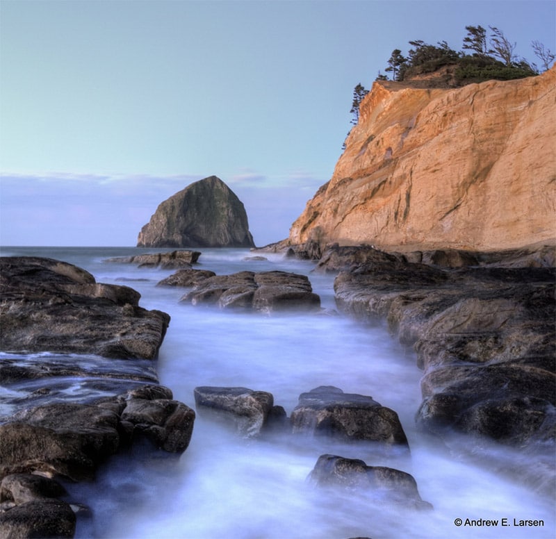
Cape Kiwanda by Andrew E. Larsen / CC BY-ND 2.0
Devils Punchbowl
Devils Punchbowl is a unique scene along the coast. It is a large bowl naturally carved into the rock that is partially open to the Pacific Ocean. There are also tide pools along the beach that are ideal for photographing.
Devil’s Punchbowl by tpsdave / CC0
Seal Rock State Park
Seal Rock State Park is a small park that includes a beautiful coast area with tide pools, rock formations, and amazing views.
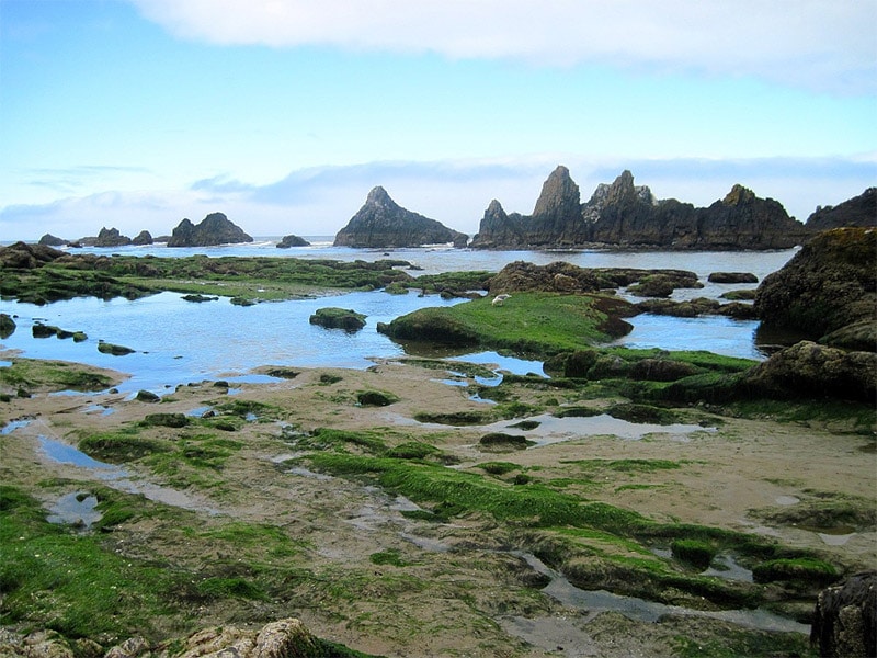
Seal Rock State Park by k rupp / CC BY 2.0
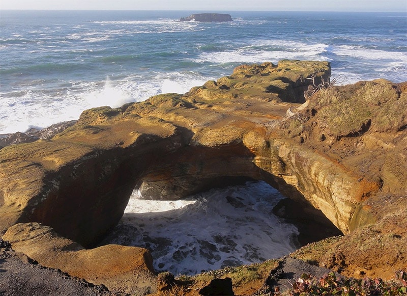
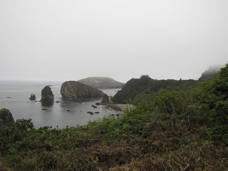
Cape Perpetua
The Cape Perpetua Scenic Area (part of the Suislaw National Forest) is a perfect place to photograph the unique beauty of the Oregon coast. The 2,700 acres of the Cape Perpetua Scenic area includes more than 25 miles of hiking trails through old growth forests and leading to tidal pools along the coast. The highest point is more than 800 feet above sea level and provides a coastal view that extends for many miles.
Cape Perpetua is also home to a few noteworthy photographic subjects. Thor’s Well seems to suck the ocean into an abys, with water spewing out at times. The scene varies greatly depending on the tides. Devil’s Churn is a long crack in the rock along the coast that fills with each wave.
Cape Perpetua by Scotter Lowrimore / CC BY 2.0
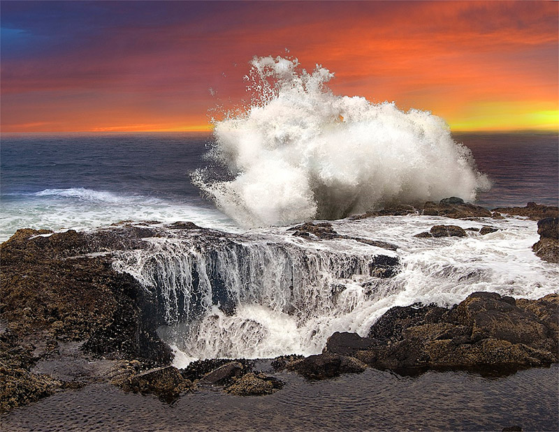
Thor’s Well by John Fowler / CC BY 2.0
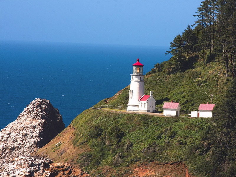
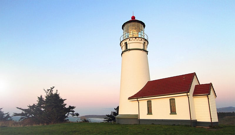
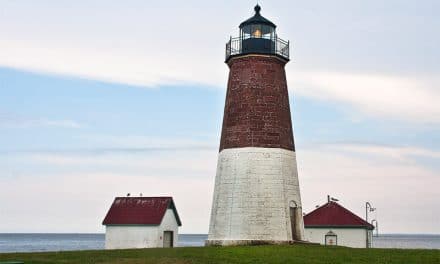
Heceta Head Lighthouse
Located about 10 miles south of Thor’s Well, the Heceta Head Lighthouse sits roughly halfway up a 200-foot headland along the coast. The Lighthouse and coast make for an excellent photograph.
Haceta Head Lighthouse by Rennett Stowe / CC BY 2.0
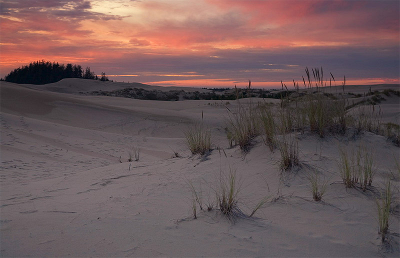
Oregon Dunes National Recreation Area
Oregon Dunes National Recreation Area covers roughly 40 miles of coast. Some of the dunes reach up to 500 feet above sea level, making it a popular location for recreation, including photography. Because of the size there are several different areas of the park and many trails available. The website has plenty of information for researching ahead of a visit. The Oregon Dunes Loop Trail and Lagoon Loop Trail are good options.
Oregon Dunes National Recreation Area by Forest Service / Public Domain
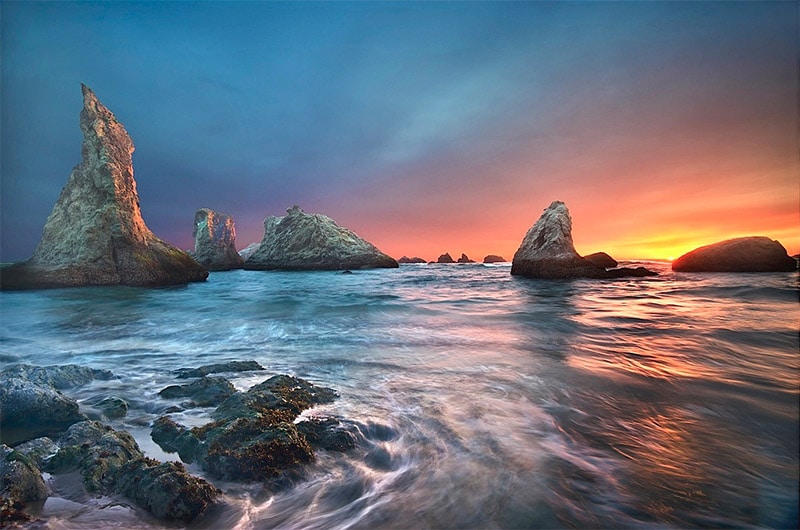
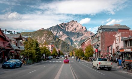
Bandon
Bandon is a town at the mouth of the Coquille River that is a popular spot due to the beautiful rock formations along the coast.
Bandon Beach by John Fowler / CC BY 2.0
Cape Blanco State Park
Cape Blanco is the westernmost point in Oregon. From here you can get a nice view of the coast or photograph the lighthouse, which is part of Cape Blanco State Park.
Cape Blanco State Park by Bureau of Land Management / CC BY-SA 2.0
Harris Beach State Park
Harris Beach State Park is home to seastacks, tide pools, plenty of wildlife (including tufted puffins, seals, sea lions, and more), and Bird Island (also known as Goat Island).
Harris Beach State Park by Thorson Family Minnesota / CC BY-SA 2.0
Other Points of Interest in Oregon
While the Columbia River Gorge and the coast include many great locations for photographers, the rest of Oregon still has plenty to offer.
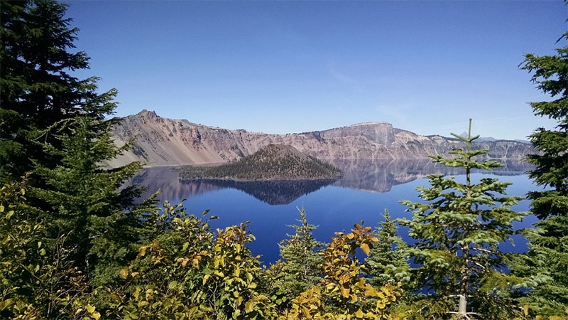
Crater Lake National Park
Crater Lake National Park is located in southwestern Oregon. Crater Lake is known for its beautiful blue waters, making it an excellent subject for photographs (the picturesque surroundings also help). Many photos of the lake include one of the two islands of the lake: Wizard Island and Phantom Ship. The park also includes old growth forest and has plenty of other things to photograph aside from just the lake. Rim Drive is a scenic road in the park that leads around the rim of the Caldera and provides some great views.
Crater Lake by Don White / CC0
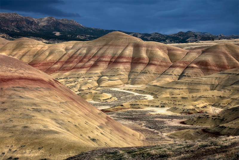
John Day Fossil Beds National Monument
Crater Lake may be the only national park in Oregon, but John Day Fossil Beds National Monument in east-central Oregon, also managed by the NPS, should not be overlooked. There are 3 separate units: Painted Hills, Sheep Rock, and Clarno. While the area is historically significant because of the fossils, photographers are likely to be most interested in the amazing colors of the landscape in the Painted Hills unit, although the other two units are beautiful as well. There are a few trails, mostly short, that allow you to easily get views for photographing.
Painted Hills of John Day Fossil Beds National Monument by John Fowler / CC BY 2.0
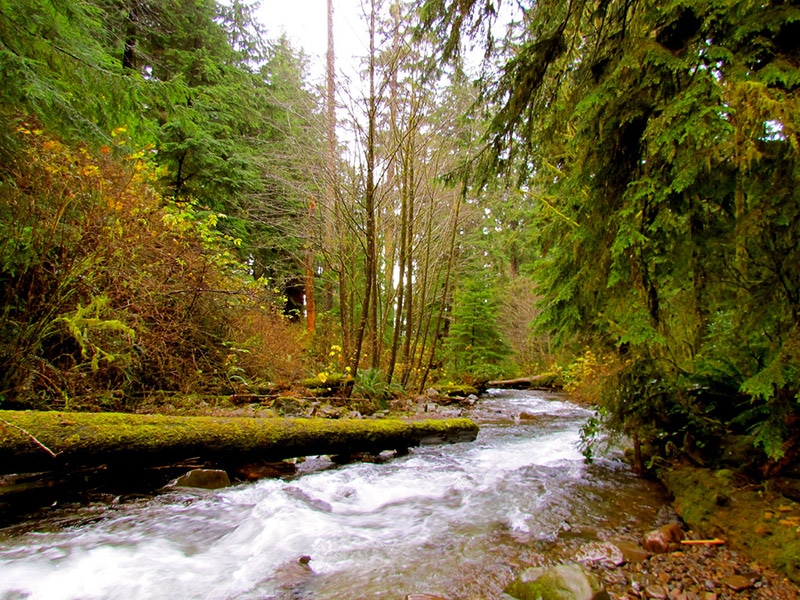
Silver Falls State Park
Silver Falls State Park is located in northwestern Oregon, about 60 miles south of Portland. If you love waterfalls, this is an amazing park. It’s easy to see why it is one of the most popular parks in Oregon. There are more than 20 miles of trails, including the 8.7-mile Canyon Trail that leads to 10 different waterfalls. At several of them you can walk behind the falls. Aside from the 10 falls on the Canyon Trail, there are also an additional 5 within the park.
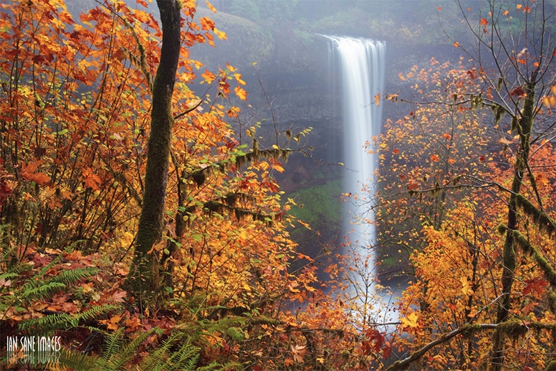
Silver Falls State Park by Ian Sane / CC BY 2.0
Smith Rock State Park
Smith Rock State Park is located in Central Oregon, about 25 miles northeast of Bend. This park is very popular with rock climbers, and the beauty of the rocks, canyons, and the Crooked River makes it ideal for photographers as well. Both the Summit Trail and the Misery Ridge offer excellent hiking and views.
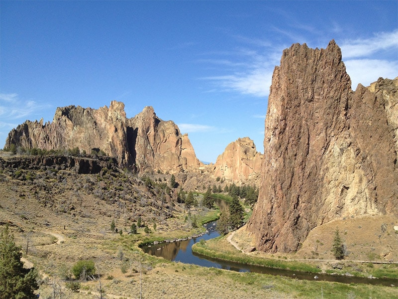
Smith Rock State Park by Carley Luehrs / CC BY 2.0
Steens Mountain
Steens Mountain is located in southeastern Oregon. It is part of the Steens Mountain Cooperative Management and Protection Area, which is maintained by the Bureau of Land Management. This remote wilderness location features deep gorges and beautiful scenery. Steens Mountain Backcountry Byway and Steens Mountain Loop Road provide access to much of the area and many great viewpoints.
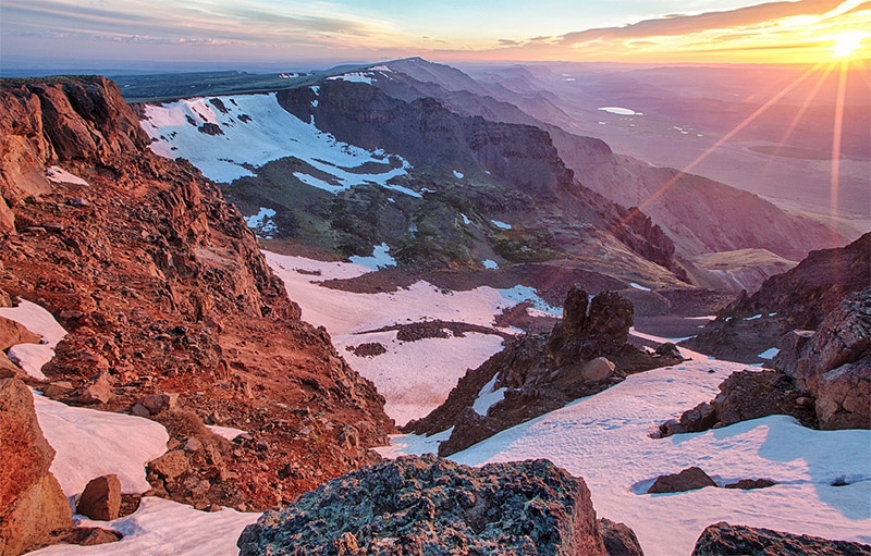
Steens Mountain by Bureau of Land Management / CC BY 2.0
Hells Canyon
Hells Canyon National Recreation Area is located in northeastern Oregon, as well as western Idaho. This wilderness area features the deepest river gorge in North America. The beautiful vistas showcase the wilderness and provide plenty of photographic opportunities, and there are well over 300 miles of trails to explore. You can also catch some great views from the scenic byway.
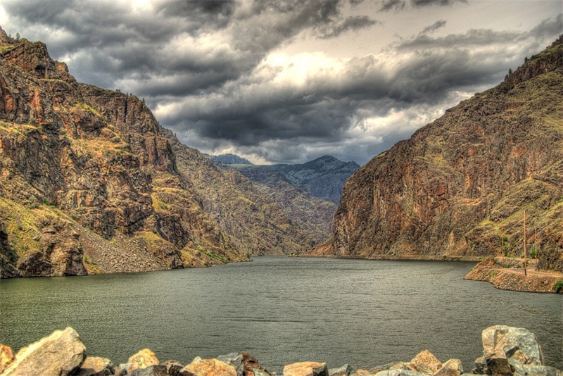
Hells Canyon by pogo_mm / CC0
Mount Hood, Lost Lake, Trillium Lake
Mount Hood, about 50 miles east of Portland, is the highest peak in Oregon. It is home to several glaciers and snow fields, and the snow-capped peak makes for excellent photographs. The peak is visible from up to 100 miles away, so there are plenty of possible vantage points for photos. Trillium Lake (south of Mount Hood) and Lost Lake (northwest of Mount Hood) are both excellent options.
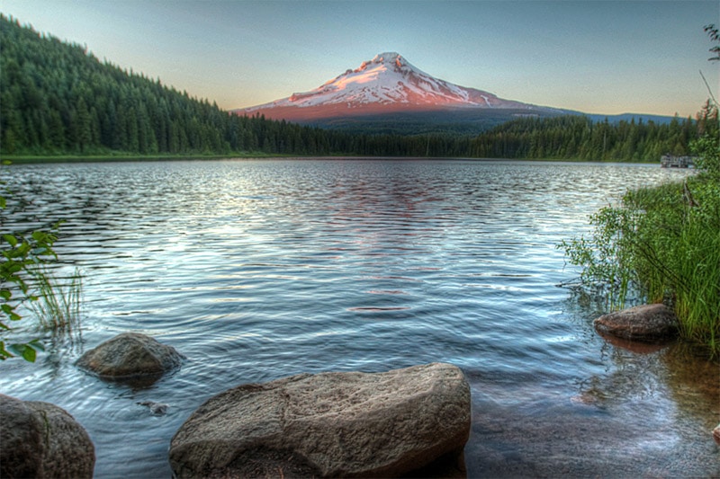
Mount Hood and Trillium Lake by Mulling it Over / CC BY-SA 2.0
White River Falls State Park
White River Falls State Park is in north central Oregon, east of Mount Hood. The centerpiece of this park is the beautiful 90-foot falls on the White River. Just downstream there is also another 40-foot fall.
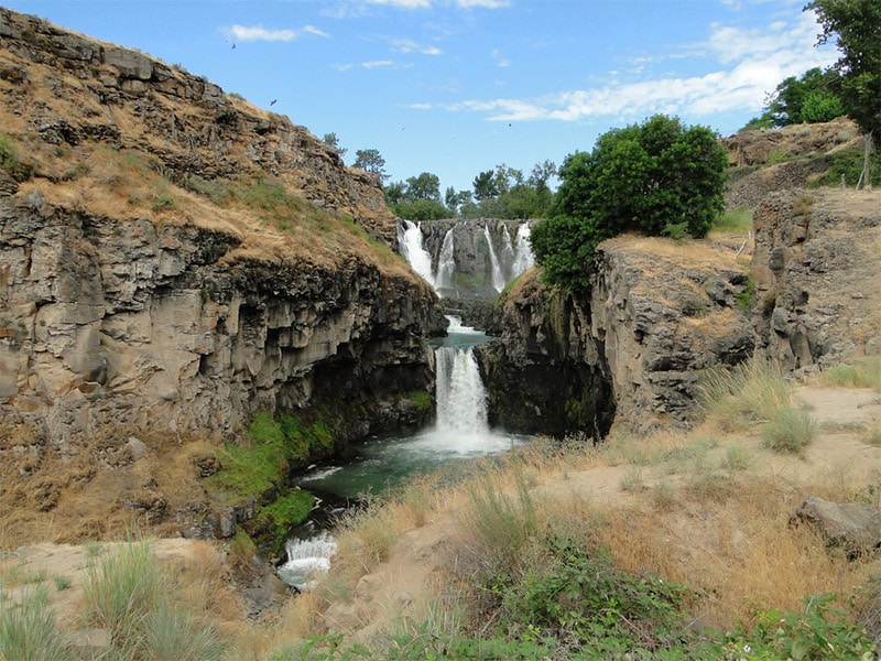
White River Falls State Park by Amy Meredith / CC BY-ND 2.0
Tumalo State Park
Tumalo State Park is located near Bend, Oregon, about 160 miles southeast of Portland. The Deschutes River runs through the park, creating a beautiful scene with rock cliffs. There are plenty of trails for hiking, as well as a waterfall to photograph.
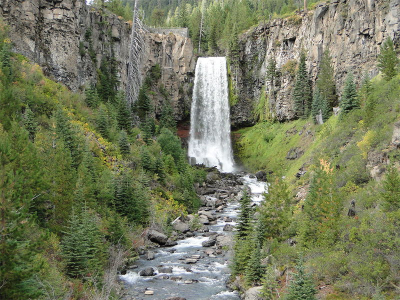
Tumalo Falls by Amy Meredith / CC BY-ND 2.0
Oregon Caves National Monument
Located in southwestern Oregon, close to the California border, is Oregon Caves National Monument. Half mile cave tours are available if you would like to get some unique nature photos.

Oregon Caves National Monument by Roger Brandt / Public Domain
Marys Peak
Marys Peak is in western Oregon, about 100 miles southwest of Portland. It is the tallest peak in the Oregon Coast Range and offers tremendous views in all directions. Marys Peak is designated as a Scenic Botanical Area and you can find many flowers and plants, which of course are great for photos. You can take the 1.5 mile hike to the summit or the Meadow Edge Hike through some old growth forest.
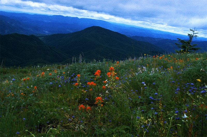
Marys Peak by Bureau of Land Management / CC BY 2.0
Fremont-Winema National Forest
The Fremont and Winema National Forests of southern Oregon offer more than 2 million acres of landscape that includes snow-capped mountains and basins. There are many different trails and campgrounds that make it possible to explore and photograph this amazing area.
Fremont-Winema National Forest / Public Domain
Eagle Cap Wilderness
The Eagle Cap Wilderness is located in northeastern Oregon in the Wallowa Mountains. With more than 300,000 acres of wilderness, more than 500 miles of trails, scenic rivers, and a variety of wildlife, this is a great location for photography. There are trailheads at all sides of the wilderness, so it can be explored from many different starting points.

Eagle Cap Wilderness by Dsdugan / Public Domain
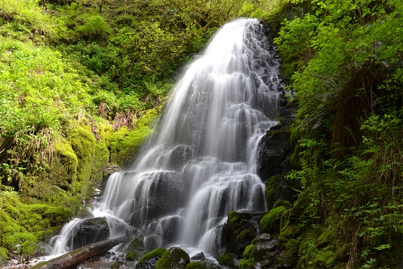
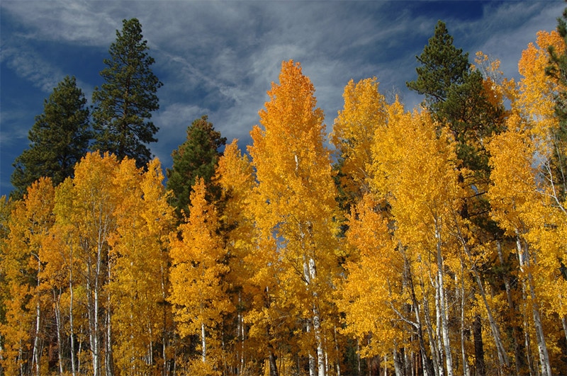
Three Sisters Wilderness
The Three Sisters Wilderness lies within both the Williamette and Deschutes National Forests. It is named for the Three Sisters, which are volcanic peaks in the Cascade Range. There are more than 250 miles of trails within the wilderness that will help you to catch views (or climb) the Three Sisters, as well as Proxy Falls.

South Sister by Sheila Sund / CC BY 2.0
Alvord Desert
The Alvord Desert is in southeastern Oregon, near Steens Mountain. It is a 12-by-7-mile dry lake bed. The salt flats and playa, as well as the view of Steens Mountain, make it a great place for photography.
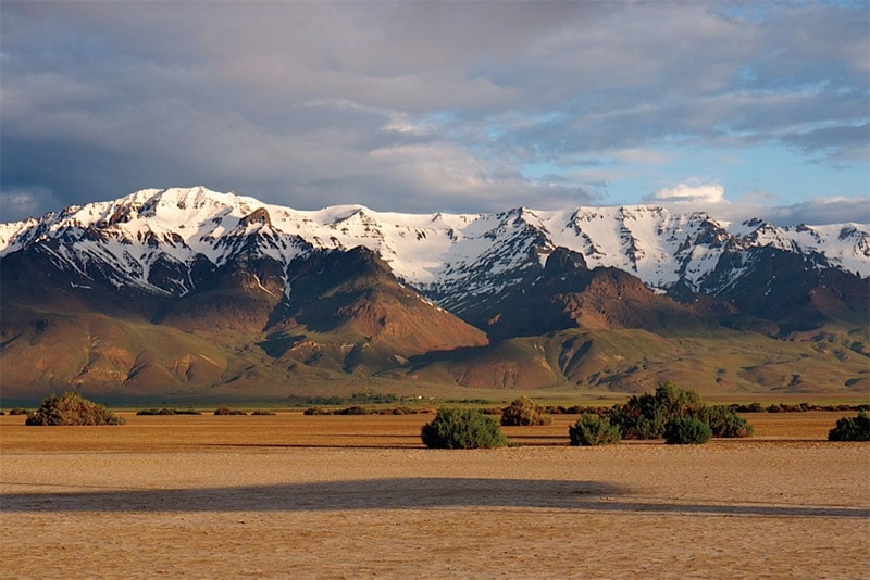
Alvord Desert and Steens Mountain by Sam Beebe / CC BY 2.0
Leslie Gulch
Located in southeastern Oregon, Leslie Gulch features stunning volcanic tuff formations. This beautiful canyon can be reach by a dirt/gravel road off of U.S. Route 95.
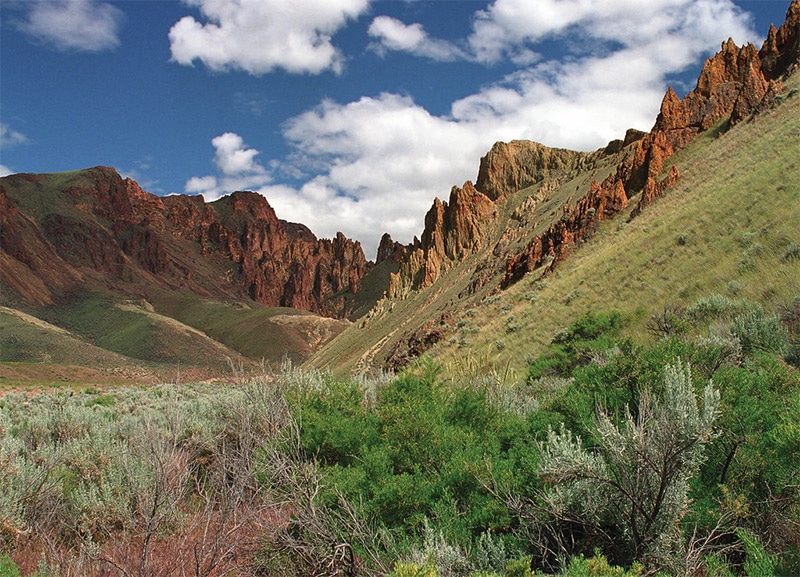
Leslie Gulch Bureau of Land Management / CC BY-SA 2.0
Astoria-Megler Bridge
The Astoria-Megler Bridge is a steel bridge that spans the Columbia River, connecting Astoria, Oregon and Megler, Washington. It is located about 4 miles from the mouth of the river in western Oregon.
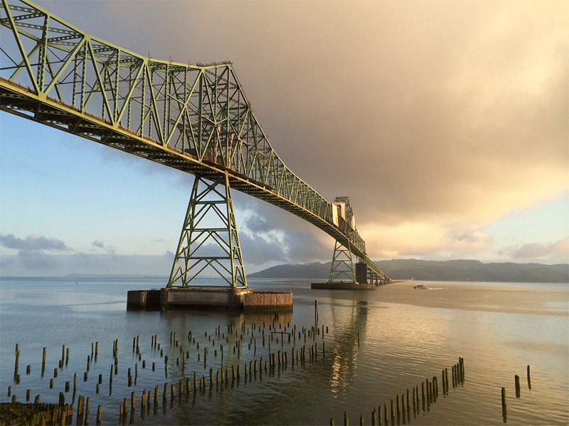
Astoria-Megler Bridge by Victor Solanoy / CC BY 2.0
Want to learn more about neighboring states: Please see:
- The Best Places to Photograph in Washington
- The Best Places to Photograph in California
- The Best Places to Photograph in Nevada
- The Best Places to Photograph in Idaho
Photo license links: CC0, CC BY 2.0, CC BY-ND 2.0, CC BY-SA 2.0, CC BY-SA 3.0


There are virtually no trails available on the south side of the Eagle Cap. The Forest Service does not clear trails. If you go there, plan on clearing the trails yourself.
a lot of these places mentioned are private, and need permission to hike. These places are not for the meek or one who wants to stop and snap a shot. IT takes HOURS to get these, Ive tried. Not to mention the LONG hike to get there (away from people) and lugging your gear.
Really amazing places, wish all of them aren’t private place