Little Gunpowder Trail
Gunpowder Falls State Park in Maryland includes about 18,000 acres in several different non-contiguous sections in the Baltimore area. The park was established to protect the Gunpowder River, as well as Big and Little Gunpowder Falls. Big and Little Gunpowder Falls are streams/rivers that flow into the Gunpowder River, an estuary of the Chesapeake Bay.
This state park features more than 120 miles of hiking trails, with several trails that run along Big and Little Gunpowder Falls. With its location just outside of Baltimore, this park presents a great opportunity to experience and photograph nature without traveling far from the city. It is also only a little over a one-hour drive from Washington, DC and about two hours from Philadelphia.
Gunpowder Falls State Park includes points of interest like:
- The Prettyboy Reservoir in the Hereford Area
- The Torrey C. Brown Rail Trail (almost 20 miles from Ashland to the Pennsylvania state line)
- Sparks Bank Nature Center along the rail trail
- Jerusalem Mill Village
- A marina near the mouth of the Gunpowder River
The park is easily accessible from Interstates 83, 95, and 695 and several of the trailheads have plenty of parking. Because the park is spread out into different sections that are not connected, it is important to do some research and planning to know what you want to see and where it can be found. If you just put “Gunpowder Falls State Park” into the GPS and head there, you will probably miss out on the best parts of the park.
→ Related reading: see more of The Best Places to Photograph in Maryland
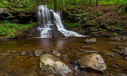
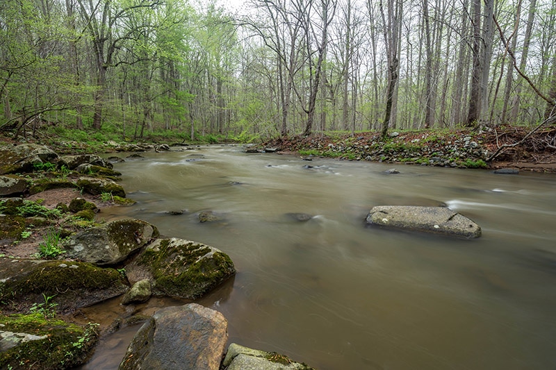
From a photography perspective, the highlight of the park is the collection of trails that run along Big and Little Gunpowder Falls. There are several trails that provide really nice views of the water, as well as plenty of opportunities to photograph the forest that surrounds the water. Shallow in most places, these bodies of water feature a lot of rocks that can be interesting to photograph.
Below I’ll cover two specific trails that I consider to be the highlight of the park for photographers. Although the scenery is beautiful, there is not a ton of variety. From a photography perspective I prefer to hike short sections of trail to get the photos that I want, rather than hiking entire trails and getting many photos that are very similar since the scenery doesn’t vary that much.
All photos in this post were processed with the Landscape Legend Lightroom Presets. Learn more about how Landscape Legend can help you to save time and process your photos more effectively.
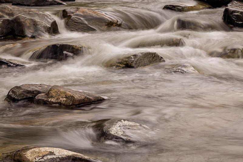
Little Gunpowder Trail
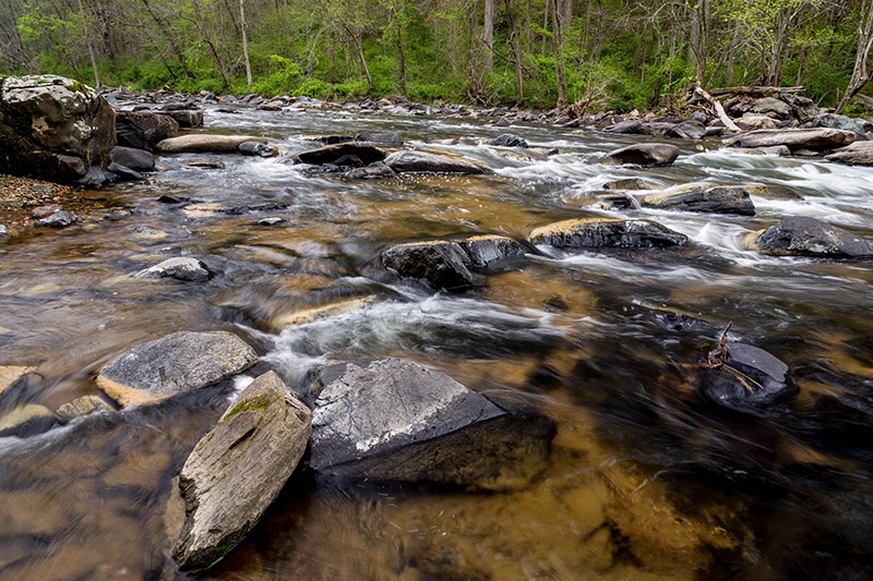
One of the more popular trails in the park is the Little Gunpowder Trail. Most of this trail runs along Little Gunpowder Falls. There are a few different places you can park and pick up this trail. The parking lot in Kingsville on Belair Road (US Route 1) is easy to find and large enough that there should be plenty of parking available. The GPS coordinates of this parking lot are 39.474686, -76.408380. From the parking lot you will need to cross Route 1 (be careful of fast-moving traffic) and then walk down towards the river. This is a white-blazed trail.
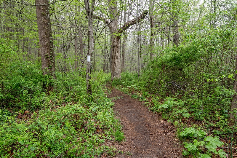
Little Gunpowder Trail, right next to Route 1
The forest runs right up to the edge of the river. Along this trail there are many places where you can venture out to the rocky edge of the river to photograph.
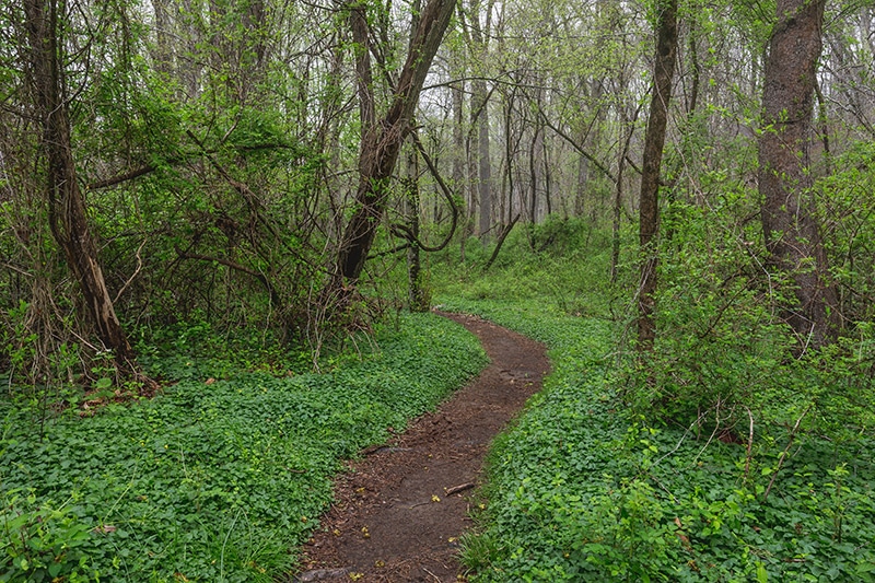
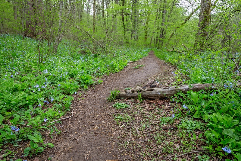
Little Gunpowder Trail
The trail and the forest are also quite picturesque and worthy of some attention.
Little Gunpowder Trail
Although this is one of the more popular trails in the state park you will still be able to find some solitude here. Depending on when you are there you may come across people fishing or riding mountain bikes. This trail extends for quite a distance. If you park in the lot on Route 1 you can hike about a mile or so until you come to Hartford Road. Of course, you can take the full trail if you’d like. I prefer to do this short section and then return to the parking lot and hit another trail for some (slightly) different scenery.
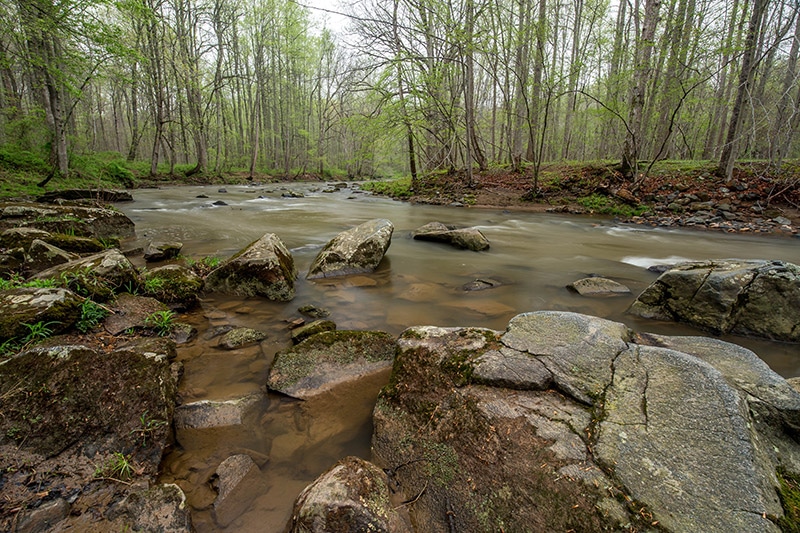
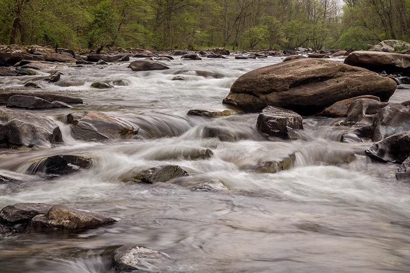
Big Gunpowder Trail
The Big Gunpowder Trail is more than 20 miles long and also very popular. In the summer you’re likely to see people tubing on the water. While you certainly can hike the entire length, there are parking lots that make it possible to hike just a shorter section. There is a parking lot on Belair Road (US Route 1) that is just a few miles down the road from the parking lot for the Little Gunpowder Trail. The GPS coordinates of this parking lot are 39.427656, -76.443405. Although there are a good number of parking spaces here, this is a popular spot that can fill up.
Big Gunpowder Trail
From the parking lot you will need to cross the river to get to the Big Gunpowder Trail. The parking lot does provide easy access to the Lost Pond Trail. The Route 1 bridge that crosses the river actually has a small walking area lower than the road, so you don’t need to walk on the side of the road. Head towards the bridge and look to the side and you should see the walking area. Once you get to the other side of the river there is a sign letting you know that you are on the Big Gunpowder Trail.
Much like the Little Gunpowder Trail, the Big Gunpowder Trail mostly follows along the side of the river. The Big Gunpowder is wider than the Little Gunpowder, but it is also shallow with many rocks on the banks and in the river itself.
Big Gunpowder Trail
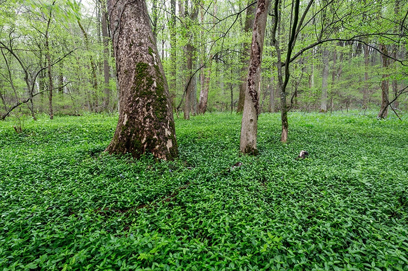
If you are on the trail in the spring or early summer you may see some wildflowers here. The forest is also nice here, although personally I prefer the forest on the Little Gunpowder Trail.
One of the reasons I like the parking lot on Route 1 is that it puts you about a 1-2 mile hike away from Pot Rocks.
Pot Rocks
Pot Rocks
Big Gunpowder Falls includes a section known as Pot Rocks. This is a huge collection of rocks and boulders rising above the river. In some places you may be able to cross the river on the rocks. That depends on the water level at the time. From the trail you can walk out onto the rocks and photograph. Just be careful because the rocks are obviously uneven, and can be wet and slippery.
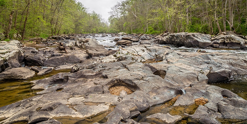
Pot Rocks
From Pot Rocks you can continue on the Big Gunpowder Trail, or you can head back to the parking lot.
Pot Rocks
Although the area covered in this article is just a fraction of the 120 miles of trails within Gunpowder Falls State Park, it does give you a good sample of what the park has to offer. If you’re looking for a quick outing in the Baltimore area I definitely recommend these trails. Aside from these trails I would also recommend the rail trail as a good place to hike and photograph.
Also in the area:
We have writeups on a few other locations in the area: